House Mountain Topo Map Texas
To zoom in, hover over the map of House Mountain
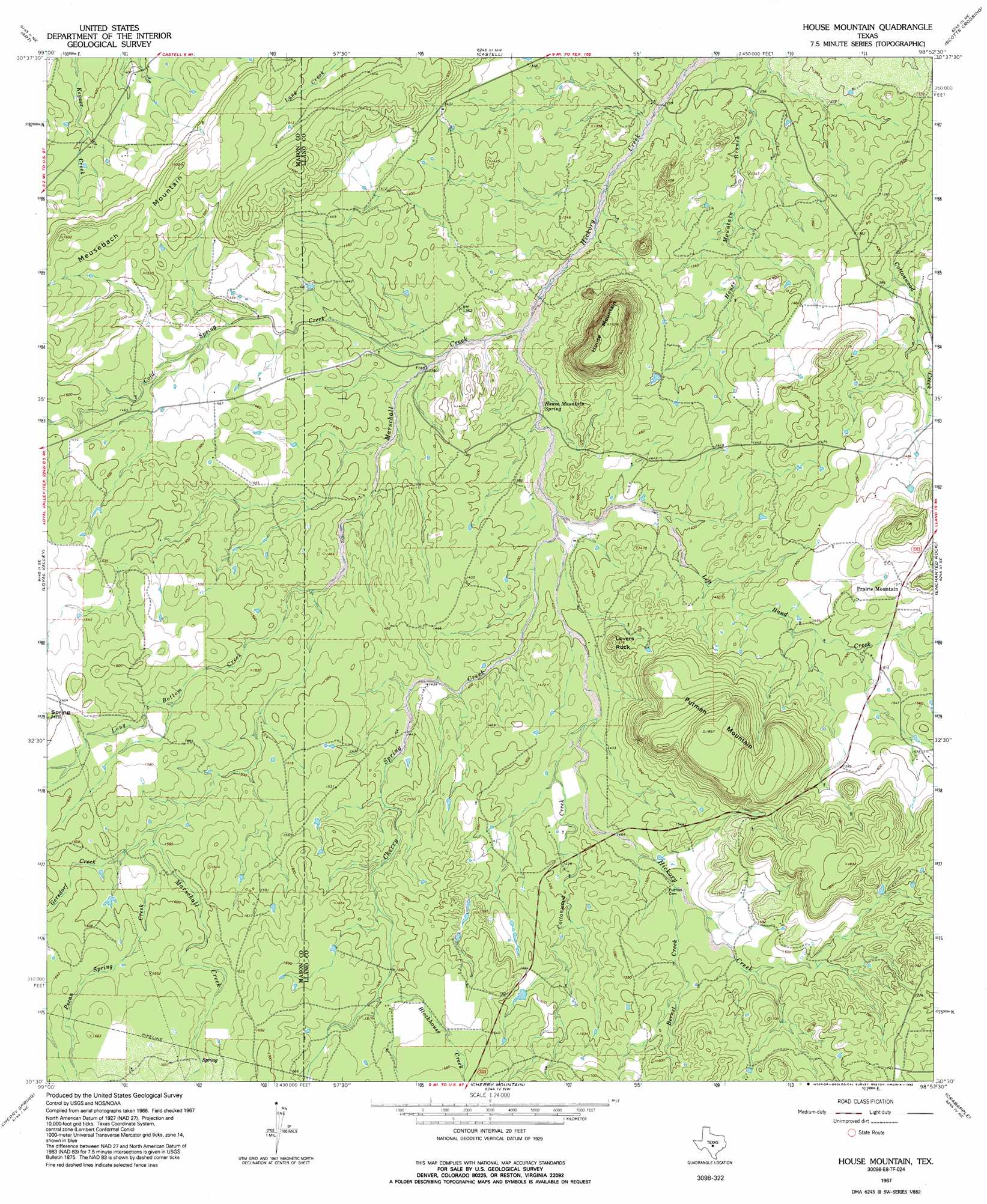
USGS Topo Quad 30098e8 - 1:24,000 scale
| Topo Map Name: | House Mountain |
| USGS Topo Quad ID: | 30098e8 |
| Print Size: | ca. 21 1/4" wide x 27" high |
| Southeast Coordinates: | 30.5° N latitude / 98.875° W longitude |
| Map Center Coordinates: | 30.5625° N latitude / 98.9375° W longitude |
| U.S. State: | TX |
| Filename: | o30098e8.jpg |
| Download Map JPG Image: | House Mountain topo map 1:24,000 scale |
| Map Type: | Topographic |
| Topo Series: | 7.5´ |
| Map Scale: | 1:24,000 |
| Source of Map Images: | United States Geological Survey (USGS) |
| Alternate Map Versions: |
House Mountain TX 1967, updated 1992 Download PDF Buy paper map House Mountain TX 2010 Download PDF Buy paper map House Mountain TX 2012 Download PDF Buy paper map House Mountain TX 2016 Download PDF Buy paper map |
1:24,000 Topo Quads surrounding House Mountain
Purdy Hill |
Fly Gap |
Smoothingiron Mountain |
Valley Spring |
Llano North |
Mason |
Art |
Castell |
Scotts Crossing |
Llano South |
Panther Creek |
Loyal Valley |
House Mountain |
Enchanted Rock |
Oxford |
Doss |
Cherry Spring |
Cherry Mountain |
Crabapple |
Willow City |
Harper East |
Roundhead |
Fredericksburg West |
Fredericksburg East |
Cave Creek School |
> Back to 30098e1 at 1:100,000 scale
> Back to 30098a1 at 1:250,000 scale
> Back to U.S. Topo Maps home
House Mountain topo map: Gazetteer
House Mountain: Populated Places
Prairie Mountain elevation 480m 1574′House Mountain: Springs
House Mountain Spring elevation 407m 1335′House Mountain: Streams
Bernst Creek elevation 458m 1502′Blockhouse Creek elevation 487m 1597′
Cherry Spring Creek elevation 415m 1361′
Cold Spring Creek elevation 405m 1328′
Cottonwood Creek elevation 433m 1420′
Gersdorf Creek elevation 468m 1535′
Left Hand Creek elevation 414m 1358′
Long Bottom Creek elevation 432m 1417′
Marschall Creek elevation 398m 1305′
Pecan Spring Creek elevation 470m 1541′
House Mountain: Summits
House Mountain elevation 558m 1830′Lovers Rock elevation 478m 1568′
Putman Mountain elevation 570m 1870′
House Mountain digital topo map on disk
Buy this House Mountain topo map showing relief, roads, GPS coordinates and other geographical features, as a high-resolution digital map file on DVD: