Mormon Mill Topo Map Texas
To zoom in, hover over the map of Mormon Mill
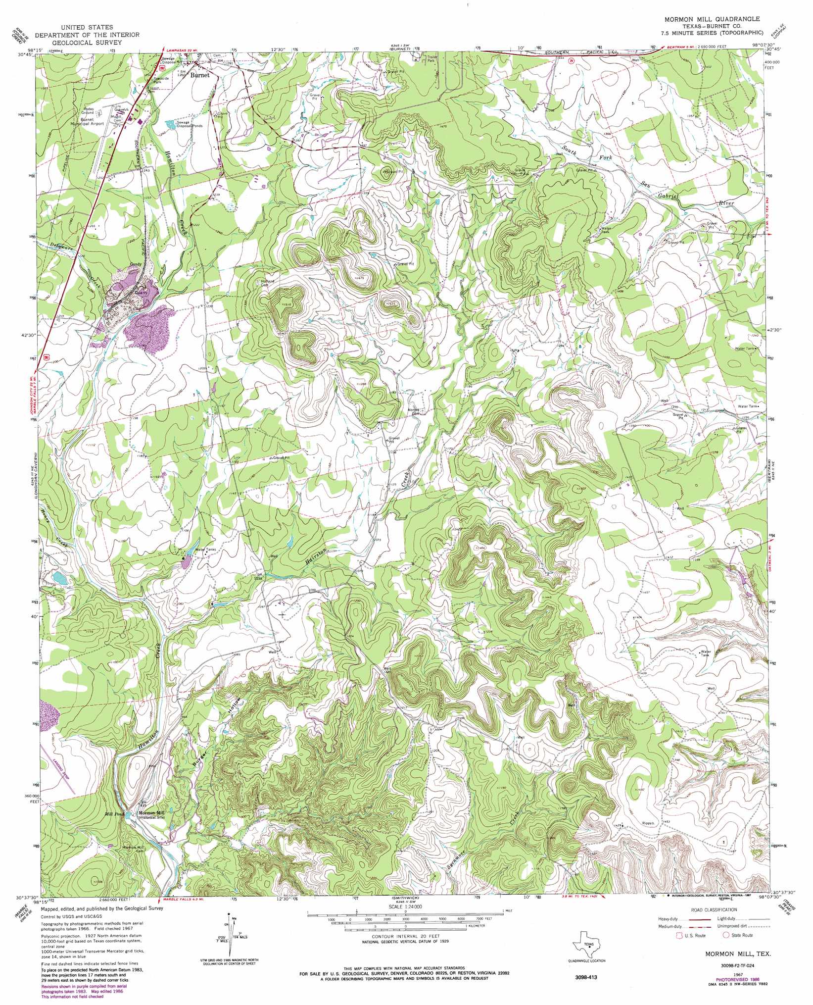
USGS Topo Quad 30098f2 - 1:24,000 scale
| Topo Map Name: | Mormon Mill |
| USGS Topo Quad ID: | 30098f2 |
| Print Size: | ca. 21 1/4" wide x 27" high |
| Southeast Coordinates: | 30.625° N latitude / 98.125° W longitude |
| Map Center Coordinates: | 30.6875° N latitude / 98.1875° W longitude |
| U.S. State: | TX |
| Filename: | o30098f2.jpg |
| Download Map JPG Image: | Mormon Mill topo map 1:24,000 scale |
| Map Type: | Topographic |
| Topo Series: | 7.5´ |
| Map Scale: | 1:24,000 |
| Source of Map Images: | United States Geological Survey (USGS) |
| Alternate Map Versions: |
Mormon Mill TX 1967, updated 1970 Download PDF Buy paper map Mormon Mill TX 1967, updated 1987 Download PDF Buy paper map Mormon Mill TX 2010 Download PDF Buy paper map Mormon Mill TX 2012 Download PDF Buy paper map Mormon Mill TX 2016 Download PDF Buy paper map |
1:24,000 Topo Quads surrounding Mormon Mill
Tow |
Naruna |
Lake Victor |
Bachelor Peak |
Briggs |
Lake Buchanan |
Council Creek |
Burnet |
Joppa |
Mahomet |
Kingsland |
Longhorn Cavern |
Mormon Mill |
Bertram |
Liberty Hill |
Dunman Mountain |
Marble Falls |
Smithwick |
Travis Peak |
Nameless |
Howell Mountain |
Round Mountain |
Spicewood |
Pace Bend |
Mansfield Dam |
> Back to 30098e1 at 1:100,000 scale
> Back to 30098a1 at 1:250,000 scale
> Back to U.S. Topo Maps home
Mormon Mill topo map: Gazetteer
Mormon Mill: Airports
Burnet Municipal Kate Craddock Field elevation 384m 1259′Mormon Mill: Lakes
Mill Pond elevation 249m 816′Mormon Mill: Populated Places
Gandy elevation 373m 1223′Mormon Mill: Springs
Holland Springs elevation 361m 1184′Mormon Mill: Streams
Delaware Creek elevation 352m 1154′Hairston Creek elevation 292m 958′
Haynie Branch elevation 383m 1256′
Honey Creek elevation 315m 1033′
Mormon Mill: Valleys
Burger Hollow elevation 240m 787′Mormon Mill digital topo map on disk
Buy this Mormon Mill topo map showing relief, roads, GPS coordinates and other geographical features, as a high-resolution digital map file on DVD: