Burnet Topo Map Texas
To zoom in, hover over the map of Burnet
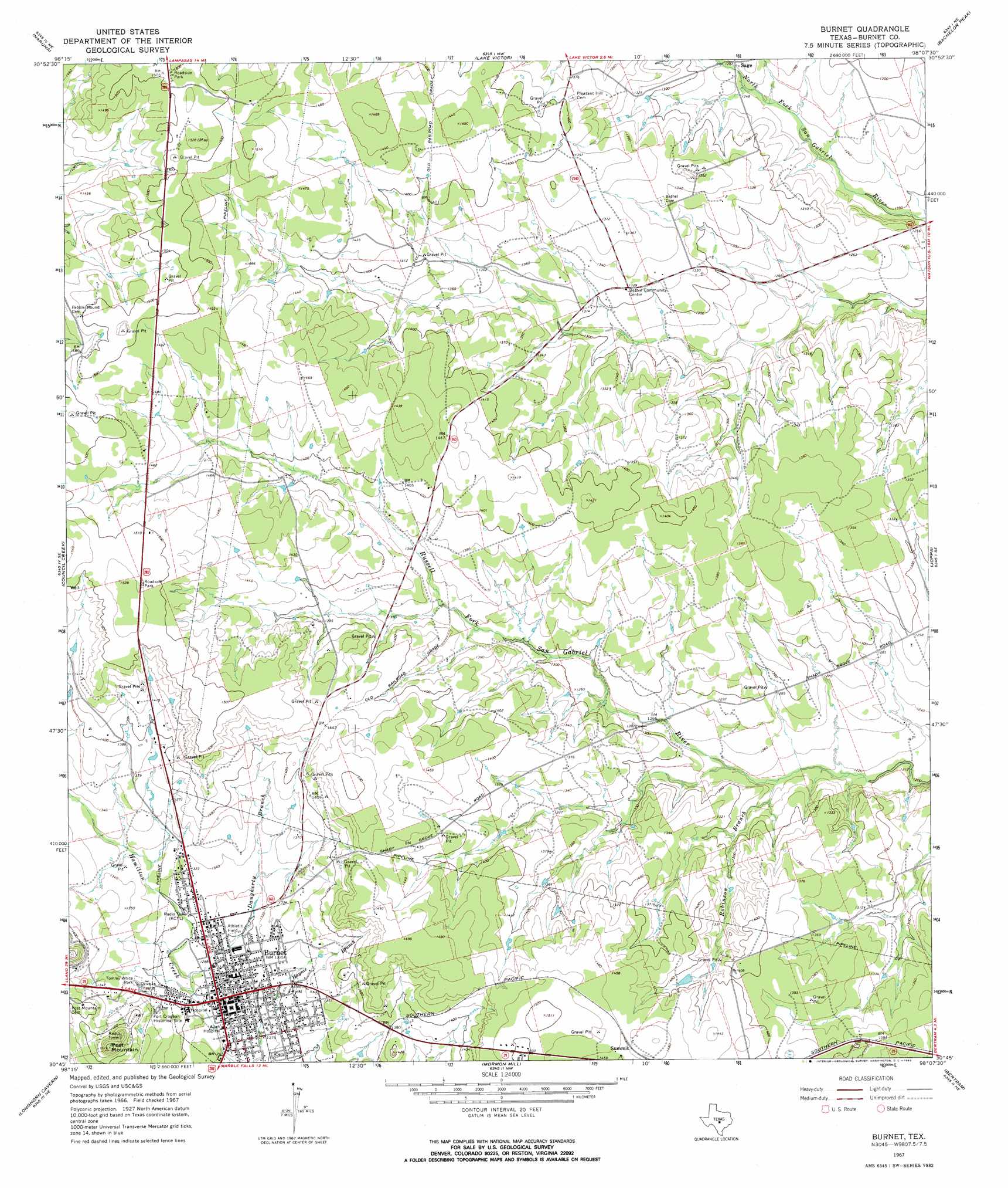
USGS Topo Quad 30098g2 - 1:24,000 scale
| Topo Map Name: | Burnet |
| USGS Topo Quad ID: | 30098g2 |
| Print Size: | ca. 21 1/4" wide x 27" high |
| Southeast Coordinates: | 30.75° N latitude / 98.125° W longitude |
| Map Center Coordinates: | 30.8125° N latitude / 98.1875° W longitude |
| U.S. State: | TX |
| Filename: | o30098g2.jpg |
| Download Map JPG Image: | Burnet topo map 1:24,000 scale |
| Map Type: | Topographic |
| Topo Series: | 7.5´ |
| Map Scale: | 1:24,000 |
| Source of Map Images: | United States Geological Survey (USGS) |
| Alternate Map Versions: |
Burnet TX 1967, updated 1969 Download PDF Buy paper map Burnet TX 1967, updated 1970 Download PDF Buy paper map Burnet TX 2010 Download PDF Buy paper map Burnet TX 2012 Download PDF Buy paper map Burnet TX 2016 Download PDF Buy paper map |
1:24,000 Topo Quads surrounding Burnet
Gorman Falls |
Nix |
Lampasas |
Kempner |
Copperas Cove |
Tow |
Naruna |
Lake Victor |
Bachelor Peak |
Briggs |
Lake Buchanan |
Council Creek |
Burnet |
Joppa |
Mahomet |
Kingsland |
Longhorn Cavern |
Mormon Mill |
Bertram |
Liberty Hill |
Dunman Mountain |
Marble Falls |
Smithwick |
Travis Peak |
Nameless |
> Back to 30098e1 at 1:100,000 scale
> Back to 30098a1 at 1:250,000 scale
> Back to U.S. Topo Maps home
Burnet topo map: Gazetteer
Burnet: Parks
Fort Croghan Historical Site elevation 405m 1328′Tommy White Park elevation 403m 1322′
Wallace Riddell Park elevation 398m 1305′
Burnet: Populated Places
Burnet elevation 392m 1286′Burnet: Streams
Daugherty Branch elevation 390m 1279′Robinson Branch elevation 376m 1233′
Burnet: Summits
Post Mountain elevation 462m 1515′Burnet digital topo map on disk
Buy this Burnet topo map showing relief, roads, GPS coordinates and other geographical features, as a high-resolution digital map file on DVD: