Naruna Topo Map Texas
To zoom in, hover over the map of Naruna
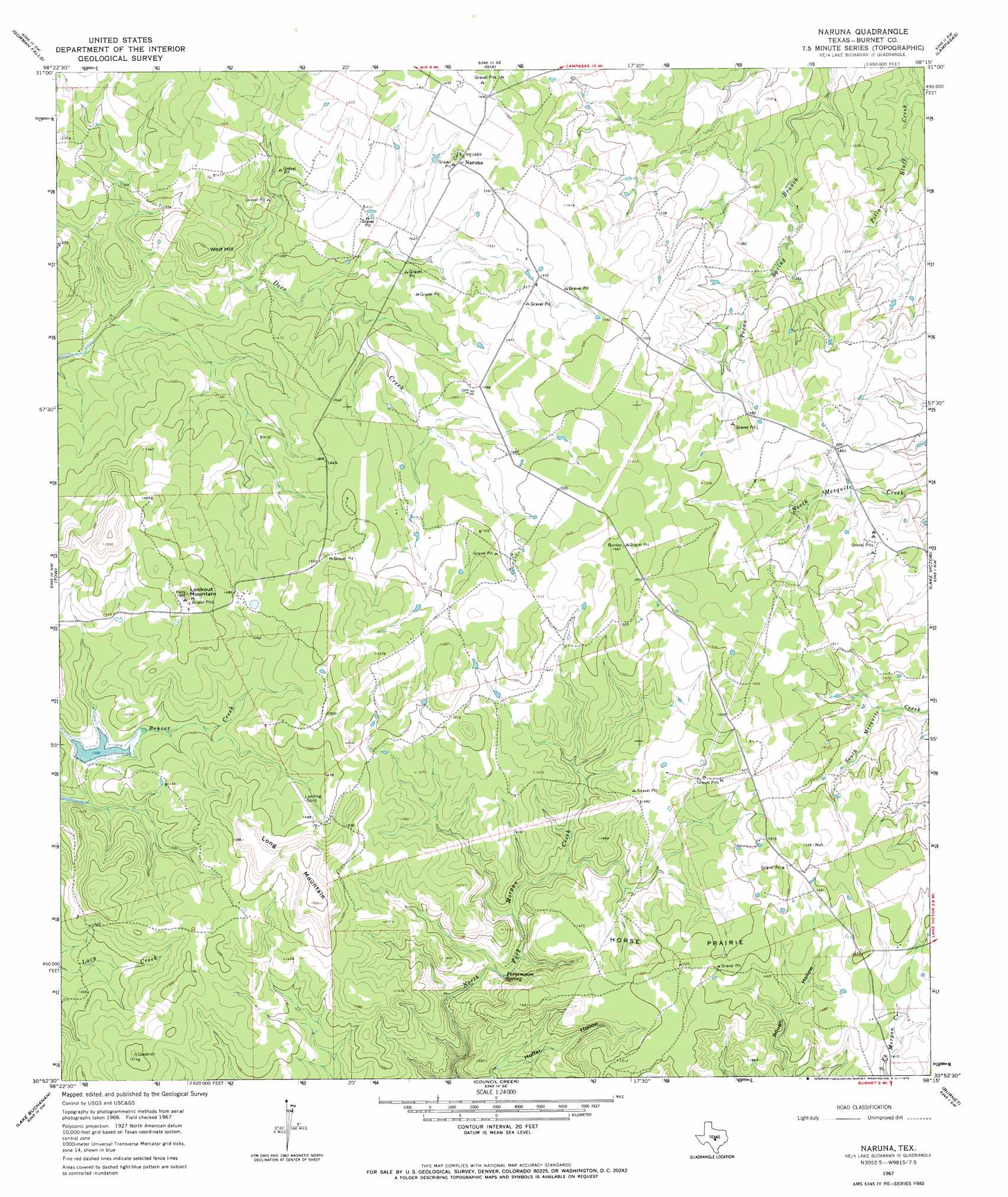
USGS Topo Quad 30098h3 - 1:24,000 scale
| Topo Map Name: | Naruna |
| USGS Topo Quad ID: | 30098h3 |
| Print Size: | ca. 21 1/4" wide x 27" high |
| Southeast Coordinates: | 30.875° N latitude / 98.25° W longitude |
| Map Center Coordinates: | 30.9375° N latitude / 98.3125° W longitude |
| U.S. State: | TX |
| Filename: | o30098h3.jpg |
| Download Map JPG Image: | Naruna topo map 1:24,000 scale |
| Map Type: | Topographic |
| Topo Series: | 7.5´ |
| Map Scale: | 1:24,000 |
| Source of Map Images: | United States Geological Survey (USGS) |
| Alternate Map Versions: |
Naruna TX 1967, updated 1970 Download PDF Buy paper map Naruna TX 2010 Download PDF Buy paper map Naruna TX 2012 Download PDF Buy paper map Naruna TX 2016 Download PDF Buy paper map |
1:24,000 Topo Quads surrounding Naruna
Wolf Ridge |
Lometa |
Ogles |
Flat Top Peak |
Rumley |
Bend |
Gorman Falls |
Nix |
Lampasas |
Kempner |
Indian Hills |
Tow |
Naruna |
Lake Victor |
Bachelor Peak |
Lone Grove |
Lake Buchanan |
Council Creek |
Burnet |
Joppa |
Cap Mountain |
Kingsland |
Longhorn Cavern |
Mormon Mill |
Bertram |
> Back to 30098e1 at 1:100,000 scale
> Back to 30098a1 at 1:250,000 scale
> Back to U.S. Topo Maps home
Naruna topo map: Gazetteer
Naruna: Dams
Owl Hollow Dam elevation 414m 1358′Naruna: Flats
Horse Prairie elevation 460m 1509′Naruna: Populated Places
Naruna elevation 446m 1463′Naruna: Reservoirs
Owl Hollow Lake elevation 414m 1358′Naruna: Springs
Persimmon Spring elevation 402m 1318′Naruna: Summits
Long Mountain elevation 490m 1607′Lookout Mountain elevation 484m 1587′
Wolf Hill elevation 460m 1509′
Naruna: Valleys
Hoffer Hollow elevation 374m 1227′Naruna digital topo map on disk
Buy this Naruna topo map showing relief, roads, GPS coordinates and other geographical features, as a high-resolution digital map file on DVD: