Magill Mountain Topo Map Texas
To zoom in, hover over the map of Magill Mountain
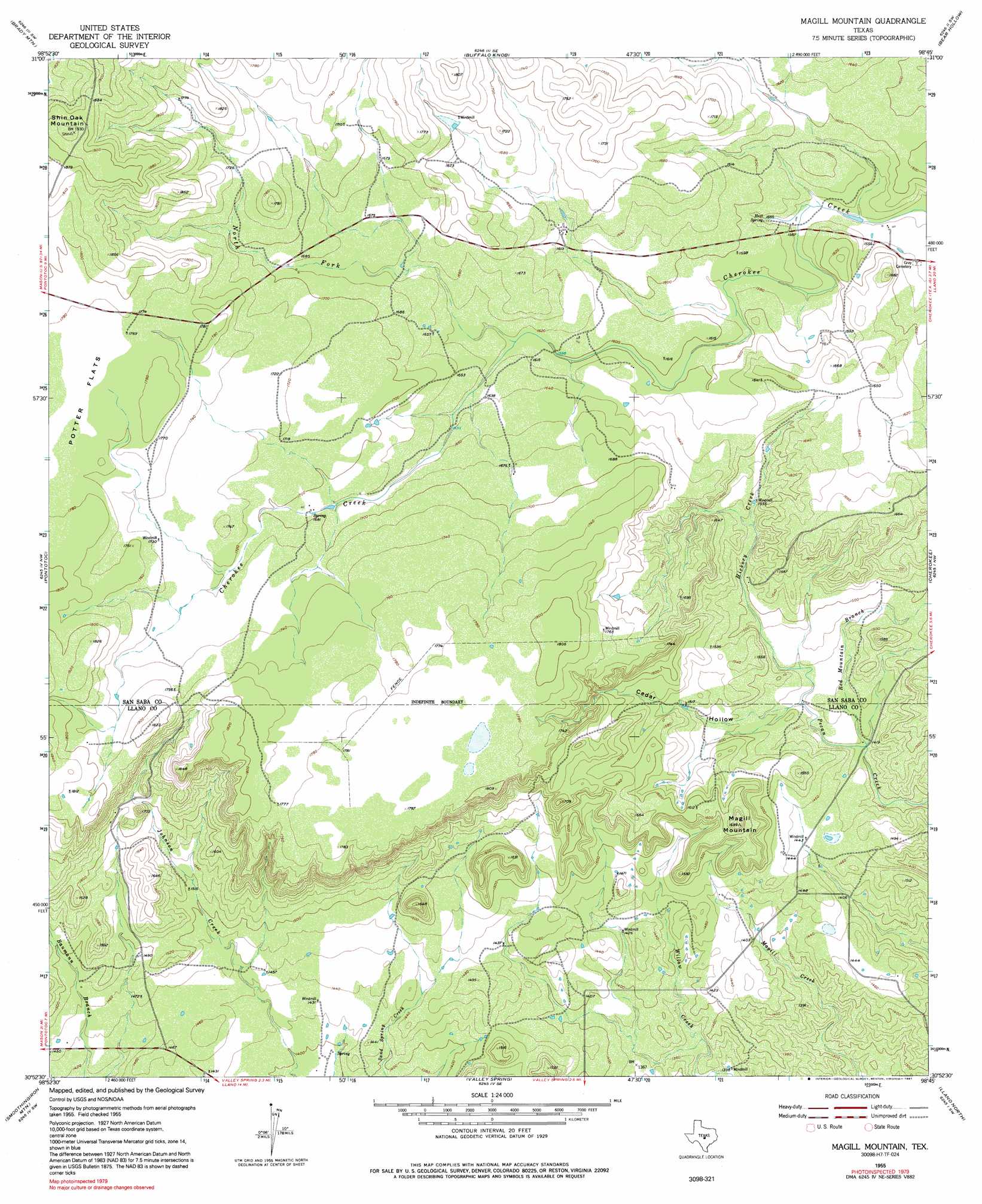
USGS Topo Quad 30098h7 - 1:24,000 scale
| Topo Map Name: | Magill Mountain |
| USGS Topo Quad ID: | 30098h7 |
| Print Size: | ca. 21 1/4" wide x 27" high |
| Southeast Coordinates: | 30.875° N latitude / 98.75° W longitude |
| Map Center Coordinates: | 30.9375° N latitude / 98.8125° W longitude |
| U.S. State: | TX |
| Filename: | o30098h7.jpg |
| Download Map JPG Image: | Magill Mountain topo map 1:24,000 scale |
| Map Type: | Topographic |
| Topo Series: | 7.5´ |
| Map Scale: | 1:24,000 |
| Source of Map Images: | United States Geological Survey (USGS) |
| Alternate Map Versions: |
Magill Mountain TX 1955, updated 1956 Download PDF Buy paper map Magill Mountain TX 1955, updated 1976 Download PDF Buy paper map Magill Mountain TX 1955, updated 1991 Download PDF Buy paper map Magill Mountain TX 2010 Download PDF Buy paper map Magill Mountain TX 2012 Download PDF Buy paper map Magill Mountain TX 2016 Download PDF Buy paper map |
1:24,000 Topo Quads surrounding Magill Mountain
Lost Creek |
Baker Spring |
Algerita |
San Saba |
Wolf Ridge |
Pecan Springs |
Brady Mountain |
Buffalo Knob |
Bear Hollow |
Bend |
Fredonia |
Pontotoc |
Magill Mountain |
Cherokee |
Indian Hills |
Fly Gap |
Smoothingiron Mountain |
Valley Spring |
Llano North |
Lone Grove |
Art |
Castell |
Scotts Crossing |
Llano South |
Cap Mountain |
> Back to 30098e1 at 1:100,000 scale
> Back to 30098a1 at 1:250,000 scale
> Back to U.S. Topo Maps home
Magill Mountain topo map: Gazetteer
Magill Mountain: Flats
Potter Flats elevation 539m 1768′Magill Mountain: Springs
Heck Springs elevation 517m 1696′Hext Spring elevation 473m 1551′
Valley Spring elevation 421m 1381′
Magill Mountain: Streams
Hickory Creek elevation 438m 1437′North Fork Cherokee Creek elevation 491m 1610′
Red Mountain Branch elevation 456m 1496′
Magill Mountain: Summits
Magill Mountain elevation 516m 1692′Shin Oak Mountain elevation 587m 1925′
Magill Mountain: Valleys
Cedar Hollow elevation 441m 1446′Magill Mountain digital topo map on disk
Buy this Magill Mountain topo map showing relief, roads, GPS coordinates and other geographical features, as a high-resolution digital map file on DVD: