Monument Mountain Topo Map Texas
To zoom in, hover over the map of Monument Mountain
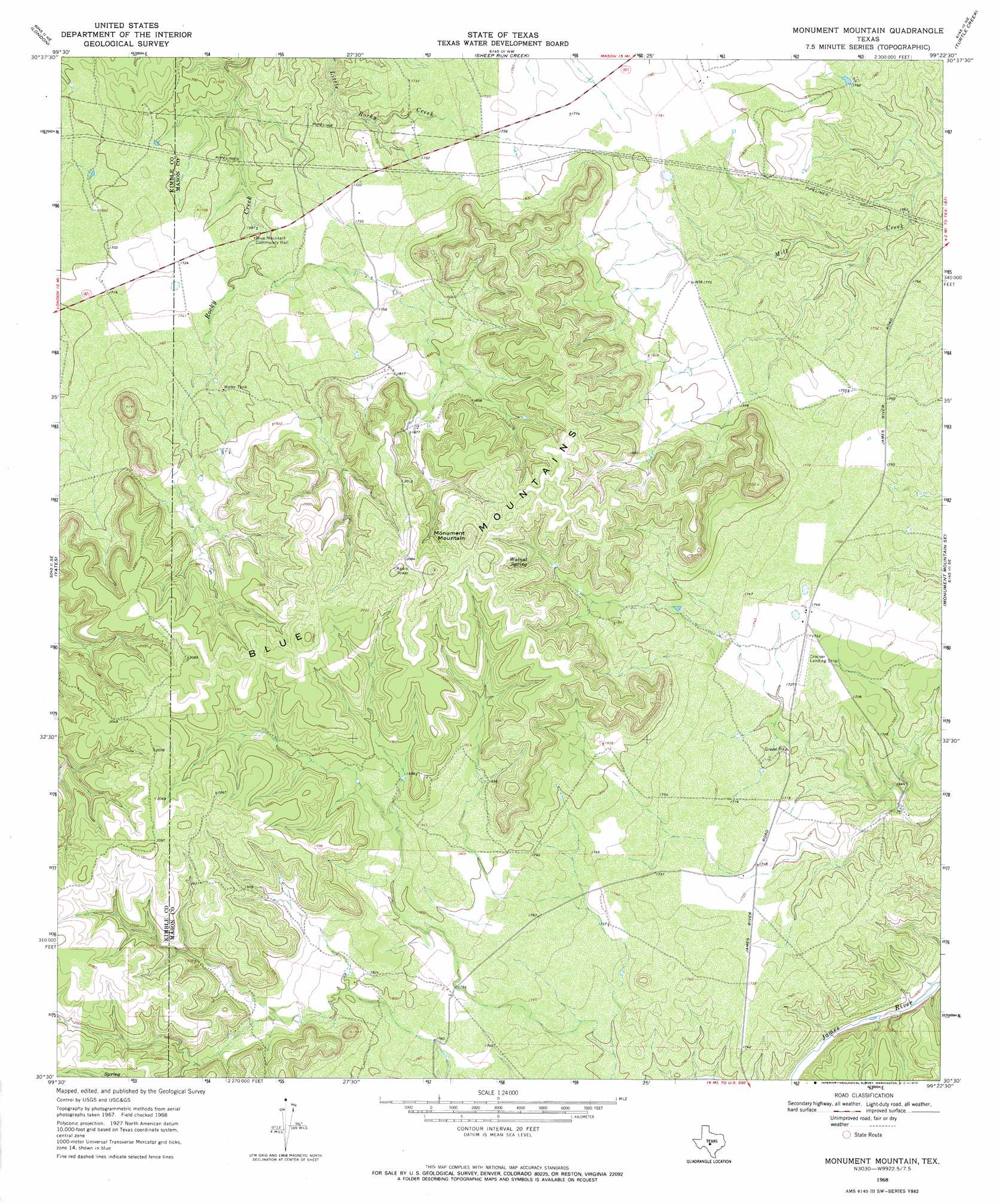
USGS Topo Quad 30099e4 - 1:24,000 scale
| Topo Map Name: | Monument Mountain |
| USGS Topo Quad ID: | 30099e4 |
| Print Size: | ca. 21 1/4" wide x 27" high |
| Southeast Coordinates: | 30.5° N latitude / 99.375° W longitude |
| Map Center Coordinates: | 30.5625° N latitude / 99.4375° W longitude |
| U.S. State: | TX |
| Filename: | o30099e4.jpg |
| Download Map JPG Image: | Monument Mountain topo map 1:24,000 scale |
| Map Type: | Topographic |
| Topo Series: | 7.5´ |
| Map Scale: | 1:24,000 |
| Source of Map Images: | United States Geological Survey (USGS) |
| Alternate Map Versions: |
Monument Mountain TX 1968, updated 1970 Download PDF Buy paper map Monument Mountain TX 2010 Download PDF Buy paper map Monument Mountain TX 2012 Download PDF Buy paper map Monument Mountain TX 2016 Download PDF Buy paper map |
1:24,000 Topo Quads surrounding Monument Mountain
East Elm Creek |
Hext |
Long Mountain |
Grit |
Purdy Hill |
Brewer Hollow |
London |
Sheep Run Creek |
Turtle Creek |
Mason |
Big Draw |
Yates |
Monument Mountain |
Monument Mountain Se |
Panther Creek |
Segovia |
Tobe Branch |
Noxville |
The Falls |
Doss |
Allen Creek |
Mudge Draw |
Old Noxville |
Harper West |
Harper East |
> Back to 30099e1 at 1:100,000 scale
> Back to 30098a1 at 1:250,000 scale
> Back to U.S. Topo Maps home
Monument Mountain topo map: Gazetteer
Monument Mountain: Ridges
Blue Mountains elevation 662m 2171′Monument Mountain: Springs
Walnut Spring elevation 602m 1975′Monument Mountain: Summits
Monument Mountain elevation 662m 2171′Monument Mountain digital topo map on disk
Buy this Monument Mountain topo map showing relief, roads, GPS coordinates and other geographical features, as a high-resolution digital map file on DVD: