Sheep Run Creek Topo Map Texas
To zoom in, hover over the map of Sheep Run Creek
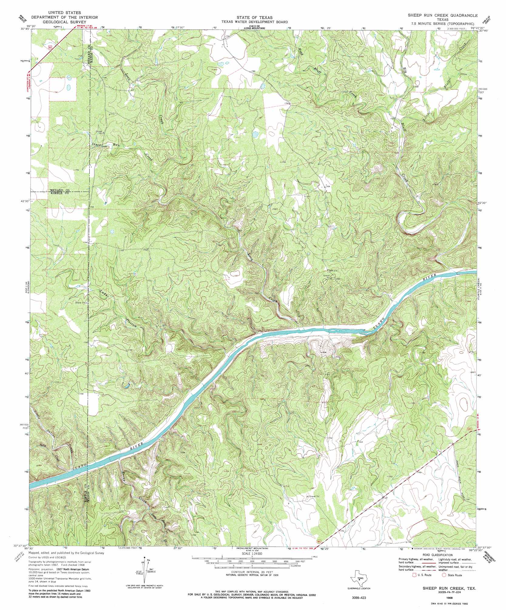
USGS Topo Quad 30099f4 - 1:24,000 scale
| Topo Map Name: | Sheep Run Creek |
| USGS Topo Quad ID: | 30099f4 |
| Print Size: | ca. 21 1/4" wide x 27" high |
| Southeast Coordinates: | 30.625° N latitude / 99.375° W longitude |
| Map Center Coordinates: | 30.6875° N latitude / 99.4375° W longitude |
| U.S. State: | TX |
| Filename: | o30099f4.jpg |
| Download Map JPG Image: | Sheep Run Creek topo map 1:24,000 scale |
| Map Type: | Topographic |
| Topo Series: | 7.5´ |
| Map Scale: | 1:24,000 |
| Source of Map Images: | United States Geological Survey (USGS) |
| Alternate Map Versions: |
Sheep Run Creek TX 1968, updated 1971 Download PDF Buy paper map Sheep Run Creek TX 1968, updated 1985 Download PDF Buy paper map Sheep Run Creek TX 2010 Download PDF Buy paper map Sheep Run Creek TX 2012 Download PDF Buy paper map Sheep Run Creek TX 2016 Download PDF Buy paper map |
1:24,000 Topo Quads surrounding Sheep Run Creek
Chapman Draw |
Robbers Roost |
Calf Creek |
Katemcy |
Spy Rock |
East Elm Creek |
Hext |
Long Mountain |
Grit |
Purdy Hill |
Brewer Hollow |
London |
Sheep Run Creek |
Turtle Creek |
Mason |
Big Draw |
Yates |
Monument Mountain |
Monument Mountain Se |
Panther Creek |
Segovia |
Tobe Branch |
Noxville |
The Falls |
Doss |
> Back to 30099e1 at 1:100,000 scale
> Back to 30098a1 at 1:250,000 scale
> Back to U.S. Topo Maps home
Sheep Run Creek topo map: Gazetteer
Sheep Run Creek: Streams
Big Bluff Creek elevation 427m 1400′Hogg Bluff Creek elevation 470m 1541′
Leon Creek elevation 434m 1423′
Little Bluff Creek elevation 468m 1535′
Little Rocky Creek elevation 468m 1535′
Little Saline Creek elevation 450m 1476′
Rocky Creek elevation 445m 1459′
Salty Creek elevation 448m 1469′
Sheep Run Creek elevation 495m 1624′
Sheep Run Creek: Valleys
Cedar Hollow elevation 440m 1443′Sheep Run Creek digital topo map on disk
Buy this Sheep Run Creek topo map showing relief, roads, GPS coordinates and other geographical features, as a high-resolution digital map file on DVD: