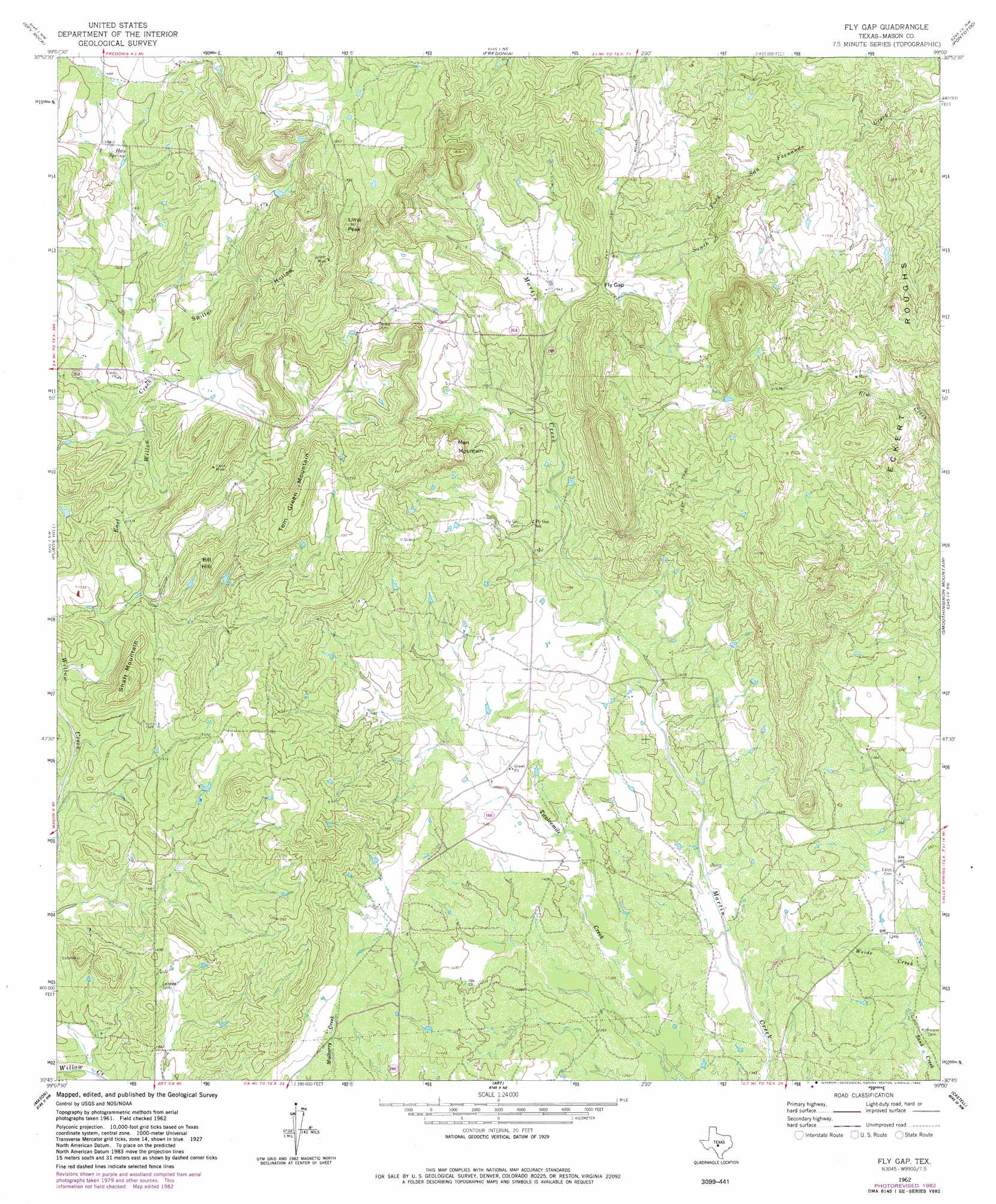
Fly Gap Topo Map Texas
To zoom in, hover over the map of Fly Gap
USGS Topo Quad 30099g1 - 1:24,000 scale
| Topo Map Name: | Fly Gap |
| USGS Topo Quad ID: | 30099g1 |
| Print Size: | ca. 21 1/4" wide x 27" high |
| Southeast Coordinates: | 30.75° N latitude / 99° W longitude |
| Map Center Coordinates: | 30.8125° N latitude / 99.0625° W longitude |
| U.S. State: | TX |
| Filename: | o30099g1.jpg |
| Download Map JPG Image: | Fly Gap topo map 1:24,000 scale |
| Map Type: | Topographic |
| Topo Series: | 7.5´ |
| Map Scale: | 1:24,000 |
| Source of Map Images: | United States Geological Survey (USGS) |
| Alternate Map Versions: |
Fly Gap TX 1962, updated 1965 Download PDF Buy paper map Fly Gap TX 1962, updated 1982 Download PDF Buy paper map Fly Gap TX 2010 Download PDF Buy paper map Fly Gap TX 2012 Download PDF Buy paper map Fly Gap TX 2016 Download PDF Buy paper map |
1:24,000 Topo Quads surrounding Fly Gap
Brady South |
Voca |
Pecan Springs |
Brady Mountain |
Buffalo Knob |
Katemcy |
Spy Rock |
Fredonia |
Pontotoc |
Magill Mountain |
Grit |
Purdy Hill |
Fly Gap |
Smoothingiron Mountain |
Valley Spring |
Turtle Creek |
Mason |
Art |
Castell |
Scotts Crossing |
Monument Mountain Se |
Panther Creek |
Loyal Valley |
House Mountain |
Enchanted Rock |
> Back to 30099e1 at 1:100,000 scale
> Back to 30098a1 at 1:250,000 scale
> Back to U.S. Topo Maps home
Fly Gap topo map: Gazetteer
Fly Gap: Gaps
Fly Gap elevation 488m 1601′Fly Gap: Mines
Hanie Mine elevation 514m 1686′Spiller Mine elevation 552m 1811′
Fly Gap: Springs
Hay Spring elevation 506m 1660′Fly Gap: Streams
East Willow Creek elevation 443m 1453′Hasse Creek elevation 412m 1351′
Fly Gap: Summits
Bill Hill elevation 523m 1715′Eckert Roughs elevation 511m 1676′
Lime Peak elevation 600m 1968′
Man Mountain elevation 531m 1742′
Shaft Mountain elevation 519m 1702′
Tom Green Mountain elevation 552m 1811′
Fly Gap: Valleys
Spiller Hollow elevation 484m 1587′Fly Gap digital topo map on disk
Buy this Fly Gap topo map showing relief, roads, GPS coordinates and other geographical features, as a high-resolution digital map file on DVD: