Purdy Hill Topo Map Texas
To zoom in, hover over the map of Purdy Hill
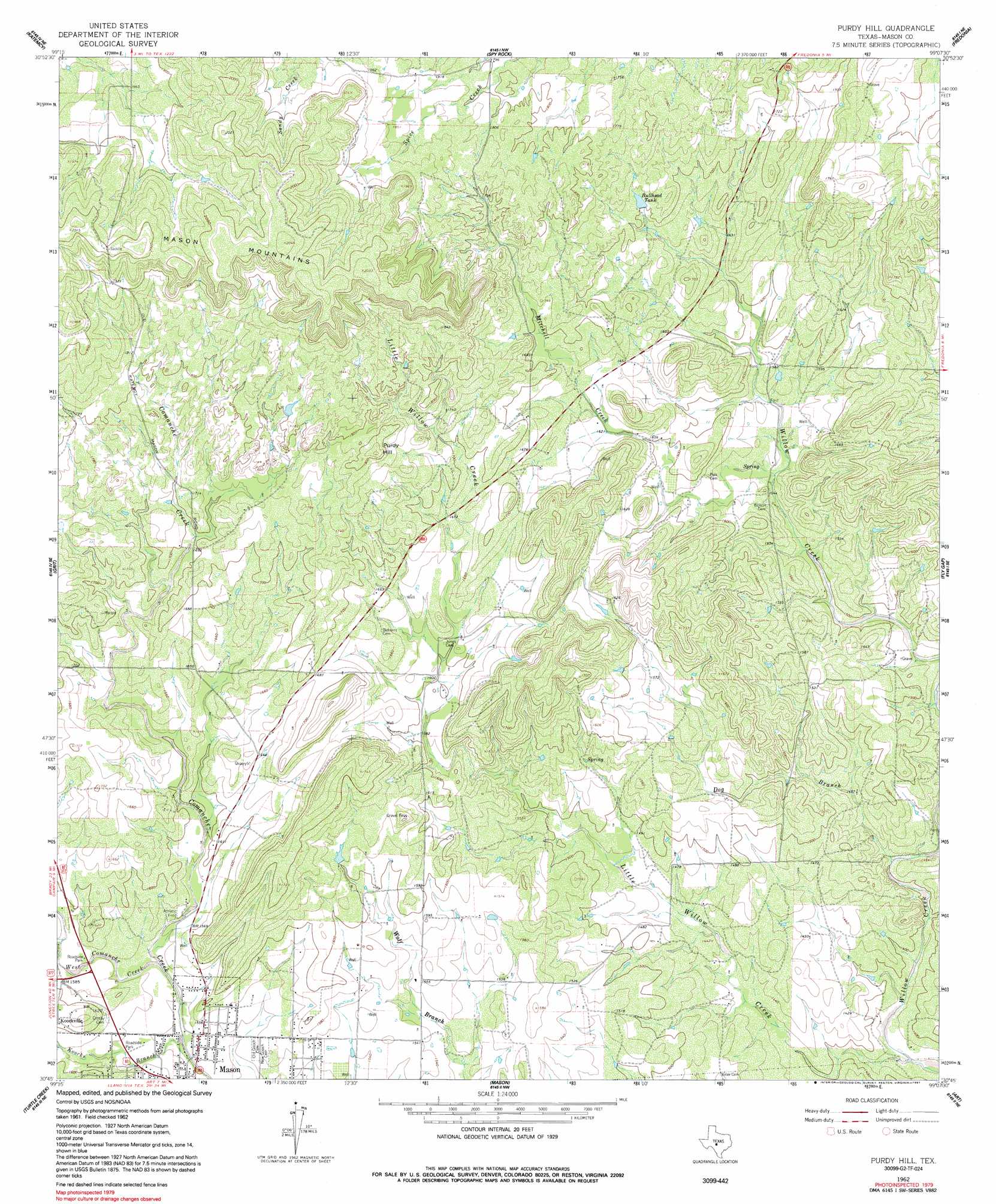
USGS Topo Quad 30099g2 - 1:24,000 scale
| Topo Map Name: | Purdy Hill |
| USGS Topo Quad ID: | 30099g2 |
| Print Size: | ca. 21 1/4" wide x 27" high |
| Southeast Coordinates: | 30.75° N latitude / 99.125° W longitude |
| Map Center Coordinates: | 30.8125° N latitude / 99.1875° W longitude |
| U.S. State: | TX |
| Filename: | o30099g2.jpg |
| Download Map JPG Image: | Purdy Hill topo map 1:24,000 scale |
| Map Type: | Topographic |
| Topo Series: | 7.5´ |
| Map Scale: | 1:24,000 |
| Source of Map Images: | United States Geological Survey (USGS) |
| Alternate Map Versions: |
Purdy Hill TX 1962, updated 1964 Download PDF Buy paper map Purdy Hill TX 1962, updated 1991 Download PDF Buy paper map Purdy Hill TX 2010 Download PDF Buy paper map Purdy Hill TX 2012 Download PDF Buy paper map Purdy Hill TX 2016 Download PDF Buy paper map |
1:24,000 Topo Quads surrounding Purdy Hill
Brady Sw |
Brady South |
Voca |
Pecan Springs |
Brady Mountain |
Calf Creek |
Katemcy |
Spy Rock |
Fredonia |
Pontotoc |
Long Mountain |
Grit |
Purdy Hill |
Fly Gap |
Smoothingiron Mountain |
Sheep Run Creek |
Turtle Creek |
Mason |
Art |
Castell |
Monument Mountain |
Monument Mountain Se |
Panther Creek |
Loyal Valley |
House Mountain |
> Back to 30099e1 at 1:100,000 scale
> Back to 30098a1 at 1:250,000 scale
> Back to U.S. Topo Maps home
Purdy Hill topo map: Gazetteer
Purdy Hill: Parks
Mason Mountain Wildlife Management Area elevation 601m 1971′Purdy Hill: Reservoirs
Bullhead Tank elevation 518m 1699′Purdy Hill: Springs
Gamel Spring elevation 481m 1578′Purdy Hill: Streams
Dog Branch elevation 428m 1404′Koocks Branch elevation 464m 1522′
Little Willow Creek elevation 415m 1361′
Mitchell Creek elevation 465m 1525′
West Comanche Creek elevation 469m 1538′
Purdy Hill: Summits
Purdy Hill elevation 562m 1843′Purdy Hill digital topo map on disk
Buy this Purdy Hill topo map showing relief, roads, GPS coordinates and other geographical features, as a high-resolution digital map file on DVD: