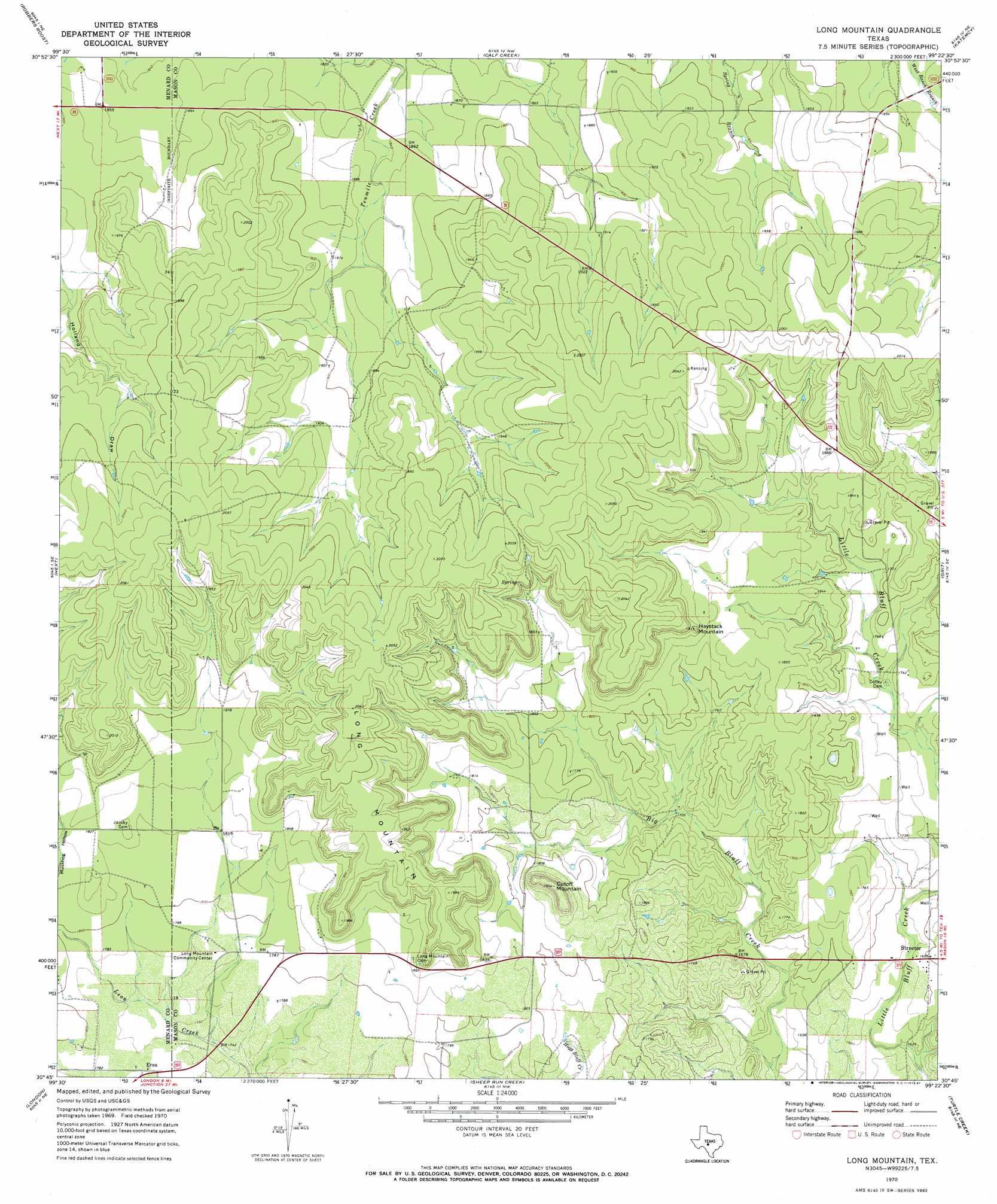
Long Mountain Topo Map Texas
To zoom in, hover over the map of Long Mountain
USGS Topo Quad 30099g4 - 1:24,000 scale
| Topo Map Name: | Long Mountain |
| USGS Topo Quad ID: | 30099g4 |
| Print Size: | ca. 21 1/4" wide x 27" high |
| Southeast Coordinates: | 30.75° N latitude / 99.375° W longitude |
| Map Center Coordinates: | 30.8125° N latitude / 99.4375° W longitude |
| U.S. State: | TX |
| Filename: | o30099g4.jpg |
| Download Map JPG Image: | Long Mountain topo map 1:24,000 scale |
| Map Type: | Topographic |
| Topo Series: | 7.5´ |
| Map Scale: | 1:24,000 |
| Source of Map Images: | United States Geological Survey (USGS) |
| Alternate Map Versions: |
Long Mountain TX 1970, updated 1973 Download PDF Buy paper map Long Mountain TX 1970, updated 1987 Download PDF Buy paper map Long Mountain TX 2010 Download PDF Buy paper map Long Mountain TX 2012 Download PDF Buy paper map Long Mountain TX 2016 Download PDF Buy paper map |
1:24,000 Topo Quads surrounding Long Mountain
Callan |
Needle Creek |
Brady Sw |
Brady South |
Voca |
Chapman Draw |
Robbers Roost |
Calf Creek |
Katemcy |
Spy Rock |
East Elm Creek |
Hext |
Long Mountain |
Grit |
Purdy Hill |
Brewer Hollow |
London |
Sheep Run Creek |
Turtle Creek |
Mason |
Big Draw |
Yates |
Monument Mountain |
Monument Mountain Se |
Panther Creek |
> Back to 30099e1 at 1:100,000 scale
> Back to 30098a1 at 1:250,000 scale
> Back to U.S. Topo Maps home
Long Mountain topo map: Gazetteer
Long Mountain: Populated Places
Erna elevation 539m 1768′Streeter elevation 518m 1699′
Long Mountain: Springs
Pluenneke Springs elevation 551m 1807′Long Mountain: Summits
Cutoff Mountain elevation 595m 1952′Haystack Mountain elevation 586m 1922′
Long Mountain digital topo map on disk
Buy this Long Mountain topo map showing relief, roads, GPS coordinates and other geographical features, as a high-resolution digital map file on DVD: