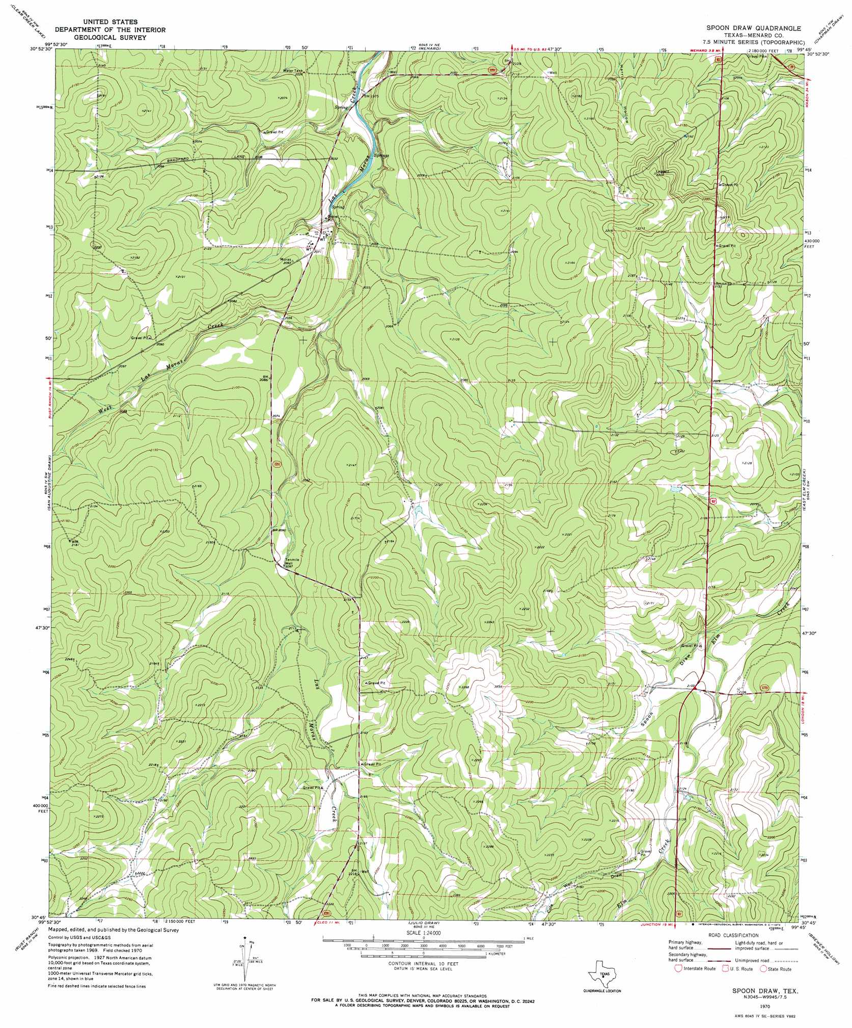
Spoon Draw Topo Map Texas
To zoom in, hover over the map of Spoon Draw
USGS Topo Quad 30099g7 - 1:24,000 scale
| Topo Map Name: | Spoon Draw |
| USGS Topo Quad ID: | 30099g7 |
| Print Size: | ca. 21 1/4" wide x 27" high |
| Southeast Coordinates: | 30.75° N latitude / 99.75° W longitude |
| Map Center Coordinates: | 30.8125° N latitude / 99.8125° W longitude |
| U.S. State: | TX |
| Filename: | o30099g7.jpg |
| Download Map JPG Image: | Spoon Draw topo map 1:24,000 scale |
| Map Type: | Topographic |
| Topo Series: | 7.5´ |
| Map Scale: | 1:24,000 |
| Source of Map Images: | United States Geological Survey (USGS) |
| Alternate Map Versions: |
Spoon Draw TX 1970, updated 1973 Download PDF Buy paper map Spoon Draw TX 2010 Download PDF Buy paper map Spoon Draw TX 2012 Download PDF Buy paper map Spoon Draw TX 2016 Download PDF Buy paper map |
1:24,000 Topo Quads surrounding Spoon Draw
Del Venado Ranch |
Eden Sw |
Eden Se |
Callan |
Needle Creek |
Fort Mckavett Ne |
Clear Creek Lake |
Menard |
Chapman Draw |
Robbers Roost |
Fort Mckavett |
San Augustine Draw |
Spoon Draw |
East Elm Creek |
Hext |
Mckegan Draw Ne |
Rust Ranch |
Julio Draw |
Brewer Hollow |
London |
Mckegan Draw |
Stark Creek |
Elm Slough |
Big Draw |
Yates |
> Back to 30099e1 at 1:100,000 scale
> Back to 30098a1 at 1:250,000 scale
> Back to U.S. Topo Maps home
Spoon Draw topo map: Gazetteer
Spoon Draw: Springs
Vaughn Spring elevation 649m 2129′Spoon Draw: Streams
West Las Moras Creek elevation 613m 2011′Spoon Draw: Valleys
Cole Well Draw elevation 654m 2145′Spoon Draw elevation 628m 2060′
Spoon Draw: Wells
Tenmile Well elevation 638m 2093′Spoon Draw digital topo map on disk
Buy this Spoon Draw topo map showing relief, roads, GPS coordinates and other geographical features, as a high-resolution digital map file on DVD: