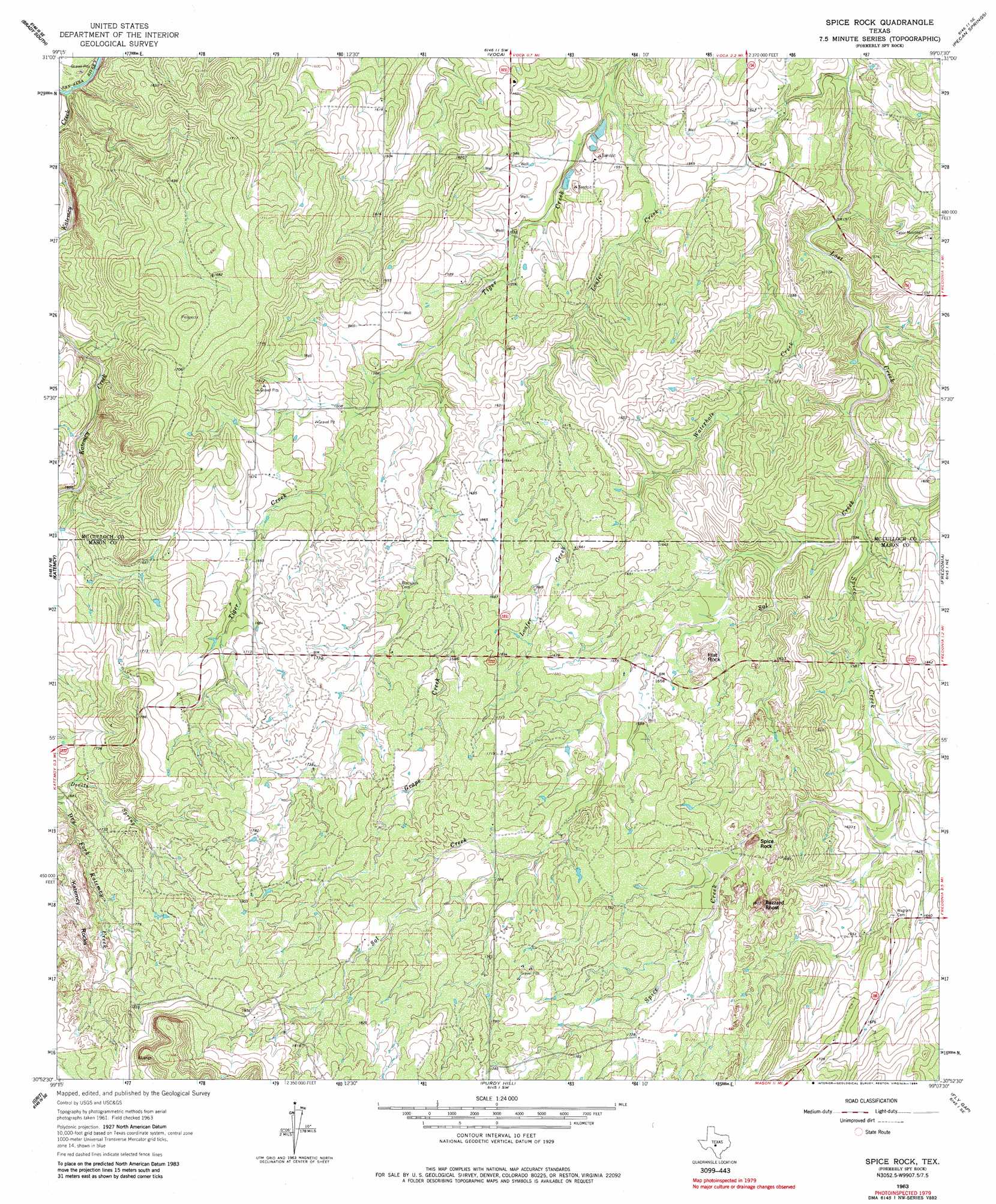
Spy Rock Topo Map Texas
To zoom in, hover over the map of Spy Rock
USGS Topo Quad 30099h2 - 1:24,000 scale
| Topo Map Name: | Spy Rock |
| USGS Topo Quad ID: | 30099h2 |
| Print Size: | ca. 21 1/4" wide x 27" high |
| Southeast Coordinates: | 30.875° N latitude / 99.125° W longitude |
| Map Center Coordinates: | 30.9375° N latitude / 99.1875° W longitude |
| U.S. State: | TX |
| Filename: | o30099h2.jpg |
| Download Map JPG Image: | Spy Rock topo map 1:24,000 scale |
| Map Type: | Topographic |
| Topo Series: | 7.5´ |
| Map Scale: | 1:24,000 |
| Source of Map Images: | United States Geological Survey (USGS) |
| Alternate Map Versions: |
Spy Rock TX 1963, updated 1964 Download PDF Buy paper map Spice Rock TX 1963, updated 1984 Download PDF Buy paper map Spice Rock TX 2010 Download PDF Buy paper map Spice Rock TX 2013 Download PDF Buy paper map Spice Rock TX 2016 Download PDF Buy paper map |
1:24,000 Topo Quads surrounding Spy Rock
West Sweden |
Brady North |
Rochelle |
Lost Creek |
Baker Spring |
Brady Sw |
Brady South |
Voca |
Pecan Springs |
Brady Mountain |
Calf Creek |
Katemcy |
Spy Rock |
Fredonia |
Pontotoc |
Long Mountain |
Grit |
Purdy Hill |
Fly Gap |
Smoothingiron Mountain |
Sheep Run Creek |
Turtle Creek |
Mason |
Art |
Castell |
> Back to 30099e1 at 1:100,000 scale
> Back to 30098a1 at 1:250,000 scale
> Back to U.S. Topo Maps home
Spy Rock topo map: Gazetteer
Spy Rock: Airports
Polk Ranch Airport elevation 559m 1833′Spy Rock: Streams
Katemcy Creek elevation 465m 1525′Loafer Creek elevation 463m 1519′
Mud Creek elevation 481m 1578′
Sandy Creek elevation 472m 1548′
Spice Creek elevation 475m 1558′
Waterhole Creek elevation 454m 1489′
Spy Rock: Summits
Flat Rock elevation 518m 1699′Spy Rock elevation 533m 1748′
Spy Rock digital topo map on disk
Buy this Spy Rock topo map showing relief, roads, GPS coordinates and other geographical features, as a high-resolution digital map file on DVD: