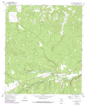
Clear Creek Lake Topo Map Texas
To zoom in, hover over the map of Clear Creek Lake
USGS Topo Quad 30099h8 - 1:24,000 scale
| Topo Map Name: | Clear Creek Lake |
| USGS Topo Quad ID: | 30099h8 |
| Print Size: | ca. 21 1/4" wide x 27" high |
| Southeast Coordinates: | 30.875° N latitude / 99.875° W longitude |
| Map Center Coordinates: | 30.9375° N latitude / 99.9375° W longitude |
| U.S. State: | TX |
| Filename: | o30099h8.jpg |
| Download Map JPG Image: | Clear Creek Lake topo map 1:24,000 scale |
| Map Type: | Topographic |
| Topo Series: | 7.5´ |
| Map Scale: | 1:24,000 |
| Source of Map Images: | United States Geological Survey (USGS) |
| Alternate Map Versions: |
Clear Creek Lake TX 1970, updated 1973 Download PDF Buy paper map Clear Creek Lake TX 1970, updated 1987 Download PDF Buy paper map Clear Creek Lake TX 2010 Download PDF Buy paper map Clear Creek Lake TX 2012 Download PDF Buy paper map Clear Creek Lake TX 2016 Download PDF Buy paper map |
1:24,000 Topo Quads surrounding Clear Creek Lake
> Back to 30099e1 at 1:100,000 scale
> Back to 30098a1 at 1:250,000 scale
> Back to U.S. Topo Maps home
Clear Creek Lake topo map: Gazetteer
Clear Creek Lake: Dams
Clear Creek Lake Dam elevation 607m 1991′Clear Creek Lake: Populated Places
Beyer Crossing elevation 593m 1945′Clear Creek Lake: Reservoirs
Clear Creek Lake elevation 607m 1991′Clear Creek Lake: Springs
Wilkinson Springs elevation 640m 2099′Clear Creek Lake: Streams
Bois D'Arc Creek elevation 594m 1948′Clear Creek elevation 595m 1952′
Dry Creek elevation 592m 1942′
Fields Creek elevation 598m 1961′
North Fork Dry Creek elevation 639m 2096′
Rocky Creek elevation 598m 1961′
Silver Mine Creek elevation 607m 1991′
Clear Creek Lake digital topo map on disk
Buy this Clear Creek Lake topo map showing relief, roads, GPS coordinates and other geographical features, as a high-resolution digital map file on DVD:


