Turney Draw Ne Topo Map Texas
To zoom in, hover over the map of Turney Draw Ne
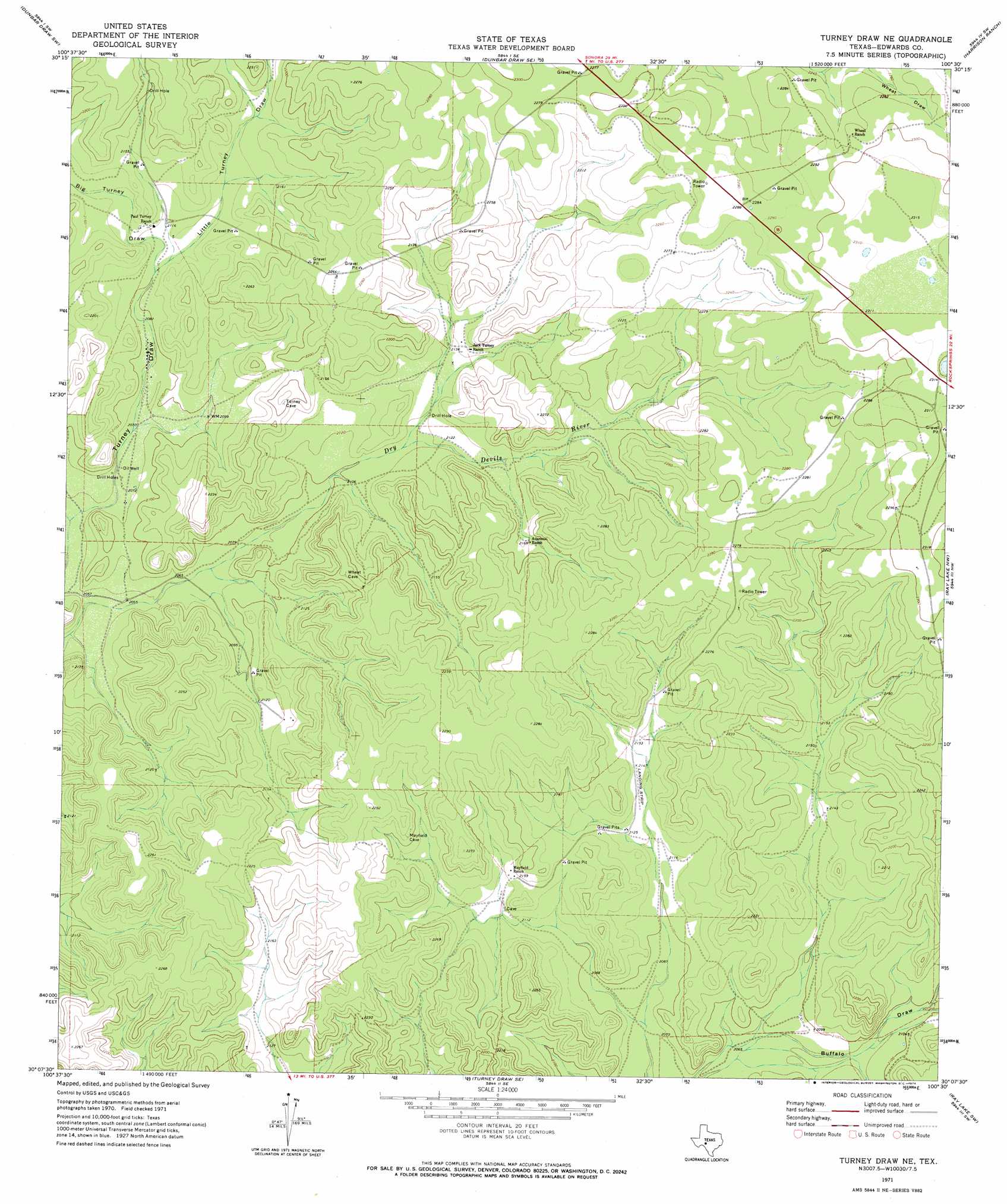
USGS Topo Quad 30100b5 - 1:24,000 scale
| Topo Map Name: | Turney Draw Ne |
| USGS Topo Quad ID: | 30100b5 |
| Print Size: | ca. 21 1/4" wide x 27" high |
| Southeast Coordinates: | 30.125° N latitude / 100.5° W longitude |
| Map Center Coordinates: | 30.1875° N latitude / 100.5625° W longitude |
| U.S. State: | TX |
| Filename: | o30100b5.jpg |
| Download Map JPG Image: | Turney Draw Ne topo map 1:24,000 scale |
| Map Type: | Topographic |
| Topo Series: | 7.5´ |
| Map Scale: | 1:24,000 |
| Source of Map Images: | United States Geological Survey (USGS) |
| Alternate Map Versions: |
Turney Draw NE TX 1971, updated 1974 Download PDF Buy paper map Turney Draw NE TX 2010 Download PDF Buy paper map Turney Draw NE TX 2012 Download PDF Buy paper map Turney Draw NE TX 2016 Download PDF Buy paper map |
1:24,000 Topo Quads surrounding Turney Draw Ne
Hudspeth Draw |
Dunbar Draw Nw |
Dunbar Draw Ne |
Steen Lake |
Live Oak Draw |
Flat Rock Draw Se |
Dunbar Draw Sw |
Dunbar Draw Se |
Harrison Ranch |
Stewart Ranch |
White Draw Ne |
Turney Draw Nw |
Turney Draw Ne |
Ray Lake Nw |
Ray Lake |
Robinson Draw |
Four Mills |
Turney Draw Se |
Ray Lake Sw |
Ray Lake Se |
Open Hollow |
Holcomb Draw |
Carta Valley Ne |
Black Waterhole |
Indian Creek Ne |
> Back to 30100a1 at 1:100,000 scale
> Back to 30100a1 at 1:250,000 scale
> Back to U.S. Topo Maps home
Turney Draw Ne topo map: Gazetteer
Turney Draw Ne: Valleys
Big Turney Draw elevation 641m 2103′Little Turney Draw elevation 640m 2099′
Turney Draw Ne digital topo map on disk
Buy this Turney Draw Ne topo map showing relief, roads, GPS coordinates and other geographical features, as a high-resolution digital map file on DVD: