White Draw Nw Topo Map Texas
To zoom in, hover over the map of White Draw Nw
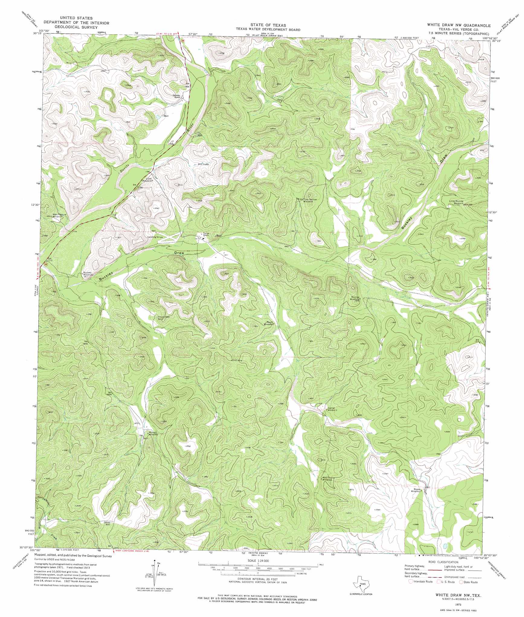
USGS Topo Quad 30100b8 - 1:24,000 scale
| Topo Map Name: | White Draw Nw |
| USGS Topo Quad ID: | 30100b8 |
| Print Size: | ca. 21 1/4" wide x 27" high |
| Southeast Coordinates: | 30.125° N latitude / 100.875° W longitude |
| Map Center Coordinates: | 30.1875° N latitude / 100.9375° W longitude |
| U.S. State: | TX |
| Filename: | o30100b8.jpg |
| Download Map JPG Image: | White Draw Nw topo map 1:24,000 scale |
| Map Type: | Topographic |
| Topo Series: | 7.5´ |
| Map Scale: | 1:24,000 |
| Source of Map Images: | United States Geological Survey (USGS) |
| Alternate Map Versions: |
White Draw NW TX 1973, updated 1975 Download PDF Buy paper map White Draw NW TX 2010 Download PDF Buy paper map White Draw NW TX 2012 Download PDF Buy paper map White Draw NW TX 2016 Download PDF Buy paper map |
1:24,000 Topo Quads surrounding White Draw Nw
Harrell Canyon |
Wild Horse Canyon |
Shafter Draw |
Hudspeth Draw |
Dunbar Draw Nw |
Indian Draw |
Brushy Draw |
Flat Rock Draw Sw |
Flat Rock Draw Se |
Dunbar Draw Sw |
Bee Canyon |
Juno |
White Draw Nw |
White Draw Ne |
Turney Draw Nw |
Sycamore Canyon |
Deaton Draw |
White Draw |
Robinson Draw |
Four Mills |
Bakers Crossing |
Telephone Canyon |
Dolan Springs |
Open Hollow |
Holcomb Draw |
> Back to 30100a1 at 1:100,000 scale
> Back to 30100a1 at 1:250,000 scale
> Back to U.S. Topo Maps home
White Draw Nw topo map: Gazetteer
White Draw Nw: Populated Places
Corner Windmill elevation 586m 1922′White Draw Nw: Valleys
Buckley Draw elevation 543m 1781′White Draw Nw: Wells
Divide Well elevation 624m 2047′House Well Number Two elevation 561m 1840′
White Draw Nw digital topo map on disk
Buy this White Draw Nw topo map showing relief, roads, GPS coordinates and other geographical features, as a high-resolution digital map file on DVD: