Flat Rock Draw Sw Topo Map Texas
To zoom in, hover over the map of Flat Rock Draw Sw
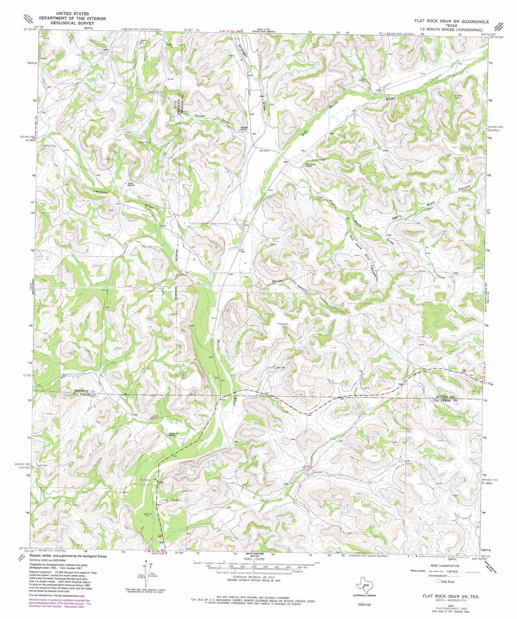
USGS Topo Quad 30100c8 - 1:24,000 scale
| Topo Map Name: | Flat Rock Draw Sw |
| USGS Topo Quad ID: | 30100c8 |
| Print Size: | ca. 21 1/4" wide x 27" high |
| Southeast Coordinates: | 30.25° N latitude / 100.875° W longitude |
| Map Center Coordinates: | 30.3125° N latitude / 100.9375° W longitude |
| U.S. State: | TX |
| Filename: | o30100c8.jpg |
| Download Map JPG Image: | Flat Rock Draw Sw topo map 1:24,000 scale |
| Map Type: | Topographic |
| Topo Series: | 7.5´ |
| Map Scale: | 1:24,000 |
| Source of Map Images: | United States Geological Survey (USGS) |
| Alternate Map Versions: |
Flat Rock Draw SW TX 1967, updated 1970 Download PDF Buy paper map Flat Rock Draw SW TX 1967, updated 1982 Download PDF Buy paper map Flat Rock Draw SW TX 2010 Download PDF Buy paper map Flat Rock Draw SW TX 2012 Download PDF Buy paper map Flat Rock Draw SW TX 2016 Download PDF Buy paper map |
1:24,000 Topo Quads surrounding Flat Rock Draw Sw
Baggett Ranch |
Ozona Se |
Hospital Ranch |
Caverns Of Sonora |
Sonora |
Harrell Canyon |
Wild Horse Canyon |
Shafter Draw |
Hudspeth Draw |
Dunbar Draw Nw |
Indian Draw |
Brushy Draw |
Flat Rock Draw Sw |
Flat Rock Draw Se |
Dunbar Draw Sw |
Bee Canyon |
Juno |
White Draw Nw |
White Draw Ne |
Turney Draw Nw |
Sycamore Canyon |
Deaton Draw |
White Draw |
Robinson Draw |
Four Mills |
> Back to 30100a1 at 1:100,000 scale
> Back to 30100a1 at 1:250,000 scale
> Back to U.S. Topo Maps home
Flat Rock Draw Sw topo map: Gazetteer
Flat Rock Draw Sw: Streams
Dry Devils River elevation 568m 1863′Flat Rock Draw Sw: Valleys
Flat Rock Draw elevation 573m 1879′Granger Draw elevation 568m 1863′
House Draw elevation 574m 1883′
Jackson Draw elevation 575m 1886′
Ogels Road Canyon elevation 591m 1938′
Pot Hole City Canyon elevation 587m 1925′
Rough Canyon elevation 569m 1866′
Flat Rock Draw Sw digital topo map on disk
Buy this Flat Rock Draw Sw topo map showing relief, roads, GPS coordinates and other geographical features, as a high-resolution digital map file on DVD: