Fort Terrett Ranch Topo Map Texas
To zoom in, hover over the map of Fort Terrett Ranch
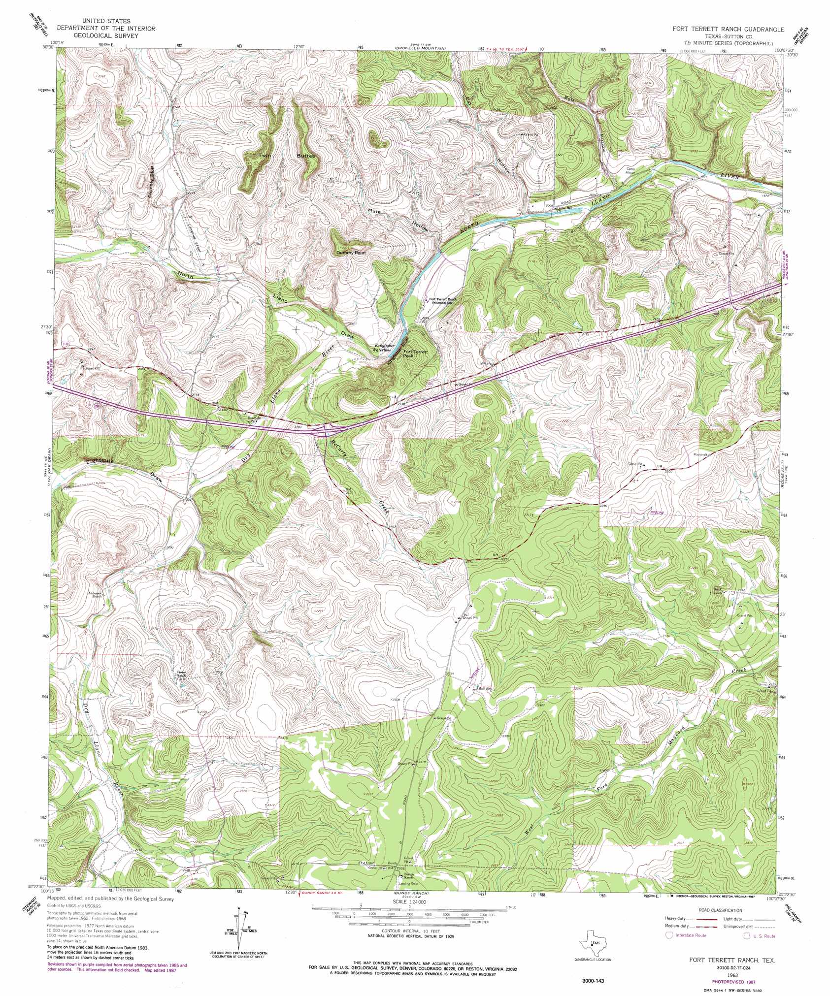
USGS Topo Quad 30100d2 - 1:24,000 scale
| Topo Map Name: | Fort Terrett Ranch |
| USGS Topo Quad ID: | 30100d2 |
| Print Size: | ca. 21 1/4" wide x 27" high |
| Southeast Coordinates: | 30.375° N latitude / 100.125° W longitude |
| Map Center Coordinates: | 30.4375° N latitude / 100.1875° W longitude |
| U.S. State: | TX |
| Filename: | o30100d2.jpg |
| Download Map JPG Image: | Fort Terrett Ranch topo map 1:24,000 scale |
| Map Type: | Topographic |
| Topo Series: | 7.5´ |
| Map Scale: | 1:24,000 |
| Source of Map Images: | United States Geological Survey (USGS) |
| Alternate Map Versions: |
Fort Terrett Ranch TX 1963, updated 1966 Download PDF Buy paper map Fort Terrett Ranch TX 1963, updated 1987 Download PDF Buy paper map Fort Terrett Ranch TX 2010 Download PDF Buy paper map Fort Terrett Ranch TX 2012 Download PDF Buy paper map Fort Terrett Ranch TX 2016 Download PDF Buy paper map |
1:24,000 Topo Quads surrounding Fort Terrett Ranch
Buffalo Well Nw |
Buffalo Well |
Coal Kiln Draw |
Mckegan Draw Ne |
Rust Ranch |
Buffalo Well Sw |
Buffalo Well Se |
Brokeleg Mountain |
Mckegan Draw |
Stark Creek |
Steen Lake |
Live Oak Draw |
Fort Terrett Ranch |
Roosevelt |
Bailey Creek |
Harrison Ranch |
Stewart Ranch |
Bundy Ranch |
Hill Ranch |
Telegraph |
Ray Lake Nw |
Ray Lake |
Elbow Lake |
Paint Rock Spring |
Bradford Creek |
> Back to 30100a1 at 1:100,000 scale
> Back to 30100a1 at 1:250,000 scale
> Back to U.S. Topo Maps home
Fort Terrett Ranch topo map: Gazetteer
Fort Terrett Ranch: Cliffs
Chimney Bluff elevation 672m 2204′Dummy Point elevation 709m 2326′
Kingfisher Bluff elevation 658m 2158′
Fort Terrett Ranch: Dams
Fort Terrett Ranch River Dam elevation 610m 2001′Fort Terrett Ranch: Lakes
Kingfisher Waterhole elevation 644m 2112′Fort Terrett Ranch: Reservoirs
Fort Terrett Ranch River Reservoir elevation 610m 2001′Fort Terrett Ranch: Springs
Fort Terrett Spring elevation 637m 2089′Fort Terrett Ranch: Streams
Dry Llano River elevation 612m 2007′McCarty Creek elevation 619m 2030′
Fort Terrett Ranch: Summits
Fort Terrett Peak elevation 671m 2201′Twin Buttes elevation 722m 2368′
Fort Terrett Ranch: Valleys
Bell Hollow elevation 605m 1984′Cat Hollow elevation 610m 2001′
Eightmile Draw elevation 624m 2047′
Mule Hollow elevation 608m 1994′
North Llano Draw elevation 612m 2007′
Fort Terrett Ranch: Wells
Bull Well elevation 704m 2309′Fort Terrett Ranch digital topo map on disk
Buy this Fort Terrett Ranch topo map showing relief, roads, GPS coordinates and other geographical features, as a high-resolution digital map file on DVD: