Hudspeth Draw Topo Map Texas
To zoom in, hover over the map of Hudspeth Draw
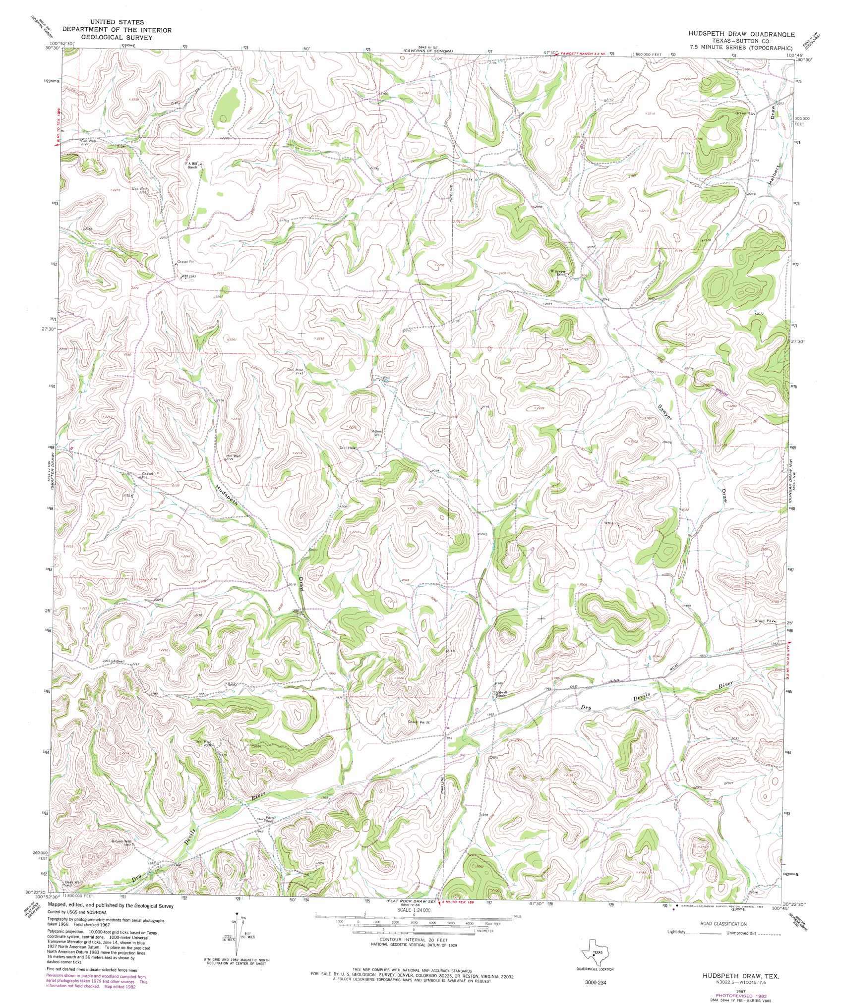
USGS Topo Quad 30100d7 - 1:24,000 scale
| Topo Map Name: | Hudspeth Draw |
| USGS Topo Quad ID: | 30100d7 |
| Print Size: | ca. 21 1/4" wide x 27" high |
| Southeast Coordinates: | 30.375° N latitude / 100.75° W longitude |
| Map Center Coordinates: | 30.4375° N latitude / 100.8125° W longitude |
| U.S. State: | TX |
| Filename: | o30100d7.jpg |
| Download Map JPG Image: | Hudspeth Draw topo map 1:24,000 scale |
| Map Type: | Topographic |
| Topo Series: | 7.5´ |
| Map Scale: | 1:24,000 |
| Source of Map Images: | United States Geological Survey (USGS) |
| Alternate Map Versions: |
Hudspeth Draw TX 1967, updated 1970 Download PDF Buy paper map Hudspeth Draw TX 1967, updated 1982 Download PDF Buy paper map Hudspeth Draw TX 2010 Download PDF Buy paper map Hudspeth Draw TX 2012 Download PDF Buy paper map Hudspeth Draw TX 2016 Download PDF Buy paper map |
1:24,000 Topo Quads surrounding Hudspeth Draw
Crockett Heights |
Nolen Draw |
Savell Ranch |
Sonora Nw |
Sonora Ne |
Ozona Se |
Hospital Ranch |
Caverns Of Sonora |
Sonora |
Sonora Se |
Wild Horse Canyon |
Shafter Draw |
Hudspeth Draw |
Dunbar Draw Nw |
Dunbar Draw Ne |
Brushy Draw |
Flat Rock Draw Sw |
Flat Rock Draw Se |
Dunbar Draw Sw |
Dunbar Draw Se |
Juno |
White Draw Nw |
White Draw Ne |
Turney Draw Nw |
Turney Draw Ne |
> Back to 30100a1 at 1:100,000 scale
> Back to 30100a1 at 1:250,000 scale
> Back to U.S. Topo Maps home
Hudspeth Draw topo map: Gazetteer
Hudspeth Draw: Valleys
Halbert Draw elevation 635m 2083′Hudspeth Draw elevation 594m 1948′
Sawyer Draw elevation 603m 1978′
Hudspeth Draw: Wells
Binyon Well elevation 594m 1948′Hill Well elevation 649m 2129′
Potter Well elevation 591m 1938′
Stokes Well elevation 643m 2109′
Hudspeth Draw digital topo map on disk
Buy this Hudspeth Draw topo map showing relief, roads, GPS coordinates and other geographical features, as a high-resolution digital map file on DVD: