Coal Kiln Draw Topo Map Texas
To zoom in, hover over the map of Coal Kiln Draw
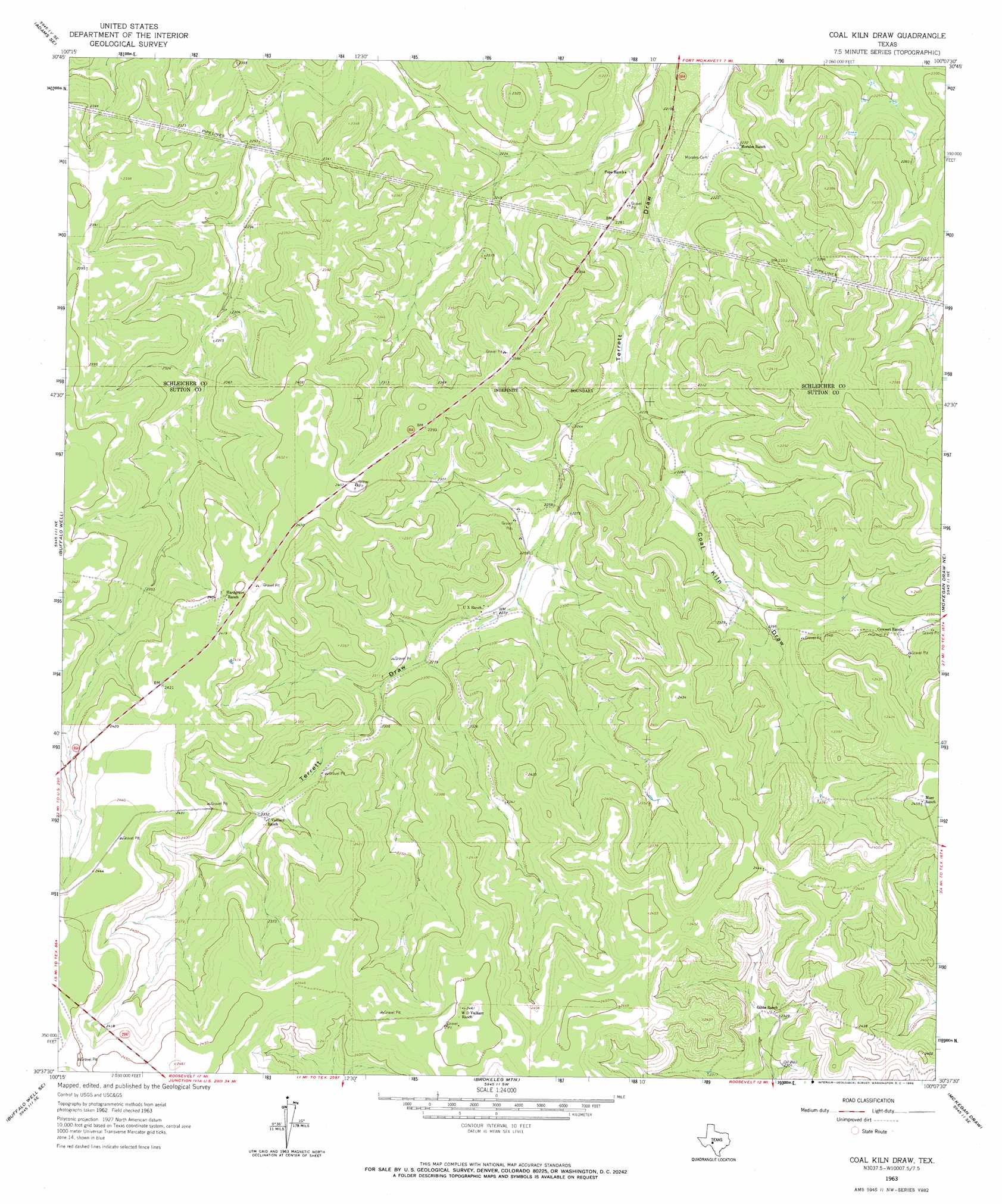
USGS Topo Quad 30100f2 - 1:24,000 scale
| Topo Map Name: | Coal Kiln Draw |
| USGS Topo Quad ID: | 30100f2 |
| Print Size: | ca. 21 1/4" wide x 27" high |
| Southeast Coordinates: | 30.625° N latitude / 100.125° W longitude |
| Map Center Coordinates: | 30.6875° N latitude / 100.1875° W longitude |
| U.S. State: | TX |
| Filename: | o30100f2.jpg |
| Download Map JPG Image: | Coal Kiln Draw topo map 1:24,000 scale |
| Map Type: | Topographic |
| Topo Series: | 7.5´ |
| Map Scale: | 1:24,000 |
| Source of Map Images: | United States Geological Survey (USGS) |
| Alternate Map Versions: |
Coal Kiln Draw TX 1963, updated 1966 Download PDF Buy paper map Coal Kiln Draw TX 2010 Download PDF Buy paper map Coal Kiln Draw TX 2012 Download PDF Buy paper map Coal Kiln Draw TX 2016 Download PDF Buy paper map |
1:24,000 Topo Quads surrounding Coal Kiln Draw
Adams Nw |
Adams |
Fort Mckavett Nw |
Fort Mckavett Ne |
Clear Creek Lake |
Adams Sw |
Adams Se |
Coralina Ranch |
Fort Mckavett |
San Augustine Draw |
Buffalo Well Nw |
Buffalo Well |
Coal Kiln Draw |
Mckegan Draw Ne |
Rust Ranch |
Buffalo Well Sw |
Buffalo Well Se |
Brokeleg Mountain |
Mckegan Draw |
Stark Creek |
Steen Lake |
Live Oak Draw |
Fort Terrett Ranch |
Roosevelt |
Bailey Creek |
> Back to 30100e1 at 1:100,000 scale
> Back to 30100a1 at 1:250,000 scale
> Back to U.S. Topo Maps home
Coal Kiln Draw digital topo map on disk
Buy this Coal Kiln Draw topo map showing relief, roads, GPS coordinates and other geographical features, as a high-resolution digital map file on DVD: