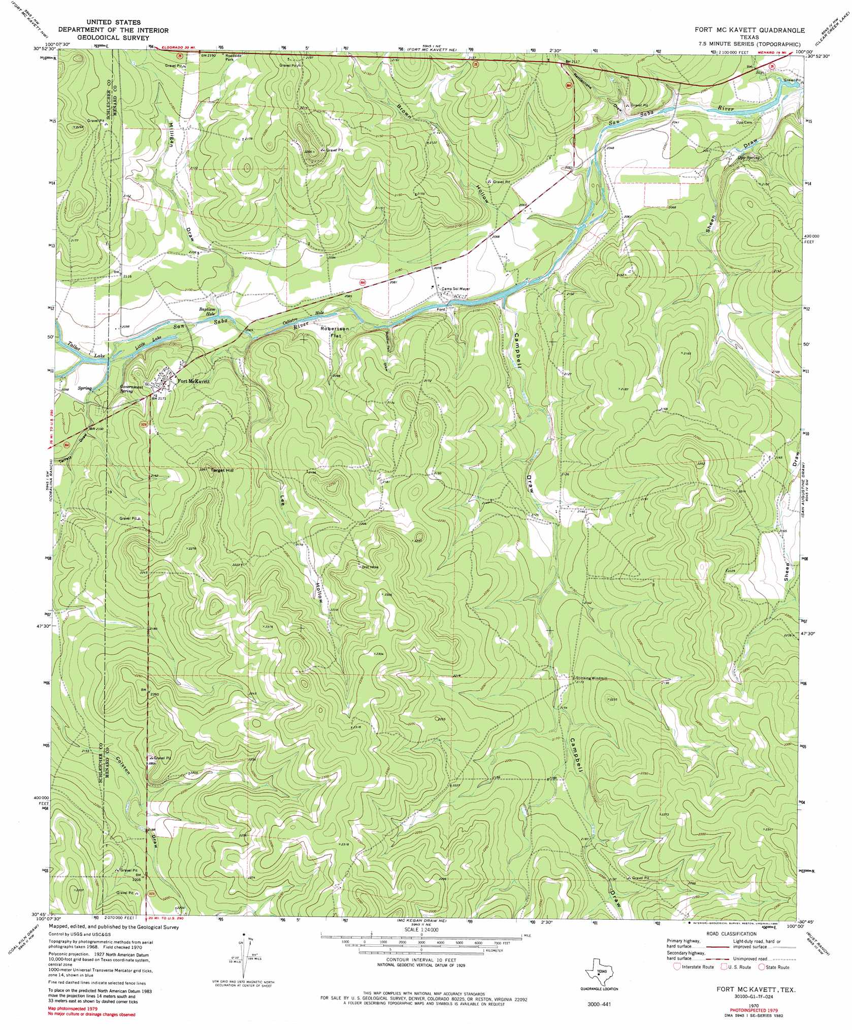
Fort Mckavett Topo Map Texas
To zoom in, hover over the map of Fort Mckavett
USGS Topo Quad 30100g1 - 1:24,000 scale
| Topo Map Name: | Fort Mckavett |
| USGS Topo Quad ID: | 30100g1 |
| Print Size: | ca. 21 1/4" wide x 27" high |
| Southeast Coordinates: | 30.75° N latitude / 100° W longitude |
| Map Center Coordinates: | 30.8125° N latitude / 100.0625° W longitude |
| U.S. State: | TX |
| Filename: | o30100g1.jpg |
| Download Map JPG Image: | Fort Mckavett topo map 1:24,000 scale |
| Map Type: | Topographic |
| Topo Series: | 7.5´ |
| Map Scale: | 1:24,000 |
| Source of Map Images: | United States Geological Survey (USGS) |
| Alternate Map Versions: |
Fort McKavett TX 1970, updated 1973 Download PDF Buy paper map Fort McKavett TX 1970, updated 1985 Download PDF Buy paper map Fort McKavett TX 2010 Download PDF Buy paper map Fort McKavett TX 2012 Download PDF Buy paper map Fort McKavett TX 2016 Download PDF Buy paper map |
1:24,000 Topo Quads surrounding Fort Mckavett
Christoval Se |
Rocking Chair Ranch |
Del Venado Ranch |
Eden Sw |
Eden Se |
Adams |
Fort Mckavett Nw |
Fort Mckavett Ne |
Clear Creek Lake |
Menard |
Adams Se |
Coralina Ranch |
Fort Mckavett |
San Augustine Draw |
Spoon Draw |
Buffalo Well |
Coal Kiln Draw |
Mckegan Draw Ne |
Rust Ranch |
Julio Draw |
Buffalo Well Se |
Brokeleg Mountain |
Mckegan Draw |
Stark Creek |
Elm Slough |
> Back to 30100e1 at 1:100,000 scale
> Back to 30100a1 at 1:250,000 scale
> Back to U.S. Topo Maps home
Fort Mckavett topo map: Gazetteer
Fort Mckavett: Flats
Robertson Flat elevation 634m 2080′Fort Mckavett: Lakes
Baptism Hole elevation 631m 2070′Calistro Hole elevation 626m 2053′
Little Lake elevation 630m 2066′
Talbot Lake elevation 632m 2073′
Fort Mckavett: Parks
Fort McKavett State Historical Park elevation 650m 2132′Fort Mckavett: Populated Places
Fort McKavett elevation 661m 2168′Fort Mckavett: Springs
Government Spring elevation 637m 2089′Government Springs elevation 641m 2103′
Opp Spring elevation 632m 2073′
Fort Mckavett: Streams
Middle Valley Prong elevation 631m 2070′North Valley Prong elevation 631m 2070′
Fort Mckavett: Summits
Target Hill elevation 690m 2263′Fort Mckavett: Valleys
Brown Hollow elevation 621m 2037′Butcher Pen Draw elevation 629m 2063′
Campbell Draw elevation 626m 2053′
Lee Hollow elevation 640m 2099′
Middle Valley elevation 631m 2070′
Milligan Draw elevation 631m 2070′
North Valley elevation 632m 2073′
Rattlesnake Draw elevation 620m 2034′
Sheen Draw elevation 613m 2011′
Terrett Draw elevation 638m 2093′
Fort Mckavett digital topo map on disk
Buy this Fort Mckavett topo map showing relief, roads, GPS coordinates and other geographical features, as a high-resolution digital map file on DVD: