Moore Ranch Topo Map Texas
To zoom in, hover over the map of Moore Ranch
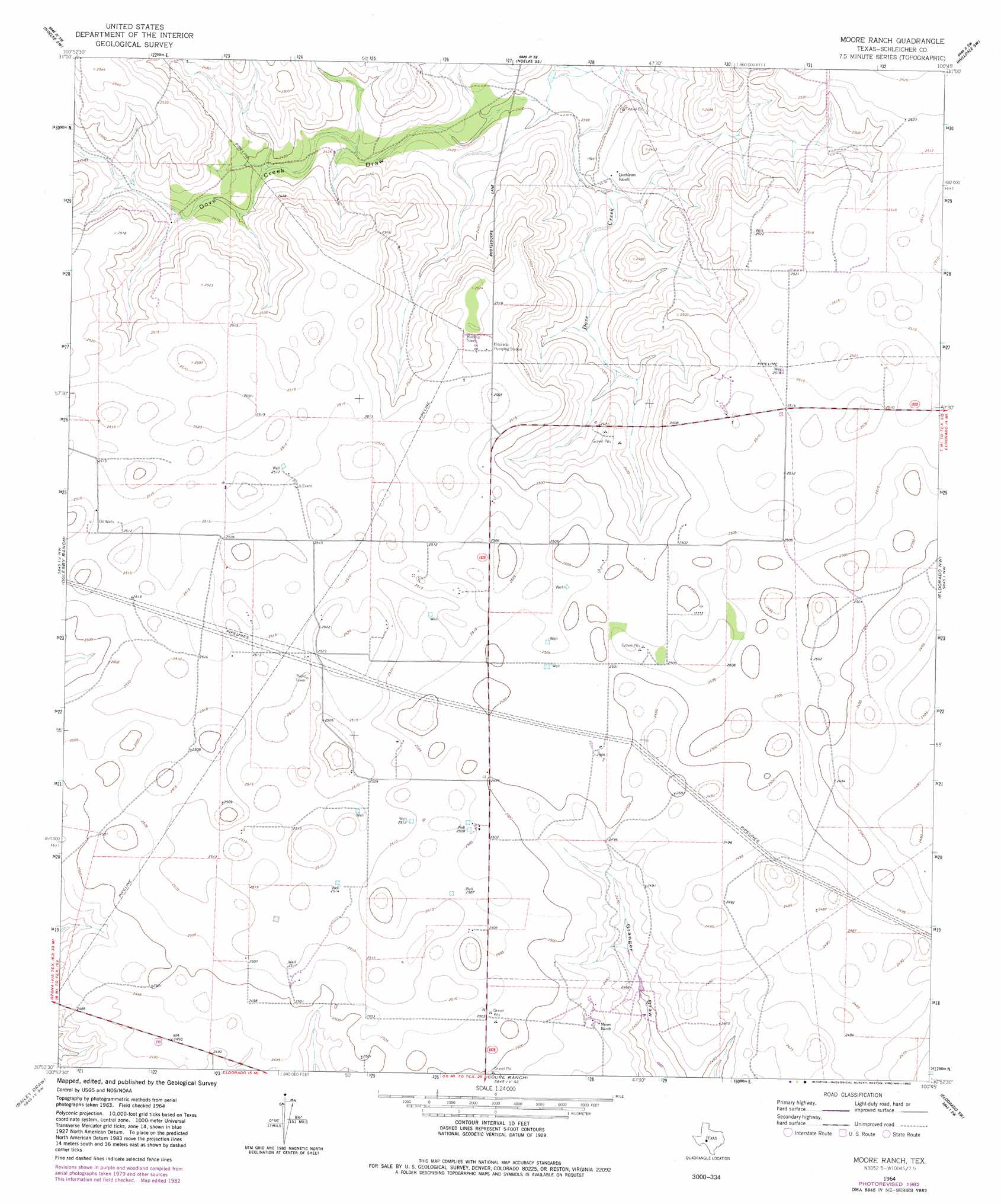
USGS Topo Quad 30100h7 - 1:24,000 scale
| Topo Map Name: | Moore Ranch |
| USGS Topo Quad ID: | 30100h7 |
| Print Size: | ca. 21 1/4" wide x 27" high |
| Southeast Coordinates: | 30.875° N latitude / 100.75° W longitude |
| Map Center Coordinates: | 30.9375° N latitude / 100.8125° W longitude |
| U.S. State: | TX |
| Filename: | o30100h7.jpg |
| Download Map JPG Image: | Moore Ranch topo map 1:24,000 scale |
| Map Type: | Topographic |
| Topo Series: | 7.5´ |
| Map Scale: | 1:24,000 |
| Source of Map Images: | United States Geological Survey (USGS) |
| Alternate Map Versions: |
Moore Ranch TX 1964, updated 1966 Download PDF Buy paper map Moore Ranch TX 1964, updated 1982 Download PDF Buy paper map Moore Ranch TX 2010 Download PDF Buy paper map Moore Ranch TX 2012 Download PDF Buy paper map Moore Ranch TX 2016 Download PDF Buy paper map |
1:24,000 Topo Quads surrounding Moore Ranch
Barnhart Ne |
Noelke |
Noelke Ne |
Hulldale Nw |
Cold Creek Spring |
Suggs |
Noelke Sw |
Noelke Se |
Hulldale Sw |
Hulldale |
Double Mill Draw Ne |
Oglesby Ranch |
Moore Ranch |
Eldorado Nw |
Eldorado Ne |
Double Mill Draw Se |
Bailey Draw |
Coupe Ranch |
Eldorado Sw |
Eldorado |
Crockett Heights |
Nolen Draw |
Savell Ranch |
Sonora Nw |
Sonora Ne |
> Back to 30100e1 at 1:100,000 scale
> Back to 30100a1 at 1:250,000 scale
> Back to U.S. Topo Maps home
No gazetteer data is available for the Moore Ranch topo map sheet.
Moore Ranch digital topo map on disk
Buy this Moore Ranch topo map showing relief, roads, GPS coordinates and other geographical features, as a high-resolution digital map file on DVD: