Little Fielder Draw Topo Map Texas
To zoom in, hover over the map of Little Fielder Draw
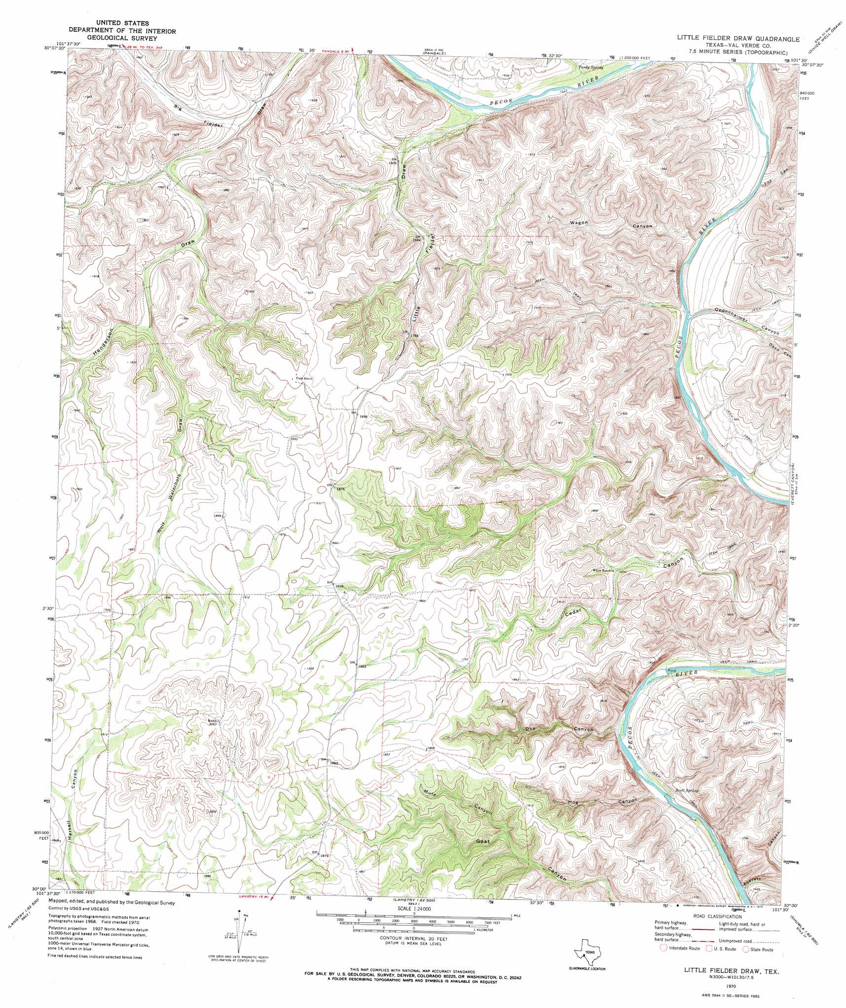
USGS Topo Quad 30101a5 - 1:24,000 scale
| Topo Map Name: | Little Fielder Draw |
| USGS Topo Quad ID: | 30101a5 |
| Print Size: | ca. 21 1/4" wide x 27" high |
| Southeast Coordinates: | 30° N latitude / 101.5° W longitude |
| Map Center Coordinates: | 30.0625° N latitude / 101.5625° W longitude |
| U.S. State: | TX |
| Filename: | o30101a5.jpg |
| Download Map JPG Image: | Little Fielder Draw topo map 1:24,000 scale |
| Map Type: | Topographic |
| Topo Series: | 7.5´ |
| Map Scale: | 1:24,000 |
| Source of Map Images: | United States Geological Survey (USGS) |
| Alternate Map Versions: |
Little Fielder Draw TX 1970, updated 1973 Download PDF Buy paper map Little Fielder Draw TX 2010 Download PDF Buy paper map Little Fielder Draw TX 2012 Download PDF Buy paper map Little Fielder Draw TX 2016 Download PDF Buy paper map |
1:24,000 Topo Quads surrounding Little Fielder Draw
Geddis Canyon East |
Post Canyon |
Antone Canyon |
Howards Well Sw |
Aermotor Draw |
Meyers Canyon Ne |
Hackberry Crossing |
Pandale |
Divide Well Draw |
Steel Star Draw |
Sevenmile Canyon |
Roundhill Ranch |
Little Fielder Draw |
Everett Canyon |
Blue Hills |
Lozier Canyon North |
Pumpville |
Harkell Canyon |
Still Canyon |
Mayfield Canyon |
Lozier Canyon South |
Ramsey Canyon |
Langtry |
Shumla |
Pecos High Bridge |
> Back to 30101a1 at 1:100,000 scale
> Back to 30100a1 at 1:250,000 scale
> Back to U.S. Topo Maps home
Little Fielder Draw topo map: Gazetteer
Little Fielder Draw: Springs
Cox Springs elevation 542m 1778′Everett Springs elevation 514m 1686′
Scott Spring elevation 435m 1427′
Tardy Spring elevation 475m 1558′
Little Fielder Draw: Valleys
Deep Canyon elevation 460m 1509′Everett Canyon elevation 427m 1400′
Fox Canyon elevation 458m 1502′
Henderson Draw elevation 492m 1614′
Hog Canyon elevation 431m 1414′
Little Fielder Draw elevation 474m 1555′
Mule Canyon elevation 512m 1679′
Oppenheimer Canyon elevation 457m 1499′
Oso Canyon elevation 430m 1410′
Wagon Canyon elevation 456m 1496′
Wolf Waterhole Draw elevation 522m 1712′
Little Fielder Draw digital topo map on disk
Buy this Little Fielder Draw topo map showing relief, roads, GPS coordinates and other geographical features, as a high-resolution digital map file on DVD: