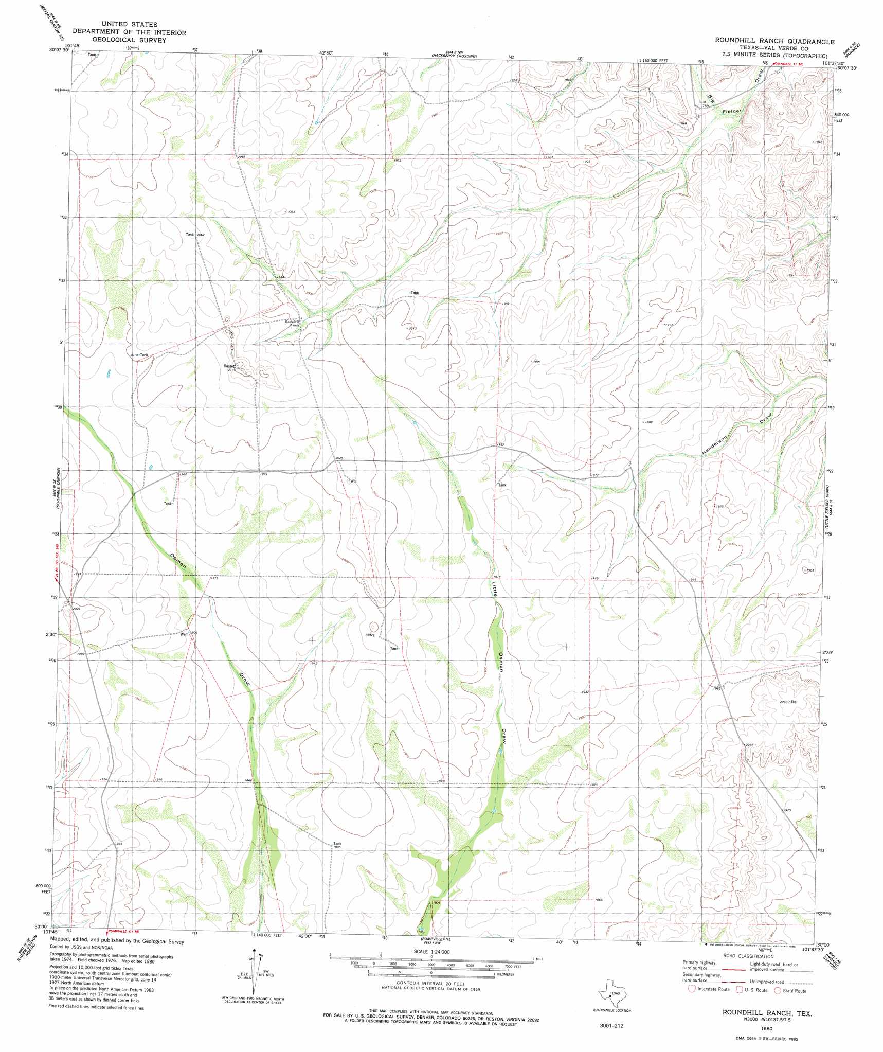
Roundhill Ranch Topo Map Texas
To zoom in, hover over the map of Roundhill Ranch
USGS Topo Quad 30101a6 - 1:24,000 scale
| Topo Map Name: | Roundhill Ranch |
| USGS Topo Quad ID: | 30101a6 |
| Print Size: | ca. 21 1/4" wide x 27" high |
| Southeast Coordinates: | 30° N latitude / 101.625° W longitude |
| Map Center Coordinates: | 30.0625° N latitude / 101.6875° W longitude |
| U.S. State: | TX |
| Filename: | o30101a6.jpg |
| Download Map JPG Image: | Roundhill Ranch topo map 1:24,000 scale |
| Map Type: | Topographic |
| Topo Series: | 7.5´ |
| Map Scale: | 1:24,000 |
| Source of Map Images: | United States Geological Survey (USGS) |
| Alternate Map Versions: |
Roundhill Ranch TX 1980, updated 1980 Download PDF Buy paper map Roundhill Ranch TX 2010 Download PDF Buy paper map Roundhill Ranch TX 2012 Download PDF Buy paper map Roundhill Ranch TX 2016 Download PDF Buy paper map |
1:24,000 Topo Quads surrounding Roundhill Ranch
Geddis Canyon West |
Geddis Canyon East |
Post Canyon |
Antone Canyon |
Howards Well Sw |
Meyers Canyon Nw |
Meyers Canyon Ne |
Hackberry Crossing |
Pandale |
Divide Well Draw |
Meyers Canyon |
Sevenmile Canyon |
Roundhill Ranch |
Little Fielder Draw |
Everett Canyon |
Cook Creek North |
Lozier Canyon North |
Pumpville |
Harkell Canyon |
Still Canyon |
Cook Creek South |
Lozier Canyon South |
Ramsey Canyon |
Langtry |
Shumla |
> Back to 30101a1 at 1:100,000 scale
> Back to 30100a1 at 1:250,000 scale
> Back to U.S. Topo Maps home
No gazetteer data is available for the Roundhill Ranch topo map sheet.
Roundhill Ranch digital topo map on disk
Buy this Roundhill Ranch topo map showing relief, roads, GPS coordinates and other geographical features, as a high-resolution digital map file on DVD: