Geddis Canyon East Topo Map Texas
To zoom in, hover over the map of Geddis Canyon East
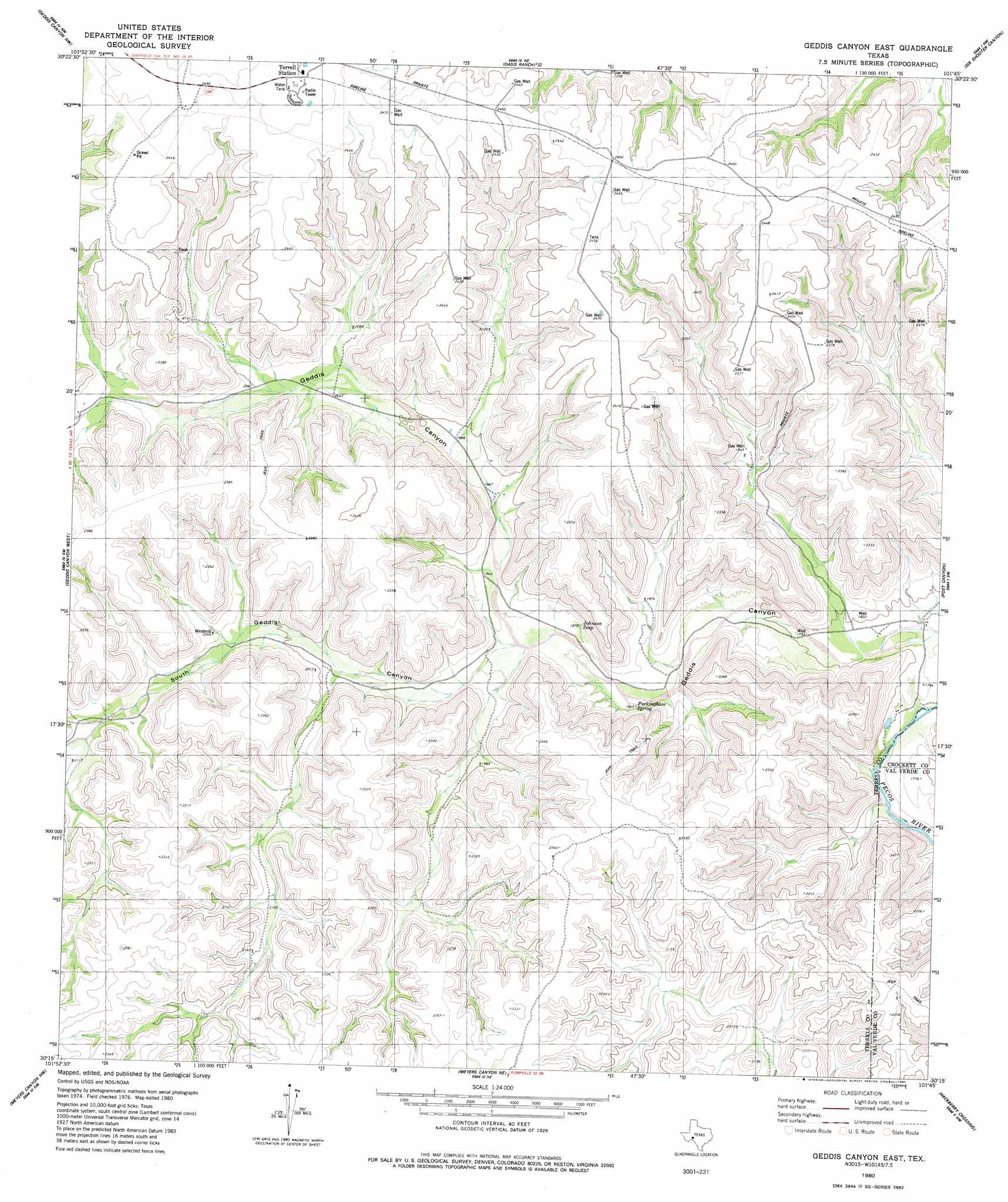
USGS Topo Quad 30101c7 - 1:24,000 scale
| Topo Map Name: | Geddis Canyon East |
| USGS Topo Quad ID: | 30101c7 |
| Print Size: | ca. 21 1/4" wide x 27" high |
| Southeast Coordinates: | 30.25° N latitude / 101.75° W longitude |
| Map Center Coordinates: | 30.3125° N latitude / 101.8125° W longitude |
| U.S. State: | TX |
| Filename: | o30101c7.jpg |
| Download Map JPG Image: | Geddis Canyon East topo map 1:24,000 scale |
| Map Type: | Topographic |
| Topo Series: | 7.5´ |
| Map Scale: | 1:24,000 |
| Source of Map Images: | United States Geological Survey (USGS) |
| Alternate Map Versions: |
Geddis Canyon East TX 1980, updated 1980 Download PDF Buy paper map Geddis Canyon East TX 2010 Download PDF Buy paper map Geddis Canyon East TX 2012 Download PDF Buy paper map Geddis Canyon East TX 2016 Download PDF Buy paper map |
1:24,000 Topo Quads surrounding Geddis Canyon East
Mitchell Draw |
Horsehead Canyon |
Sheffield Se |
Dead Man Canyon |
Burnt Canyon |
Circle Dot Ranch Ne |
Geddis Canyon Nw |
Oasis Ranch |
Sixshooter Canyon |
Prince Albert Draw |
Continental Ranch |
Geddis Canyon West |
Geddis Canyon East |
Post Canyon |
Antone Canyon |
Dryden Ne |
Meyers Canyon Nw |
Meyers Canyon Ne |
Hackberry Crossing |
Pandale |
Dryden |
Meyers Canyon |
Sevenmile Canyon |
Roundhill Ranch |
Little Fielder Draw |
> Back to 30101a1 at 1:100,000 scale
> Back to 30100a1 at 1:250,000 scale
> Back to U.S. Topo Maps home
Geddis Canyon East topo map: Gazetteer
Geddis Canyon East: Oilfields
Brown Bassett Gas Field elevation 756m 2480′Geddis Canyon East: Springs
Geddis Springs elevation 549m 1801′Johnson Seep elevation 583m 1912′
Sweetwater Springs elevation 699m 2293′
Geddis Canyon East: Valleys
Geddis Canyon elevation 534m 1751′South Geddis Canyon elevation 581m 1906′
Geddis Canyon East digital topo map on disk
Buy this Geddis Canyon East topo map showing relief, roads, GPS coordinates and other geographical features, as a high-resolution digital map file on DVD: