Harrell Canyon Topo Map Texas
To zoom in, hover over the map of Harrell Canyon
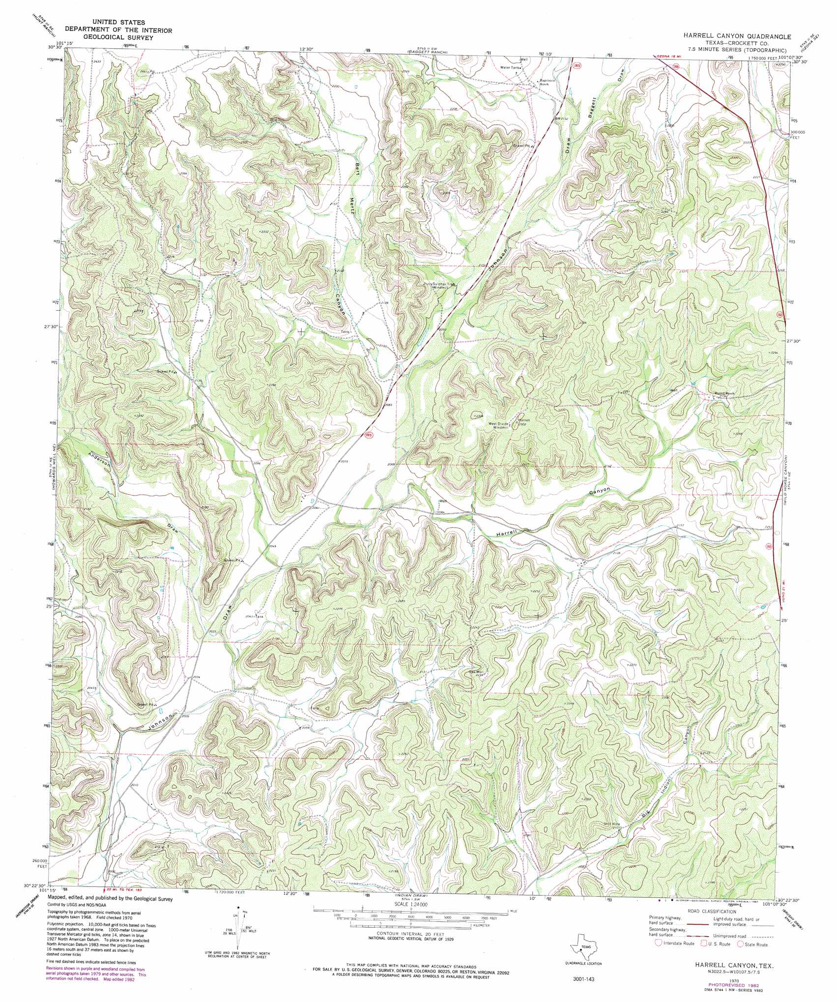
USGS Topo Quad 30101d2 - 1:24,000 scale
| Topo Map Name: | Harrell Canyon |
| USGS Topo Quad ID: | 30101d2 |
| Print Size: | ca. 21 1/4" wide x 27" high |
| Southeast Coordinates: | 30.375° N latitude / 101.125° W longitude |
| Map Center Coordinates: | 30.4375° N latitude / 101.1875° W longitude |
| U.S. State: | TX |
| Filename: | o30101d2.jpg |
| Download Map JPG Image: | Harrell Canyon topo map 1:24,000 scale |
| Map Type: | Topographic |
| Topo Series: | 7.5´ |
| Map Scale: | 1:24,000 |
| Source of Map Images: | United States Geological Survey (USGS) |
| Alternate Map Versions: |
Harrell Canyon TX 1970, updated 1973 Download PDF Buy paper map Harrell Canyon TX 1970, updated 1982 Download PDF Buy paper map Harrell Canyon TX 2010 Download PDF Buy paper map Harrell Canyon TX 2012 Download PDF Buy paper map Harrell Canyon TX 2016 Download PDF Buy paper map |
1:24,000 Topo Quads surrounding Harrell Canyon
Pikes Peak |
Mitchell Canyon Ne |
Ozona |
Crockett Heights |
Nolen Draw |
Mitchell Canyon |
Hunt Ranch |
Baggett Ranch |
Ozona Se |
Hospital Ranch |
Howards Well |
Howards Well Ne |
Harrell Canyon |
Wild Horse Canyon |
Shafter Draw |
Howards Well Sw |
Aermotor Draw |
Indian Draw |
Brushy Draw |
Flat Rock Draw Sw |
Divide Well Draw |
Steel Star Draw |
Bee Canyon |
Juno |
White Draw Nw |
> Back to 30101a1 at 1:100,000 scale
> Back to 30100a1 at 1:250,000 scale
> Back to U.S. Topo Maps home
Harrell Canyon topo map: Gazetteer
Harrell Canyon: Valleys
Anderson Draw elevation 618m 2027′Baggett Draw elevation 646m 2119′
Bert Mertz Canyon elevation 634m 2080′
Herrell Canyon elevation 628m 2060′
Harrell Canyon digital topo map on disk
Buy this Harrell Canyon topo map showing relief, roads, GPS coordinates and other geographical features, as a high-resolution digital map file on DVD: