Sixshooter Canyon Topo Map Texas
To zoom in, hover over the map of Sixshooter Canyon
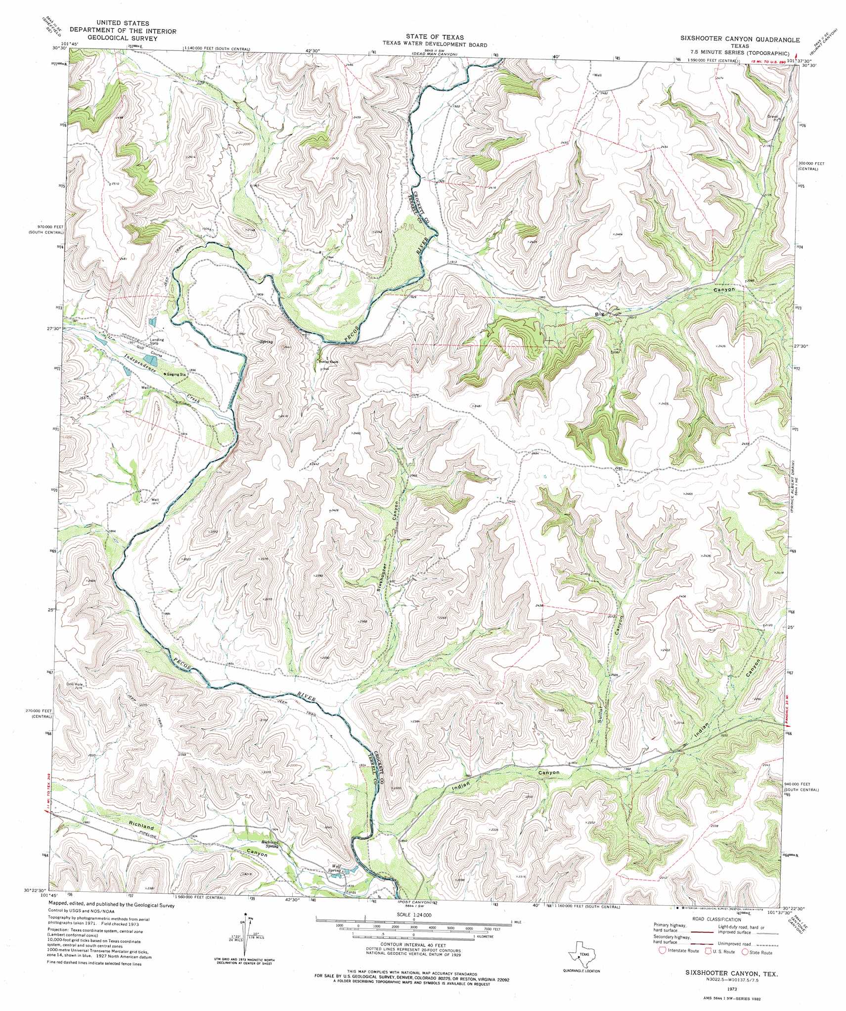
USGS Topo Quad 30101d6 - 1:24,000 scale
| Topo Map Name: | Sixshooter Canyon |
| USGS Topo Quad ID: | 30101d6 |
| Print Size: | ca. 21 1/4" wide x 27" high |
| Southeast Coordinates: | 30.375° N latitude / 101.625° W longitude |
| Map Center Coordinates: | 30.4375° N latitude / 101.6875° W longitude |
| U.S. State: | TX |
| Filename: | o30101d6.jpg |
| Download Map JPG Image: | Sixshooter Canyon topo map 1:24,000 scale |
| Map Type: | Topographic |
| Topo Series: | 7.5´ |
| Map Scale: | 1:24,000 |
| Source of Map Images: | United States Geological Survey (USGS) |
| Alternate Map Versions: |
Sixshooter Canyon TX 1973, updated 1976 Download PDF Buy paper map Sixshooter Canyon TX 2010 Download PDF Buy paper map Sixshooter Canyon TX 2012 Download PDF Buy paper map Sixshooter Canyon TX 2016 Download PDF Buy paper map |
1:24,000 Topo Quads surrounding Sixshooter Canyon
Sheffield Nw |
Sheffield |
Fort Lancaster |
Bachelor Hill |
Pikes Peak |
Horsehead Canyon |
Sheffield Se |
Dead Man Canyon |
Burnt Canyon |
Mitchell Canyon |
Geddis Canyon Nw |
Oasis Ranch |
Sixshooter Canyon |
Prince Albert Draw |
Howards Well |
Geddis Canyon West |
Geddis Canyon East |
Post Canyon |
Antone Canyon |
Howards Well Sw |
Meyers Canyon Nw |
Meyers Canyon Ne |
Hackberry Crossing |
Pandale |
Divide Well Draw |
> Back to 30101a1 at 1:100,000 scale
> Back to 30100a1 at 1:250,000 scale
> Back to U.S. Topo Maps home
Sixshooter Canyon topo map: Gazetteer
Sixshooter Canyon: Springs
Richland Spring elevation 579m 1899′Wolf Spring elevation 561m 1840′
Sixshooter Canyon: Streams
Independence Creek elevation 567m 1860′Sixshooter Canyon: Valleys
Big Canyon elevation 580m 1902′Indian Canyon elevation 644m 2112′
Richland Canyon elevation 553m 1814′
Sixshooter Canyon elevation 561m 1840′
Sulfur Canyon elevation 595m 1952′
Sixshooter Canyon digital topo map on disk
Buy this Sixshooter Canyon topo map showing relief, roads, GPS coordinates and other geographical features, as a high-resolution digital map file on DVD: