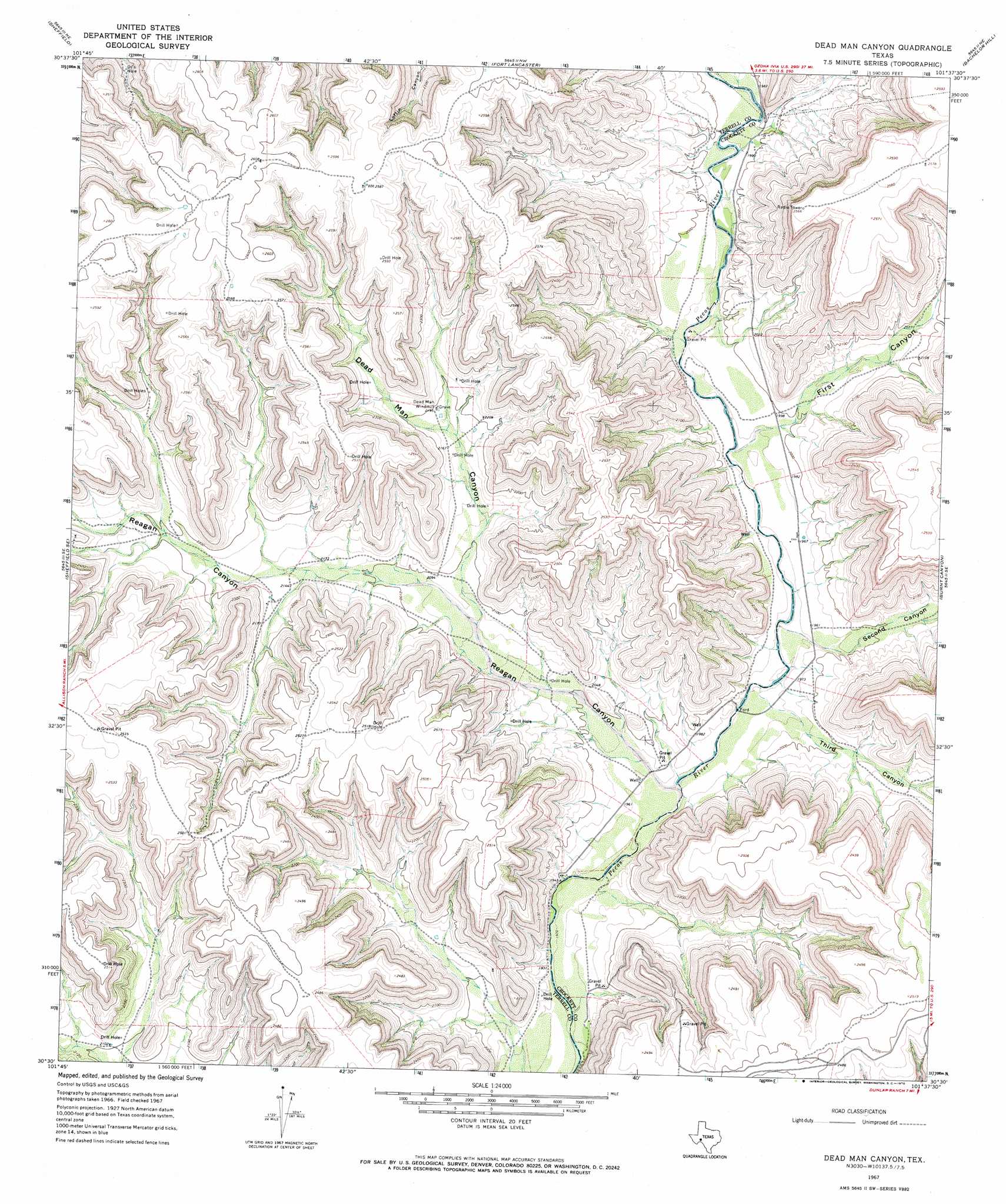
Dead Man Canyon Topo Map Texas
To zoom in, hover over the map of Dead Man Canyon
USGS Topo Quad 30101e6 - 1:24,000 scale
| Topo Map Name: | Dead Man Canyon |
| USGS Topo Quad ID: | 30101e6 |
| Print Size: | ca. 21 1/4" wide x 27" high |
| Southeast Coordinates: | 30.5° N latitude / 101.625° W longitude |
| Map Center Coordinates: | 30.5625° N latitude / 101.6875° W longitude |
| U.S. State: | TX |
| Filename: | o30101e6.jpg |
| Download Map JPG Image: | Dead Man Canyon topo map 1:24,000 scale |
| Map Type: | Topographic |
| Topo Series: | 7.5´ |
| Map Scale: | 1:24,000 |
| Source of Map Images: | United States Geological Survey (USGS) |
| Alternate Map Versions: |
Dead Man Canyon TX 1967, updated 1970 Download PDF Buy paper map Dead Man Canyon TX 2010 Download PDF Buy paper map Dead Man Canyon TX 2012 Download PDF Buy paper map Dead Man Canyon TX 2016 Download PDF Buy paper map |
1:24,000 Topo Quads surrounding Dead Man Canyon
Divide Country |
Deer Canyon |
Owens Creek Sw |
Owens Creek Se |
Schneeman Draw Sw |
Sheffield Nw |
Sheffield |
Fort Lancaster |
Bachelor Hill |
Pikes Peak |
Horsehead Canyon |
Sheffield Se |
Dead Man Canyon |
Burnt Canyon |
Mitchell Canyon |
Geddis Canyon Nw |
Oasis Ranch |
Sixshooter Canyon |
Prince Albert Draw |
Howards Well |
Geddis Canyon West |
Geddis Canyon East |
Post Canyon |
Antone Canyon |
Howards Well Sw |
> Back to 30101e1 at 1:100,000 scale
> Back to 30100a1 at 1:250,000 scale
> Back to U.S. Topo Maps home
Dead Man Canyon topo map: Gazetteer
Dead Man Canyon: Springs
Cedar Springs elevation 614m 2014′Dead Man Canyon: Valleys
Dead Man Canyon elevation 635m 2083′First Canyon elevation 600m 1968′
Reagan Canyon elevation 596m 1955′
Second Canyon elevation 596m 1955′
Third Canyon elevation 594m 1948′
Dead Man Canyon digital topo map on disk
Buy this Dead Man Canyon topo map showing relief, roads, GPS coordinates and other geographical features, as a high-resolution digital map file on DVD: