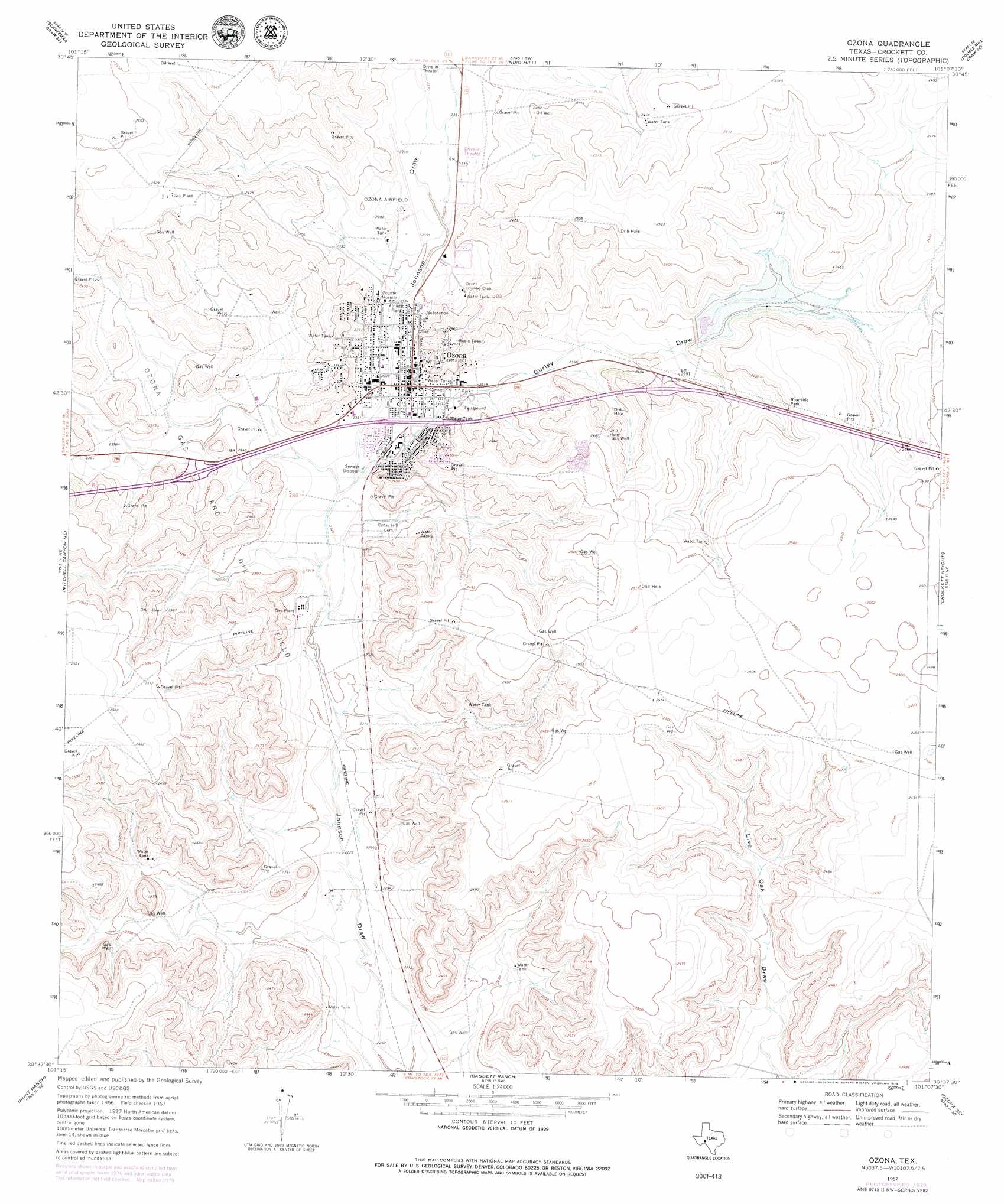
Ozona Topo Map Texas
To zoom in, hover over the map of Ozona
USGS Topo Quad 30101f2 - 1:24,000 scale
| Topo Map Name: | Ozona |
| USGS Topo Quad ID: | 30101f2 |
| Print Size: | ca. 21 1/4" wide x 27" high |
| Southeast Coordinates: | 30.625° N latitude / 101.125° W longitude |
| Map Center Coordinates: | 30.6875° N latitude / 101.1875° W longitude |
| U.S. State: | TX |
| Filename: | o30101f2.jpg |
| Download Map JPG Image: | Ozona topo map 1:24,000 scale |
| Map Type: | Topographic |
| Topo Series: | 7.5´ |
| Map Scale: | 1:24,000 |
| Source of Map Images: | United States Geological Survey (USGS) |
| Alternate Map Versions: |
Ozona TX 1967, updated 1970 Download PDF Buy paper map Ozona TX 1967, updated 1979 Download PDF Buy paper map Ozona TX 2010 Download PDF Buy paper map Ozona TX 2012 Download PDF Buy paper map Ozona TX 2016 Download PDF Buy paper map |
1:24,000 Topo Quads surrounding Ozona
Schneeman Draw Nw |
Schneeman Draw Ne |
Double Mill Draw Nw |
Double Mill Draw Ne |
Oglesby Ranch |
Schneeman Draw Sw |
Schneeman Draw Se |
Indio Hill |
Double Mill Draw Se |
Bailey Draw |
Pikes Peak |
Mitchell Canyon Ne |
Ozona |
Crockett Heights |
Nolen Draw |
Mitchell Canyon |
Hunt Ranch |
Baggett Ranch |
Ozona Se |
Hospital Ranch |
Howards Well |
Howards Well Ne |
Harrell Canyon |
Wild Horse Canyon |
Shafter Draw |
> Back to 30101e1 at 1:100,000 scale
> Back to 30100a1 at 1:250,000 scale
> Back to U.S. Topo Maps home
Ozona topo map: Gazetteer
Ozona: Airports
Ozona Municipal Airport elevation 721m 2365′Ozona: Dams
Soil Conservation Service Site 7 Dam elevation 728m 2388′Ozona: Oilfields
Ozona Gas and Oil Field elevation 739m 2424′Ozona: Populated Places
Ozona elevation 716m 2349′Ozona: Reservoirs
Soil Conservation Service Site 7 Reservoir elevation 728m 2388′Ozona: Valleys
Gurley Draw elevation 708m 2322′Ozona digital topo map on disk
Buy this Ozona topo map showing relief, roads, GPS coordinates and other geographical features, as a high-resolution digital map file on DVD: