Sheffield Topo Map Texas
To zoom in, hover over the map of Sheffield
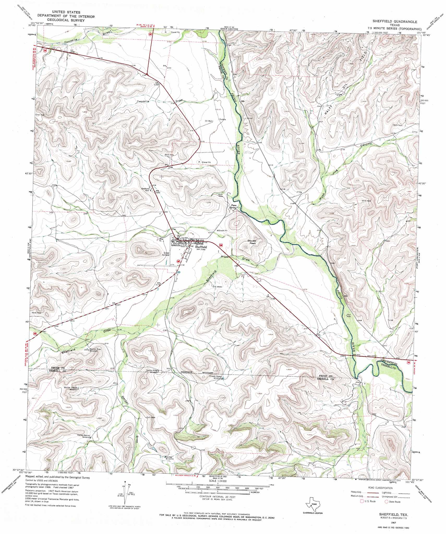
USGS Topo Quad 30101f7 - 1:24,000 scale
| Topo Map Name: | Sheffield |
| USGS Topo Quad ID: | 30101f7 |
| Print Size: | ca. 21 1/4" wide x 27" high |
| Southeast Coordinates: | 30.625° N latitude / 101.75° W longitude |
| Map Center Coordinates: | 30.6875° N latitude / 101.8125° W longitude |
| U.S. State: | TX |
| Filename: | o30101f7.jpg |
| Download Map JPG Image: | Sheffield topo map 1:24,000 scale |
| Map Type: | Topographic |
| Topo Series: | 7.5´ |
| Map Scale: | 1:24,000 |
| Source of Map Images: | United States Geological Survey (USGS) |
| Alternate Map Versions: |
Sheffield TX 1967, updated 1970 Download PDF Buy paper map Sheffield TX 2010 Download PDF Buy paper map Sheffield TX 2012 Download PDF Buy paper map Sheffield TX 2016 Download PDF Buy paper map |
1:24,000 Topo Quads surrounding Sheffield
Indian Mesa Ne |
Iraan |
Twelvemile Camp |
Owens Creek Nw |
Owens Creek Ne |
Indian Mesa Se |
Divide Country |
Deer Canyon |
Owens Creek Sw |
Owens Creek Se |
Smokey Mountain Ranch |
Sheffield Nw |
Sheffield |
Fort Lancaster |
Bachelor Hill |
Mitchell Draw |
Horsehead Canyon |
Sheffield Se |
Dead Man Canyon |
Burnt Canyon |
Circle Dot Ranch Ne |
Geddis Canyon Nw |
Oasis Ranch |
Sixshooter Canyon |
Prince Albert Draw |
> Back to 30101e1 at 1:100,000 scale
> Back to 30100a1 at 1:250,000 scale
> Back to U.S. Topo Maps home
Sheffield topo map: Gazetteer
Sheffield: Oilfields
Halff Oil Field elevation 805m 2641′Sheffield: Populated Places
Sheffield elevation 660m 2165′Sheffield: Springs
Pecos Spring elevation 628m 2060′Sheffield: Summits
Squaw Peak elevation 685m 2247′Sheffield: Valleys
Harkey Draw elevation 665m 2181′Musk Hog Canyon elevation 628m 2060′
Sheffield Draw elevation 627m 2057′
Twomile Draw elevation 633m 2076′
Sheffield digital topo map on disk
Buy this Sheffield topo map showing relief, roads, GPS coordinates and other geographical features, as a high-resolution digital map file on DVD: