Schneeman Draw Ne Topo Map Texas
To zoom in, hover over the map of Schneeman Draw Ne
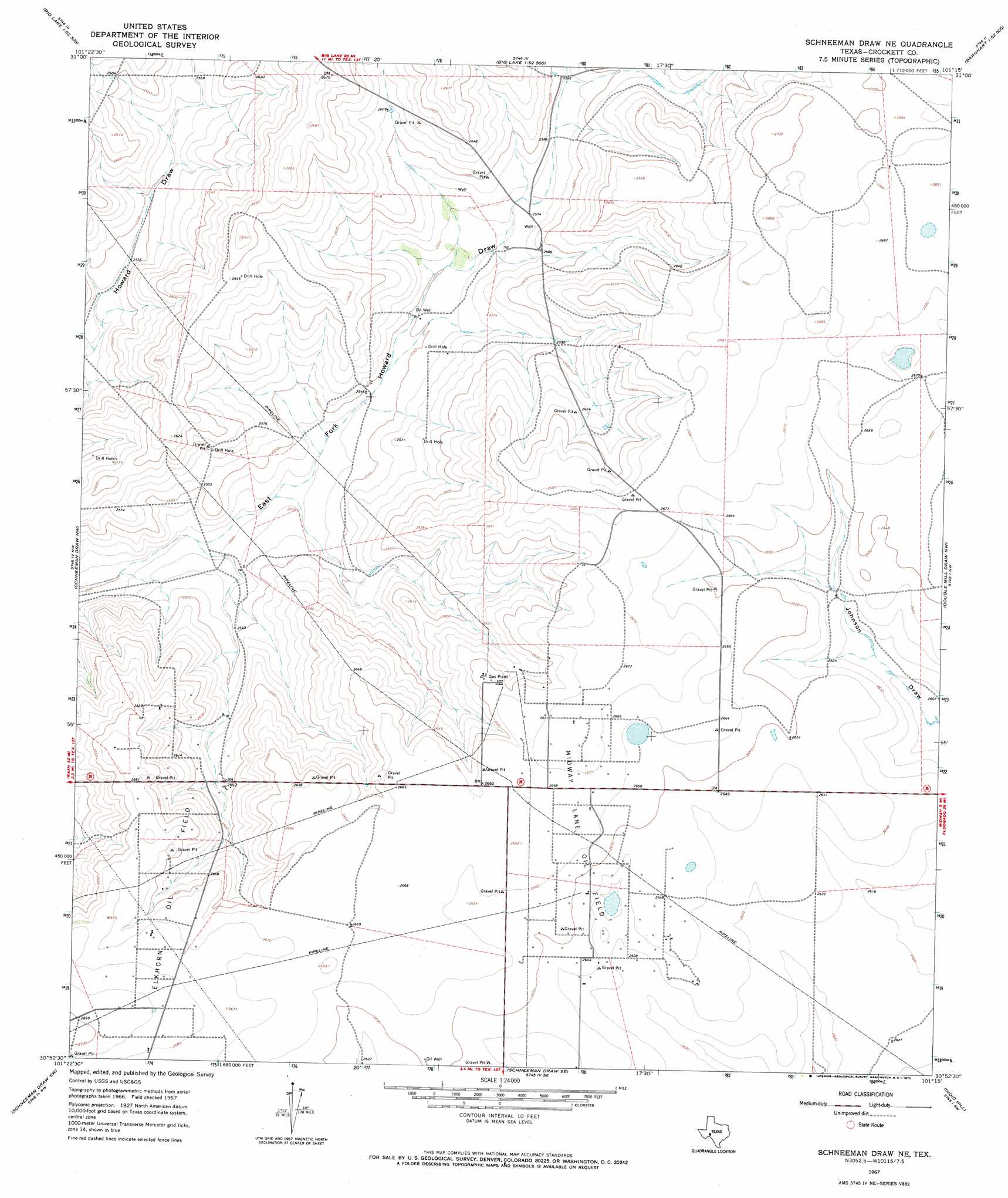
USGS Topo Quad 30101h3 - 1:24,000 scale
| Topo Map Name: | Schneeman Draw Ne |
| USGS Topo Quad ID: | 30101h3 |
| Print Size: | ca. 21 1/4" wide x 27" high |
| Southeast Coordinates: | 30.875° N latitude / 101.25° W longitude |
| Map Center Coordinates: | 30.9375° N latitude / 101.3125° W longitude |
| U.S. State: | TX |
| Filename: | o30101h3.jpg |
| Download Map JPG Image: | Schneeman Draw Ne topo map 1:24,000 scale |
| Map Type: | Topographic |
| Topo Series: | 7.5´ |
| Map Scale: | 1:24,000 |
| Source of Map Images: | United States Geological Survey (USGS) |
| Alternate Map Versions: |
Schneeman Draw NE TX 1967, updated 1970 Download PDF Buy paper map Schneeman Draw NE TX 2010 Download PDF Buy paper map Schneeman Draw NE TX 2012 Download PDF Buy paper map Schneeman Draw NE TX 2016 Download PDF Buy paper map |
1:24,000 Topo Quads surrounding Schneeman Draw Ne
Best |
Big Lake |
Witco |
Barnhart |
Barnhart Ne |
Texon Se |
Big Lake Sw |
Big Lake Se |
Barnhart Sw |
Suggs |
Owens Creek Ne |
Schneeman Draw Nw |
Schneeman Draw Ne |
Double Mill Draw Nw |
Double Mill Draw Ne |
Owens Creek Se |
Schneeman Draw Sw |
Schneeman Draw Se |
Indio Hill |
Double Mill Draw Se |
Bachelor Hill |
Pikes Peak |
Mitchell Canyon Ne |
Ozona |
Crockett Heights |
> Back to 30101e1 at 1:100,000 scale
> Back to 30100a1 at 1:250,000 scale
> Back to U.S. Topo Maps home
Schneeman Draw Ne topo map: Gazetteer
Schneeman Draw Ne: Oilfields
Elkhorn Oil Field elevation 808m 2650′Midway Lane Oil Field elevation 811m 2660′
Schneeman Draw Ne digital topo map on disk
Buy this Schneeman Draw Ne topo map showing relief, roads, GPS coordinates and other geographical features, as a high-resolution digital map file on DVD: