Ninemile Ranch Topo Map Texas
To zoom in, hover over the map of Ninemile Ranch
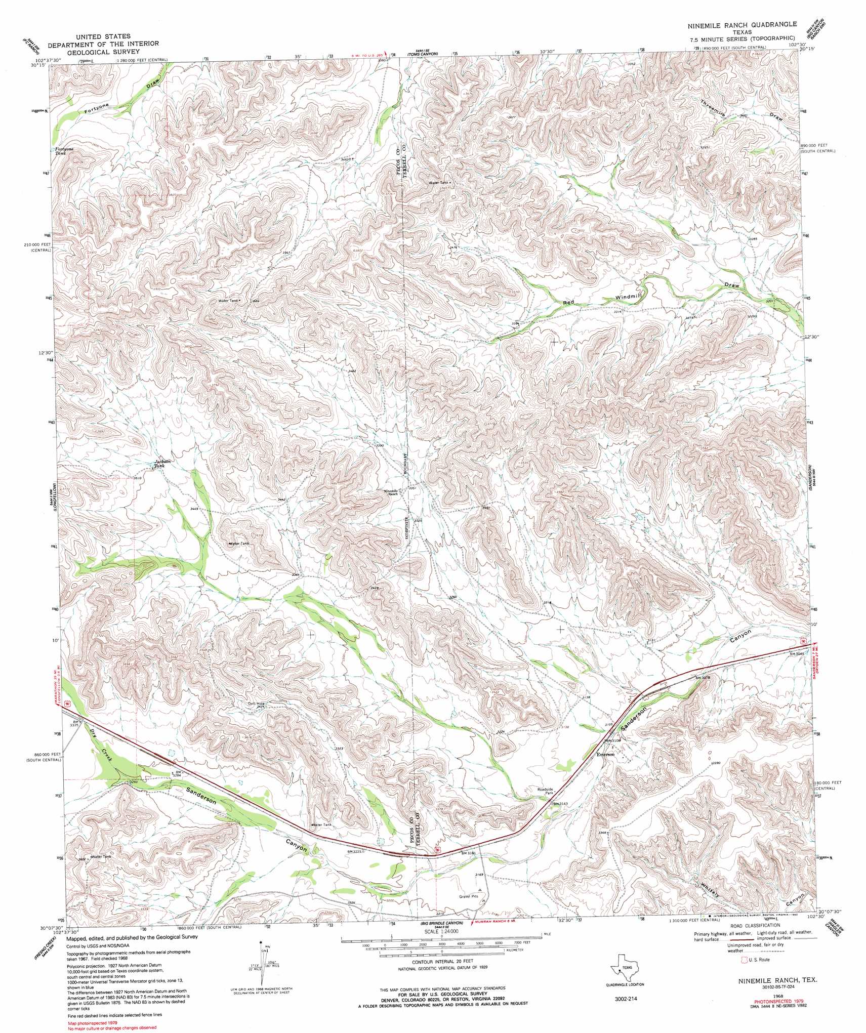
USGS Topo Quad 30102b5 - 1:24,000 scale
| Topo Map Name: | Ninemile Ranch |
| USGS Topo Quad ID: | 30102b5 |
| Print Size: | ca. 21 1/4" wide x 27" high |
| Southeast Coordinates: | 30.125° N latitude / 102.5° W longitude |
| Map Center Coordinates: | 30.1875° N latitude / 102.5625° W longitude |
| U.S. State: | TX |
| Filename: | o30102b5.jpg |
| Download Map JPG Image: | Ninemile Ranch topo map 1:24,000 scale |
| Map Type: | Topographic |
| Topo Series: | 7.5´ |
| Map Scale: | 1:24,000 |
| Source of Map Images: | United States Geological Survey (USGS) |
| Alternate Map Versions: |
Ninemile Ranch TX 1968, updated 1971 Download PDF Buy paper map Ninemile Ranch TX 1968, updated 1992 Download PDF Buy paper map Ninemile Ranch TX 2010 Download PDF Buy paper map Ninemile Ranch TX 2012 Download PDF Buy paper map Ninemile Ranch TX 2016 Download PDF Buy paper map |
1:24,000 Topo Quads surrounding Ninemile Ranch
Reininger Draw |
Ebers Camp |
Busher Canyon |
Big Canyon Ranch Nw |
Big Canyon Ranch Ne |
Cap Rock Butte |
F C Ranch |
Toms Canyon |
Big Canyon Ranch Sw |
Big Canyon Ranch |
Tesnus Ne |
Longfellow |
Ninemile Ranch |
Sanderson |
Sanderson Ne |
Tesnus Se |
Fresno Creek |
Big Brindle Canyon |
Hagler Canyon |
Sanderson Se |
Pine Mountain East |
San Francisco Shutups |
Bullis Gap Ne |
Candilla Canyon West |
Candilla Canyon East |
> Back to 30102a1 at 1:100,000 scale
> Back to 30102a1 at 1:250,000 scale
> Back to U.S. Topo Maps home
Ninemile Ranch topo map: Gazetteer
Ninemile Ranch: Populated Places
Emerson elevation 948m 3110′Ninemile Ranch: Reservoirs
Fortyone Tank elevation 1094m 3589′Jackson Tank elevation 1068m 3503′
Ninemile Ranch: Streams
Dry Creek elevation 1004m 3293′Ninemile Ranch digital topo map on disk
Buy this Ninemile Ranch topo map showing relief, roads, GPS coordinates and other geographical features, as a high-resolution digital map file on DVD: