Housetop Mountains Topo Map Texas
To zoom in, hover over the map of Housetop Mountains
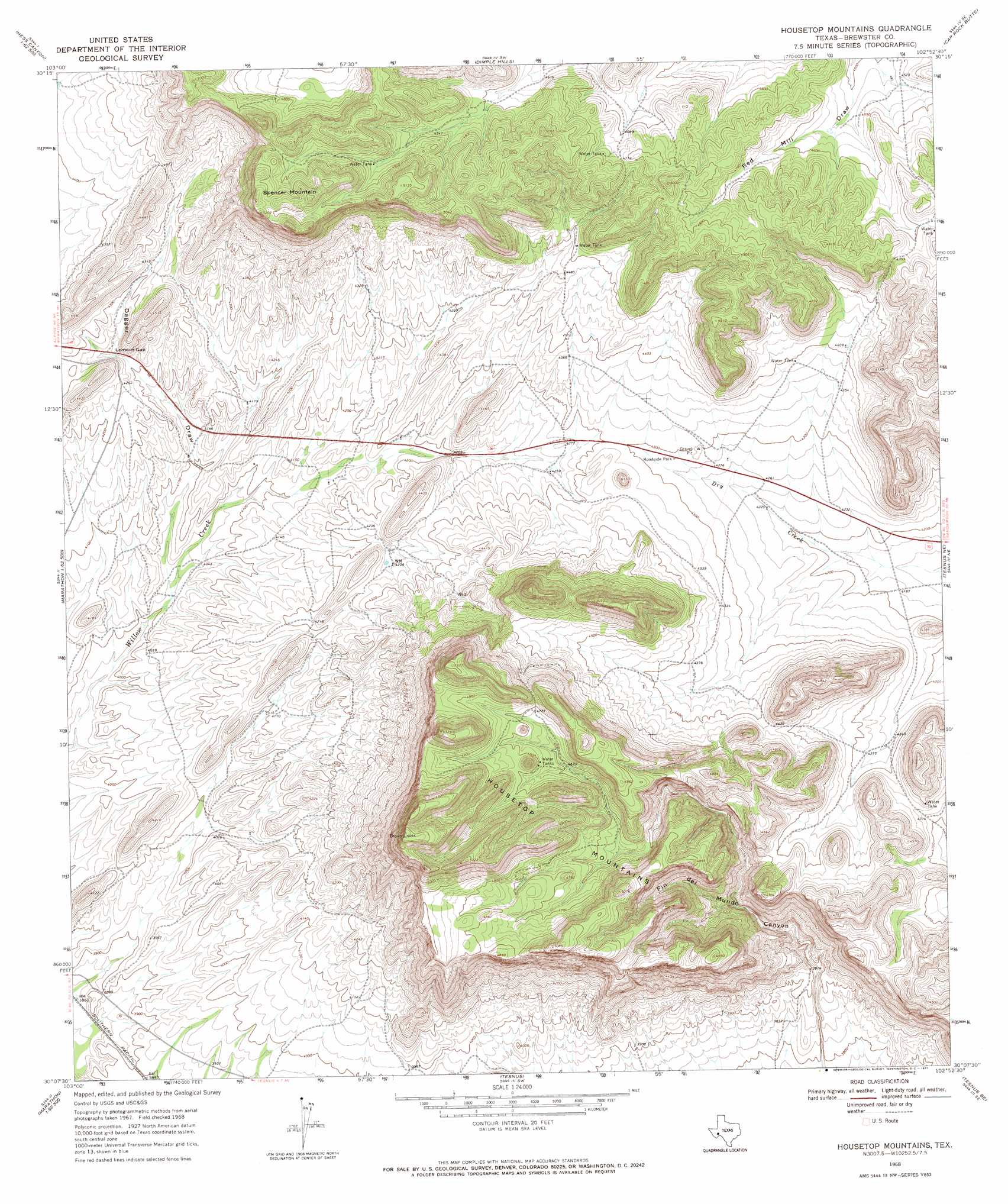
USGS Topo Quad 30102b8 - 1:24,000 scale
| Topo Map Name: | Housetop Mountains |
| USGS Topo Quad ID: | 30102b8 |
| Print Size: | ca. 21 1/4" wide x 27" high |
| Southeast Coordinates: | 30.125° N latitude / 102.875° W longitude |
| Map Center Coordinates: | 30.1875° N latitude / 102.9375° W longitude |
| U.S. State: | TX |
| Filename: | o30102b8.jpg |
| Download Map JPG Image: | Housetop Mountains topo map 1:24,000 scale |
| Map Type: | Topographic |
| Topo Series: | 7.5´ |
| Map Scale: | 1:24,000 |
| Source of Map Images: | United States Geological Survey (USGS) |
| Alternate Map Versions: |
Housetop Mountains TX 1968, updated 1971 Download PDF Buy paper map Housetop Mountains TX 2010 Download PDF Buy paper map Housetop Mountains TX 2012 Download PDF Buy paper map Housetop Mountains TX 2016 Download PDF Buy paper map |
1:24,000 Topo Quads surrounding Housetop Mountains
Hess Canyon |
Glass Mountain Ranch |
Marathon Gap |
Reininger Draw |
Ebers Camp |
Leonard Mountain |
Wolf Camp Hills |
Dimple Hills |
Cap Rock Butte |
F C Ranch |
Marathon |
Lightening Hills |
Housetop Mountains |
Tesnus Ne |
Longfellow |
Pena Blanca Mountains |
Horse Mountain |
Tesnus |
Tesnus Se |
Fresno Creek |
Heart Mountain |
Hood Spring |
Pine Mountain West |
Pine Mountain East |
San Francisco Shutups |
> Back to 30102a1 at 1:100,000 scale
> Back to 30102a1 at 1:250,000 scale
> Back to U.S. Topo Maps home
Housetop Mountains topo map: Gazetteer
Housetop Mountains: Gaps
Lemons Gap elevation 1287m 4222′Housetop Mountains: Ranges
Housetop Mountains elevation 1533m 5029′Housetop Mountains: Summits
Housetop Mountain elevation 1552m 5091′Spencer Mountain elevation 1582m 5190′
Housetop Mountains: Valleys
Dagger Draw elevation 1229m 4032′Fin Del Mundo Canyon elevation 1152m 3779′
Housetop Mountains digital topo map on disk
Buy this Housetop Mountains topo map showing relief, roads, GPS coordinates and other geographical features, as a high-resolution digital map file on DVD: