Ebers Camp Topo Map Texas
To zoom in, hover over the map of Ebers Camp
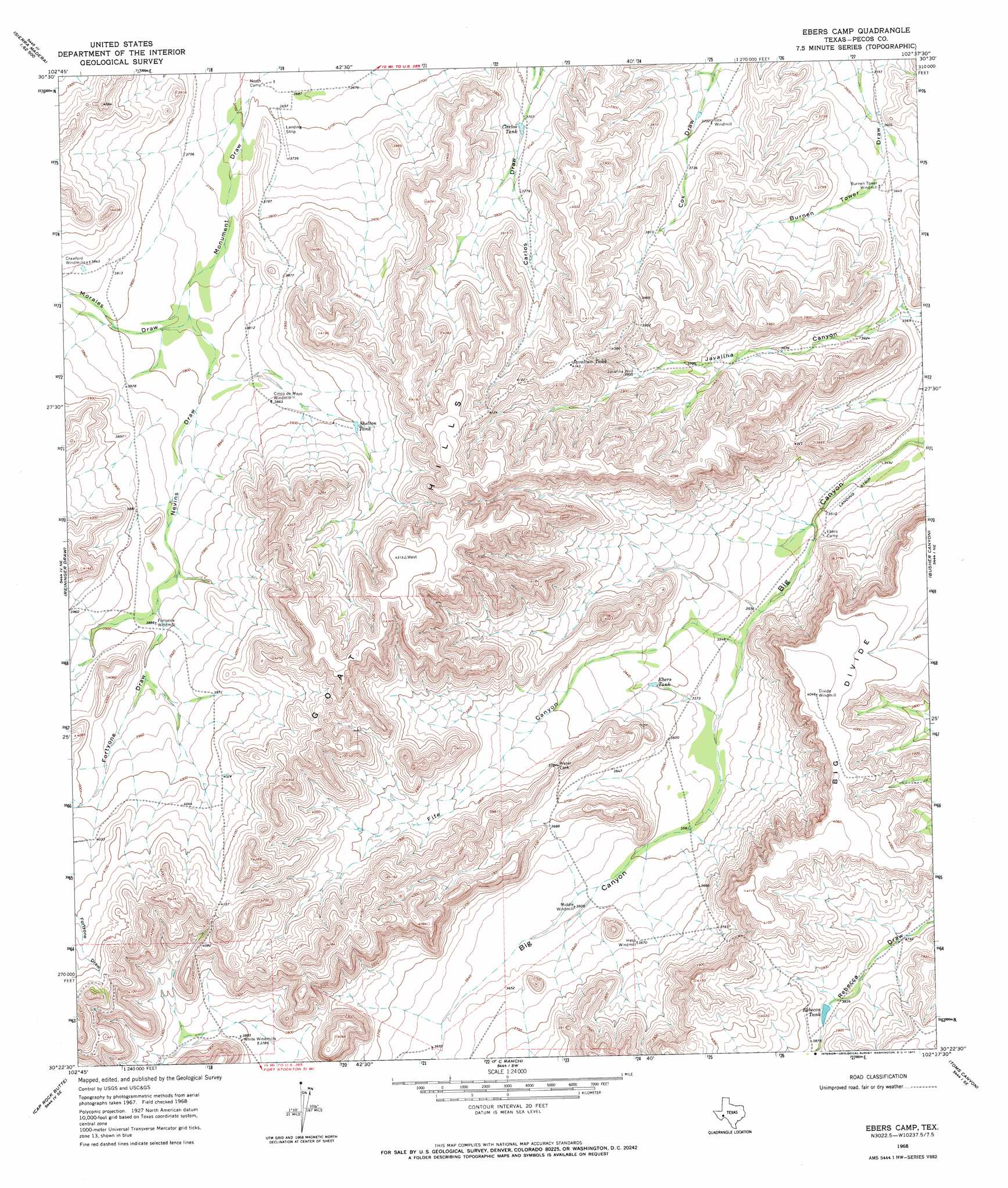
USGS Topo Quad 30102d6 - 1:24,000 scale
| Topo Map Name: | Ebers Camp |
| USGS Topo Quad ID: | 30102d6 |
| Print Size: | ca. 21 1/4" wide x 27" high |
| Southeast Coordinates: | 30.375° N latitude / 102.625° W longitude |
| Map Center Coordinates: | 30.4375° N latitude / 102.6875° W longitude |
| U.S. State: | TX |
| Filename: | o30102d6.jpg |
| Download Map JPG Image: | Ebers Camp topo map 1:24,000 scale |
| Map Type: | Topographic |
| Topo Series: | 7.5´ |
| Map Scale: | 1:24,000 |
| Source of Map Images: | United States Geological Survey (USGS) |
| Alternate Map Versions: |
Ebers Camp TX 1968, updated 1971 Download PDF Buy paper map Ebers Camp TX 2010 Download PDF Buy paper map Ebers Camp TX 2012 Download PDF Buy paper map Ebers Camp TX 2016 Download PDF Buy paper map |
1:24,000 Topo Quads surrounding Ebers Camp
Sierra Madera Nw |
Sierra Madera Ne |
Rock House Draw Nw |
Rock House Draw Ne |
Hackberry Draw Nw |
Sierra Madera |
Sierra Madera Se |
Panther Tank |
Rock House Draw |
Hackberry Draw Sw |
Marathon Gap |
Reininger Draw |
Ebers Camp |
Busher Canyon |
Big Canyon Ranch Nw |
Dimple Hills |
Cap Rock Butte |
F C Ranch |
Toms Canyon |
Big Canyon Ranch Sw |
Housetop Mountains |
Tesnus Ne |
Longfellow |
Ninemile Ranch |
Sanderson |
> Back to 30102a1 at 1:100,000 scale
> Back to 30102a1 at 1:250,000 scale
> Back to U.S. Topo Maps home
Ebers Camp topo map: Gazetteer
Ebers Camp: Reservoirs
Carlos Tank elevation 1134m 3720′Ebers Tank elevation 1098m 3602′
Javalina Tank elevation 1265m 4150′
Rebecca Tank elevation 1175m 3854′
Shelton Tank elevation 1191m 3907′
Ebers Camp: Summits
Boat Hills elevation 1314m 4311′Ebers Camp: Valleys
Fife Canyon elevation 1081m 3546′Fortyone Draw elevation 1185m 3887′
Morales Draw elevation 1150m 3772′
Nevins Draw elevation 1149m 3769′
Ebers Camp: Wells
Javalina Well elevation 1173m 3848′Ebers Camp digital topo map on disk
Buy this Ebers Camp topo map showing relief, roads, GPS coordinates and other geographical features, as a high-resolution digital map file on DVD: