Panther Tank Topo Map Texas
To zoom in, hover over the map of Panther Tank
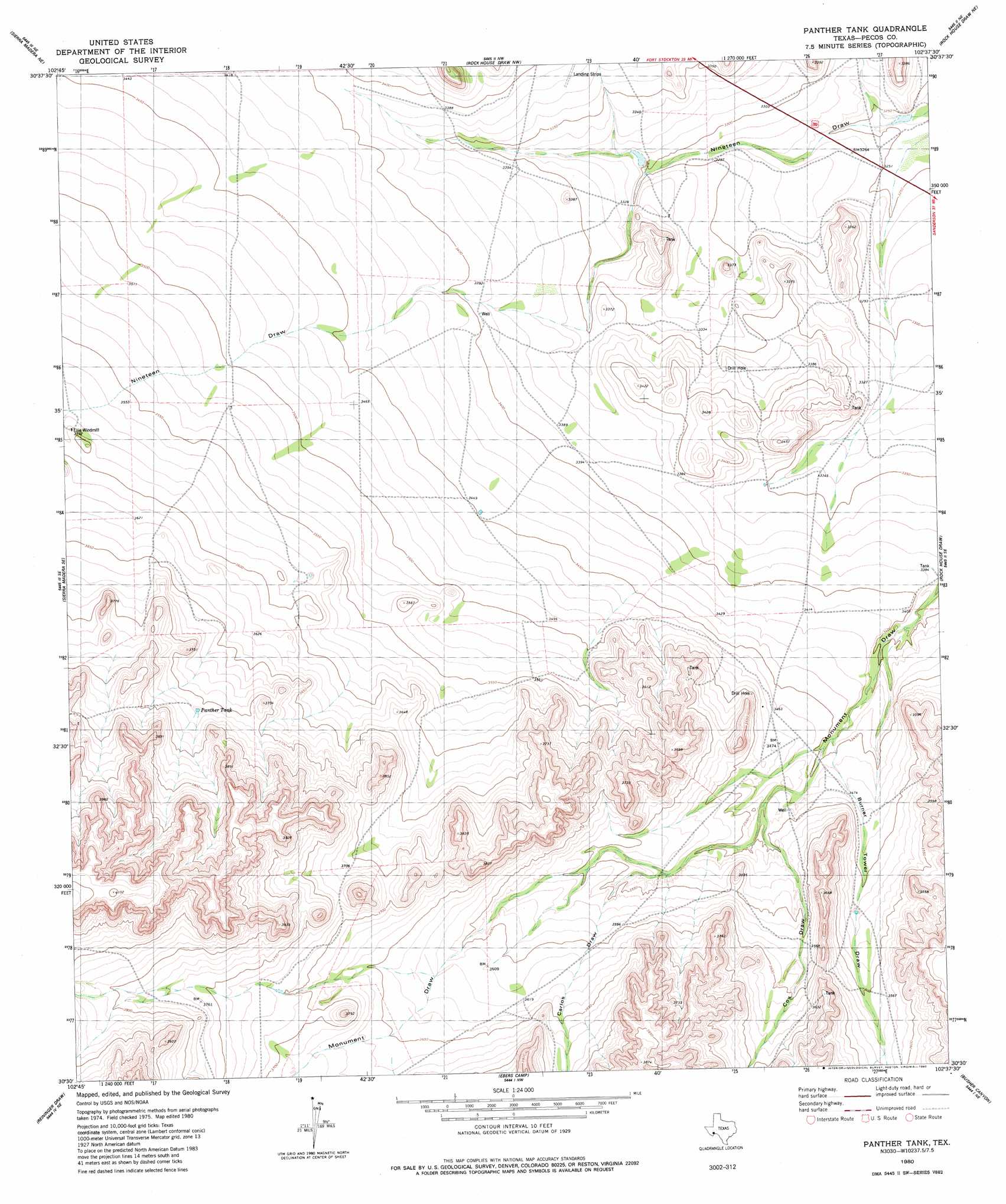
USGS Topo Quad 30102e6 - 1:24,000 scale
| Topo Map Name: | Panther Tank |
| USGS Topo Quad ID: | 30102e6 |
| Print Size: | ca. 21 1/4" wide x 27" high |
| Southeast Coordinates: | 30.5° N latitude / 102.625° W longitude |
| Map Center Coordinates: | 30.5625° N latitude / 102.6875° W longitude |
| U.S. State: | TX |
| Filename: | o30102e6.jpg |
| Download Map JPG Image: | Panther Tank topo map 1:24,000 scale |
| Map Type: | Topographic |
| Topo Series: | 7.5´ |
| Map Scale: | 1:24,000 |
| Source of Map Images: | United States Geological Survey (USGS) |
| Alternate Map Versions: |
Panther Tank TX 1980, updated 1980 Download PDF Buy paper map Panther Tank TX 2010 Download PDF Buy paper map Panther Tank TX 2012 Download PDF Buy paper map Panther Tank TX 2016 Download PDF Buy paper map |
1:24,000 Topo Quads surrounding Panther Tank
Twelvemile Mesa |
Fivemile Mesa |
East Mesa Sw |
Panther Bluff |
Skyscraper Peak |
Sierra Madera Nw |
Sierra Madera Ne |
Rock House Draw Nw |
Rock House Draw Ne |
Hackberry Draw Nw |
Sierra Madera |
Sierra Madera Se |
Panther Tank |
Rock House Draw |
Hackberry Draw Sw |
Marathon Gap |
Reininger Draw |
Ebers Camp |
Busher Canyon |
Big Canyon Ranch Nw |
Dimple Hills |
Cap Rock Butte |
F C Ranch |
Toms Canyon |
Big Canyon Ranch Sw |
> Back to 30102e1 at 1:100,000 scale
> Back to 30102a1 at 1:250,000 scale
> Back to U.S. Topo Maps home
Panther Tank topo map: Gazetteer
Panther Tank: Reservoirs
Panther Tank elevation 1131m 3710′Panther Tank: Valleys
Burnen Tower Draw elevation 1047m 3435′Carlos Draw elevation 1073m 3520′
Cox Draw elevation 1061m 3480′
Panther Tank digital topo map on disk
Buy this Panther Tank topo map showing relief, roads, GPS coordinates and other geographical features, as a high-resolution digital map file on DVD: