Fort Stockton East Topo Map Texas
To zoom in, hover over the map of Fort Stockton East
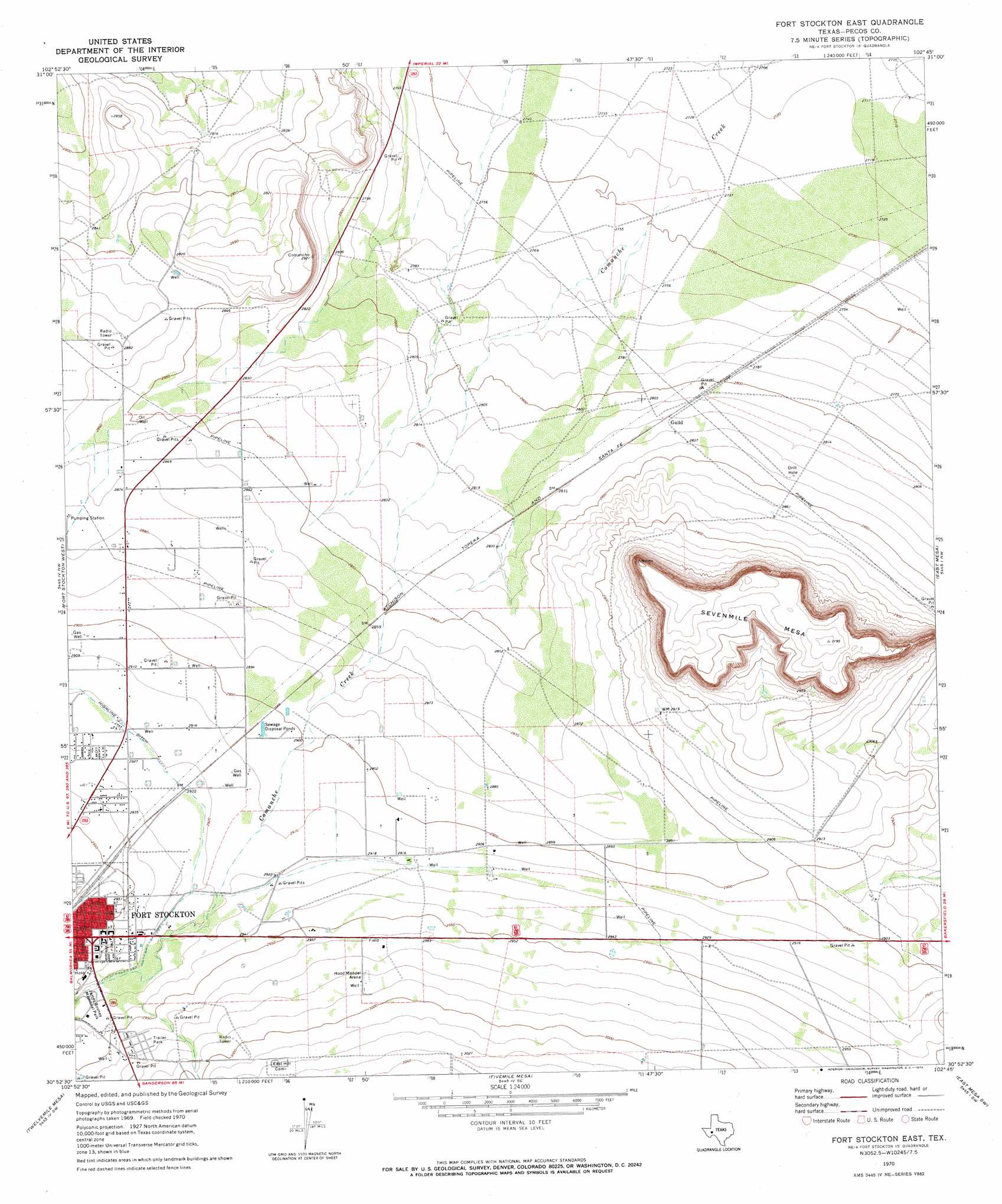
USGS Topo Quad 30102h7 - 1:24,000 scale
| Topo Map Name: | Fort Stockton East |
| USGS Topo Quad ID: | 30102h7 |
| Print Size: | ca. 21 1/4" wide x 27" high |
| Southeast Coordinates: | 30.875° N latitude / 102.75° W longitude |
| Map Center Coordinates: | 30.9375° N latitude / 102.8125° W longitude |
| U.S. State: | TX |
| Filename: | o30102h7.jpg |
| Download Map JPG Image: | Fort Stockton East topo map 1:24,000 scale |
| Map Type: | Topographic |
| Topo Series: | 7.5´ |
| Map Scale: | 1:24,000 |
| Source of Map Images: | United States Geological Survey (USGS) |
| Alternate Map Versions: |
Fort Stockton East TX 1970, updated 1973 Download PDF Buy paper map Fort Stockton East TX 2010 Download PDF Buy paper map Fort Stockton East TX 2012 Download PDF Buy paper map Fort Stockton East TX 2016 Download PDF Buy paper map |
1:24,000 Topo Quads surrounding Fort Stockton East
Coyanosa |
Diamond Y Spring Nw |
Diamond Y Spring Ne |
Buena Vista |
Buena Vista Ne |
Coyanosa Se |
Diamond Y Spring |
Diamond Y Spring Se |
Buena Vista Sw |
Owego |
Belding Ne |
Fort Stockton West |
Fort Stockton East |
East Mesa |
Saddle Butte |
Belding |
Twelvemile Mesa |
Fivemile Mesa |
East Mesa Sw |
Panther Bluff |
Cave Mesa Ne |
Sierra Madera Nw |
Sierra Madera Ne |
Rock House Draw Nw |
Rock House Draw Ne |
> Back to 30102e1 at 1:100,000 scale
> Back to 30102a1 at 1:250,000 scale
> Back to U.S. Topo Maps home
Fort Stockton East topo map: Gazetteer
Fort Stockton East: Populated Places
Bodieville Colonia elevation 897m 2942′Fort Stockton East: Springs
Cold Springs elevation 863m 2831′San Pedro Springs (historical) elevation 849m 2785′
Fort Stockton East digital topo map on disk
Buy this Fort Stockton East topo map showing relief, roads, GPS coordinates and other geographical features, as a high-resolution digital map file on DVD: