Rock House Gap Topo Map Texas
To zoom in, hover over the map of Rock House Gap
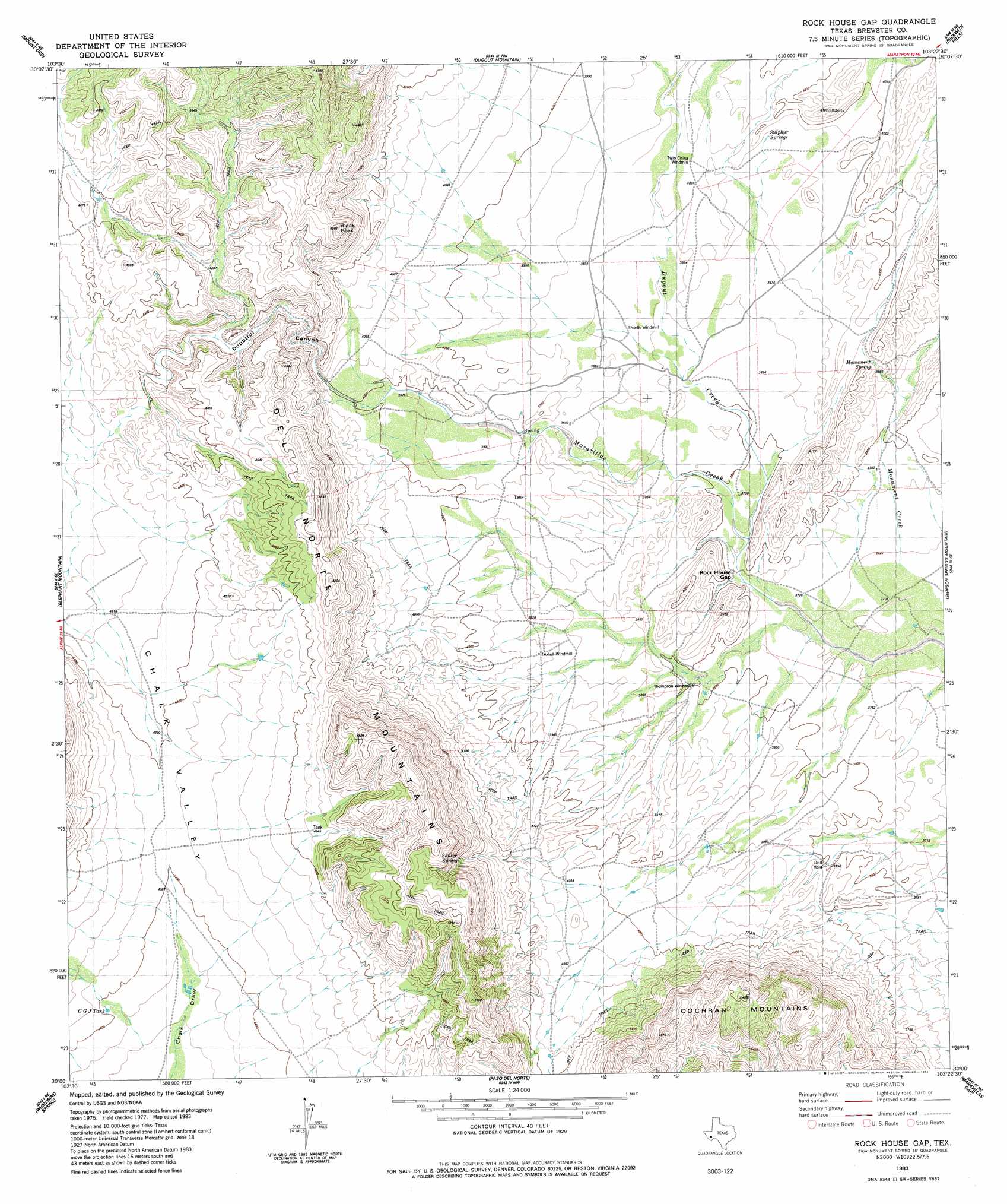
USGS Topo Quad 30103a4 - 1:24,000 scale
| Topo Map Name: | Rock House Gap |
| USGS Topo Quad ID: | 30103a4 |
| Print Size: | ca. 21 1/4" wide x 27" high |
| Southeast Coordinates: | 30° N latitude / 103.375° W longitude |
| Map Center Coordinates: | 30.0625° N latitude / 103.4375° W longitude |
| U.S. State: | TX |
| Filename: | o30103a4.jpg |
| Download Map JPG Image: | Rock House Gap topo map 1:24,000 scale |
| Map Type: | Topographic |
| Topo Series: | 7.5´ |
| Map Scale: | 1:24,000 |
| Source of Map Images: | United States Geological Survey (USGS) |
| Alternate Map Versions: |
Rock House Gap TX 1983, updated 1984 Download PDF Buy paper map Rock House Gap TX 2010 Download PDF Buy paper map Rock House Gap TX 2012 Download PDF Buy paper map Rock House Gap TX 2016 Download PDF Buy paper map |
1:24,000 Topo Quads surrounding Rock House Gap
Alpine South |
Bird Mountain |
Altuda |
Gilliland Peak |
Leonard Mountain |
Cathedral Mountain |
Mount Ord |
Dugout Mountain |
Beckwith Hills |
Marathon |
Goat Mountain |
Elephant Mountain |
Rock House Gap |
Simpson Springs Mountain |
Pena Blanca Mountains |
Duff Springs |
Whirlwind Spring |
Paso Del Norte |
Maravillas Gap |
Heart Mountain |
Straddlebug Mountain |
Buck Hill |
Santiago Peak |
Ye Mesa |
Sosa Peak |
> Back to 30103a1 at 1:100,000 scale
> Back to 30102a1 at 1:250,000 scale
> Back to U.S. Topo Maps home
Rock House Gap topo map: Gazetteer
Rock House Gap: Gaps
Rock House Gap elevation 1148m 3766′Rock House Gap: Springs
Monument Spring elevation 1198m 3930′Monument Springs elevation 1180m 3871′
Rock House Gap: Streams
Dugout Creek elevation 1147m 3763′Monument Creek elevation 1144m 3753′
Rock House Gap: Summits
Black Peak elevation 1464m 4803′Rock House Gap: Valleys
Doubtful Canyon elevation 1242m 4074′Rock House Gap digital topo map on disk
Buy this Rock House Gap topo map showing relief, roads, GPS coordinates and other geographical features, as a high-resolution digital map file on DVD: