Goat Mountain Topo Map Texas
To zoom in, hover over the map of Goat Mountain
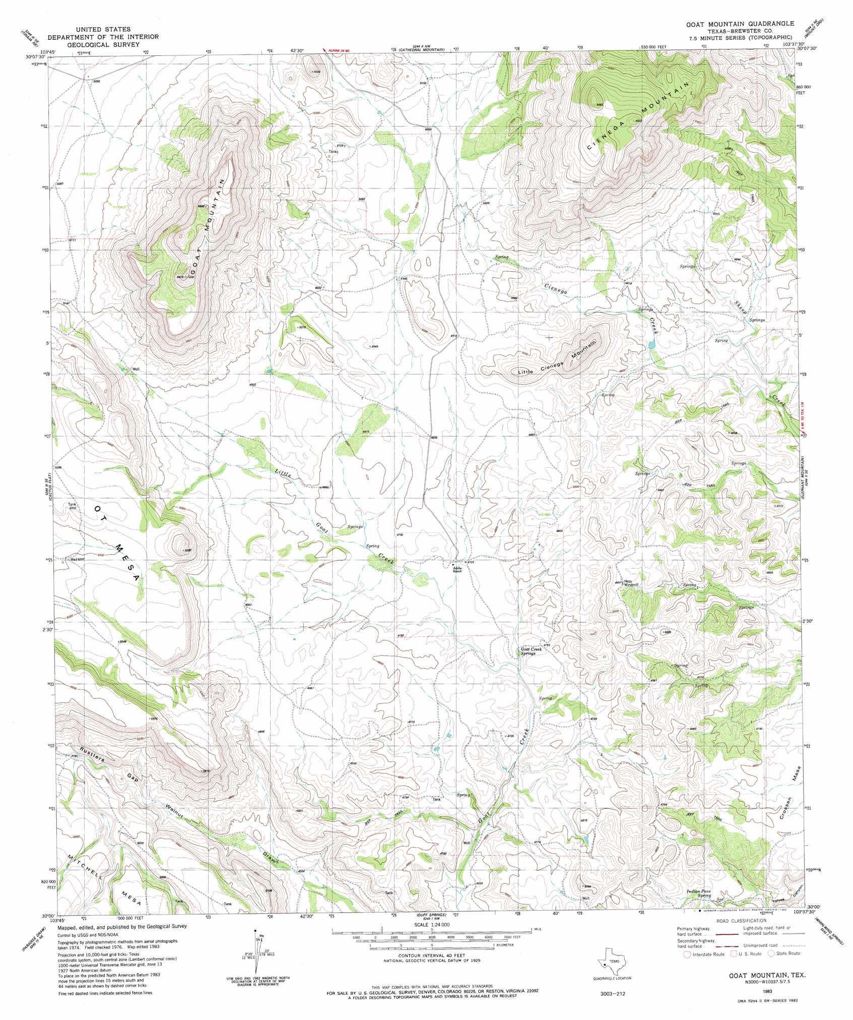
USGS Topo Quad 30103a6 - 1:24,000 scale
| Topo Map Name: | Goat Mountain |
| USGS Topo Quad ID: | 30103a6 |
| Print Size: | ca. 21 1/4" wide x 27" high |
| Southeast Coordinates: | 30° N latitude / 103.625° W longitude |
| Map Center Coordinates: | 30.0625° N latitude / 103.6875° W longitude |
| U.S. State: | TX |
| Filename: | o30103a6.jpg |
| Download Map JPG Image: | Goat Mountain topo map 1:24,000 scale |
| Map Type: | Topographic |
| Topo Series: | 7.5´ |
| Map Scale: | 1:24,000 |
| Source of Map Images: | United States Geological Survey (USGS) |
| Alternate Map Versions: |
Goat Mountain TX 1983, updated 1983 Download PDF Buy paper map Goat Mountain TX 2010 Download PDF Buy paper map Goat Mountain TX 2012 Download PDF Buy paper map Goat Mountain TX 2016 Download PDF Buy paper map |
1:24,000 Topo Quads surrounding Goat Mountain
Nopal |
Paisano |
Alpine South |
Bird Mountain |
Altuda |
Tinaja |
Tinaja Ne |
Cathedral Mountain |
Mount Ord |
Dugout Mountain |
Devils Den |
Cactus Flat |
Goat Mountain |
Elephant Mountain |
Rock House Gap |
Jordan Gap |
Paradise Draw |
Duff Springs |
Whirlwind Spring |
Paso Del Norte |
Puerto Potrillo |
Mckinney Mountain |
Straddlebug Mountain |
Buck Hill |
Santiago Peak |
> Back to 30103a1 at 1:100,000 scale
> Back to 30102a1 at 1:250,000 scale
> Back to U.S. Topo Maps home
Goat Mountain topo map: Gazetteer
Goat Mountain: Streams
Cienega Creek elevation 1402m 4599′Goat Mountain: Summits
Cienega Mountain elevation 1745m 5725′Goat Mountain elevation 1774m 5820′
Goat Mountain digital topo map on disk
Buy this Goat Mountain topo map showing relief, roads, GPS coordinates and other geographical features, as a high-resolution digital map file on DVD: