Tinaja Ne Topo Map Texas
To zoom in, hover over the map of Tinaja Ne
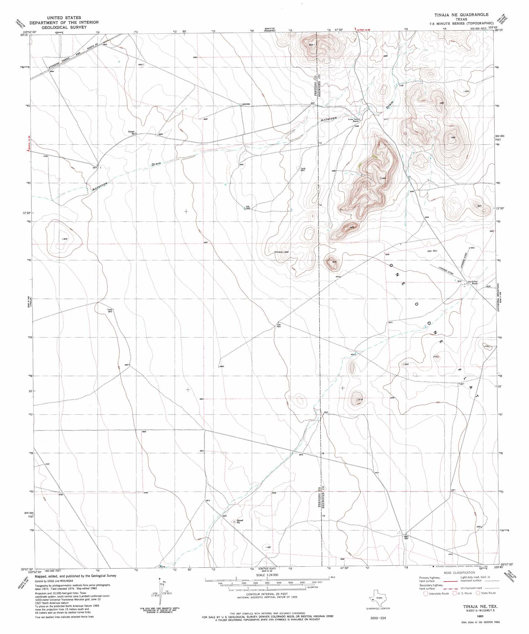
USGS Topo Quad 30103b7 - 1:24,000 scale
| Topo Map Name: | Tinaja Ne |
| USGS Topo Quad ID: | 30103b7 |
| Print Size: | ca. 21 1/4" wide x 27" high |
| Southeast Coordinates: | 30.125° N latitude / 103.75° W longitude |
| Map Center Coordinates: | 30.1875° N latitude / 103.8125° W longitude |
| U.S. State: | TX |
| Filename: | o30103b7.jpg |
| Download Map JPG Image: | Tinaja Ne topo map 1:24,000 scale |
| Map Type: | Topographic |
| Topo Series: | 7.5´ |
| Map Scale: | 1:24,000 |
| Source of Map Images: | United States Geological Survey (USGS) |
| Alternate Map Versions: |
Tinaja NE TX 1983, updated 1983 Download PDF Buy paper map Tinaja NE TX 2010 Download PDF Buy paper map Tinaja NE TX 2012 Download PDF Buy paper map Tinaja NE TX 2016 Download PDF Buy paper map |
1:24,000 Topo Quads surrounding Tinaja Ne
Smith Hills |
Mano Prieto Mountain |
Mitre Peak |
Alpine North |
Elam Mountain |
Marfa |
Nopal |
Paisano |
Alpine South |
Bird Mountain |
San Estaban Lake |
Tinaja |
Tinaja Ne |
Cathedral Mountain |
Mount Ord |
Frenchman Hills |
Devils Den |
Cactus Flat |
Goat Mountain |
Elephant Mountain |
Plata Ne |
Jordan Gap |
Paradise Draw |
Duff Springs |
Whirlwind Spring |
> Back to 30103a1 at 1:100,000 scale
> Back to 30102a1 at 1:250,000 scale
> Back to U.S. Topo Maps home
No gazetteer data is available for the Tinaja Ne topo map sheet.
Tinaja Ne digital topo map on disk
Buy this Tinaja Ne topo map showing relief, roads, GPS coordinates and other geographical features, as a high-resolution digital map file on DVD: