Gilliland Peak Topo Map Texas
To zoom in, hover over the map of Gilliland Peak
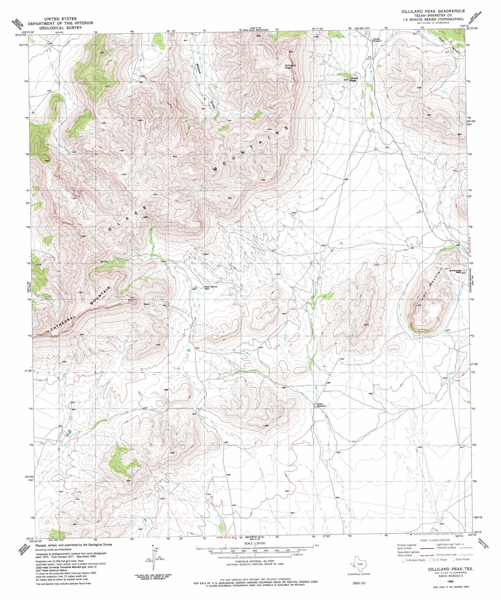
USGS Topo Quad 30103c3 - 1:24,000 scale
| Topo Map Name: | Gilliland Peak |
| USGS Topo Quad ID: | 30103c3 |
| Print Size: | ca. 21 1/4" wide x 27" high |
| Southeast Coordinates: | 30.25° N latitude / 103.25° W longitude |
| Map Center Coordinates: | 30.3125° N latitude / 103.3125° W longitude |
| U.S. State: | TX |
| Filename: | o30103c3.jpg |
| Download Map JPG Image: | Gilliland Peak topo map 1:24,000 scale |
| Map Type: | Topographic |
| Topo Series: | 7.5´ |
| Map Scale: | 1:24,000 |
| Source of Map Images: | United States Geological Survey (USGS) |
| Alternate Map Versions: |
Gilliland Peak TX 1983, updated 1984 Download PDF Buy paper map Gilliland Peak TX 2010 Download PDF Buy paper map Gilliland Peak TX 2012 Download PDF Buy paper map Gilliland Peak TX 2016 Download PDF Buy paper map |
1:24,000 Topo Quads surrounding Gilliland Peak
Last Chance Mesa |
Hovey Sw |
Hovey |
Cave Mesa |
Cave Mesa Se |
Elam Mountain |
Bissett Mountain |
Old Blue Mountain |
Hess Canyon |
Glass Mountain Ranch |
Bird Mountain |
Altuda |
Gilliland Peak |
Leonard Mountain |
Wolf Camp Hills |
Mount Ord |
Dugout Mountain |
Beckwith Hills |
Marathon |
Lightening Hills |
Elephant Mountain |
Rock House Gap |
Simpson Springs Mountain |
Pena Blanca Mountains |
Horse Mountain |
> Back to 30103a1 at 1:100,000 scale
> Back to 30102a1 at 1:250,000 scale
> Back to U.S. Topo Maps home
Gilliland Peak topo map: Gazetteer
Gilliland Peak: Populated Places
Beatty Place elevation 1455m 4773′Gilliland Peak: Summits
Cathedral Mountain elevation 1788m 5866′Iron Mountain elevation 1607m 5272′
Gilliland Peak digital topo map on disk
Buy this Gilliland Peak topo map showing relief, roads, GPS coordinates and other geographical features, as a high-resolution digital map file on DVD: