Nopal Topo Map Texas
To zoom in, hover over the map of Nopal
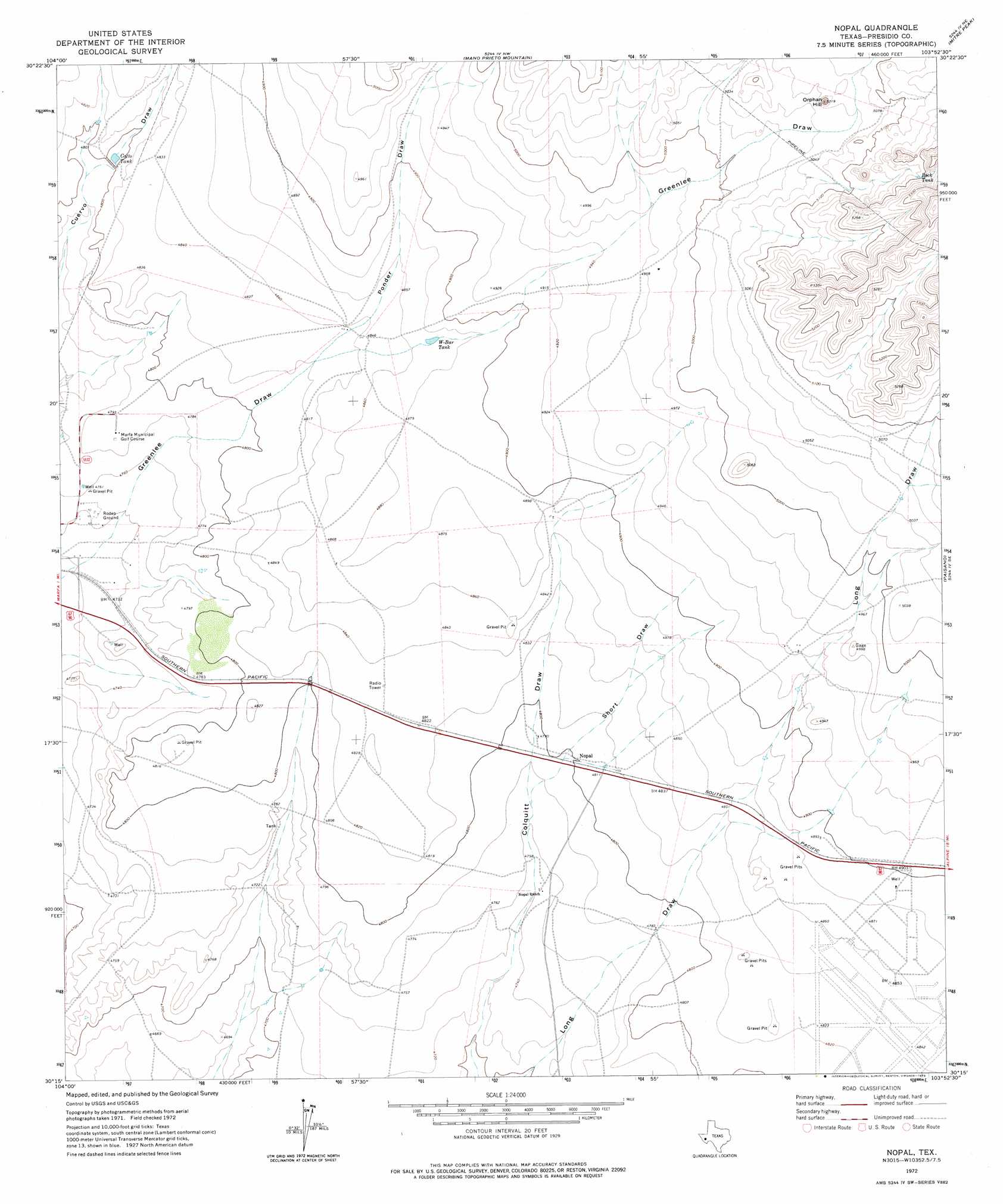
USGS Topo Quad 30103c8 - 1:24,000 scale
| Topo Map Name: | Nopal |
| USGS Topo Quad ID: | 30103c8 |
| Print Size: | ca. 21 1/4" wide x 27" high |
| Southeast Coordinates: | 30.25° N latitude / 103.875° W longitude |
| Map Center Coordinates: | 30.3125° N latitude / 103.9375° W longitude |
| U.S. State: | TX |
| Filename: | o30103c8.jpg |
| Download Map JPG Image: | Nopal topo map 1:24,000 scale |
| Map Type: | Topographic |
| Topo Series: | 7.5´ |
| Map Scale: | 1:24,000 |
| Source of Map Images: | United States Geological Survey (USGS) |
| Alternate Map Versions: |
Nopal TX 1972, updated 1975 Download PDF Buy paper map Nopal TX 2010 Download PDF Buy paper map Nopal TX 2012 Download PDF Buy paper map Nopal TX 2016 Download PDF Buy paper map |
1:24,000 Topo Quads surrounding Nopal
Paradise Mountain |
Blue Mountain |
Fort Davis |
Fort Davis Se |
Henderson Mesa |
Burro Draw |
Smith Hills |
Mano Prieto Mountain |
Mitre Peak |
Alpine North |
Aragon |
Marfa |
Nopal |
Paisano |
Alpine South |
Oak Creek |
San Estaban Lake |
Tinaja |
Tinaja Ne |
Cathedral Mountain |
San Estaban Lake Sw |
Frenchman Hills |
Devils Den |
Cactus Flat |
Goat Mountain |
> Back to 30103a1 at 1:100,000 scale
> Back to 30102a1 at 1:250,000 scale
> Back to U.S. Topo Maps home
Nopal topo map: Gazetteer
Nopal: Populated Places
Nopal elevation 1465m 4806′Nopal: Reservoirs
Catto Tank elevation 1464m 4803′W-Bar Tank elevation 1486m 4875′
Nopal: Summits
Orphan Hill elevation 1582m 5190′Nopal: Valleys
Ponder Draw elevation 1474m 4835′Short Draw elevation 1458m 4783′
Nopal digital topo map on disk
Buy this Nopal topo map showing relief, roads, GPS coordinates and other geographical features, as a high-resolution digital map file on DVD: