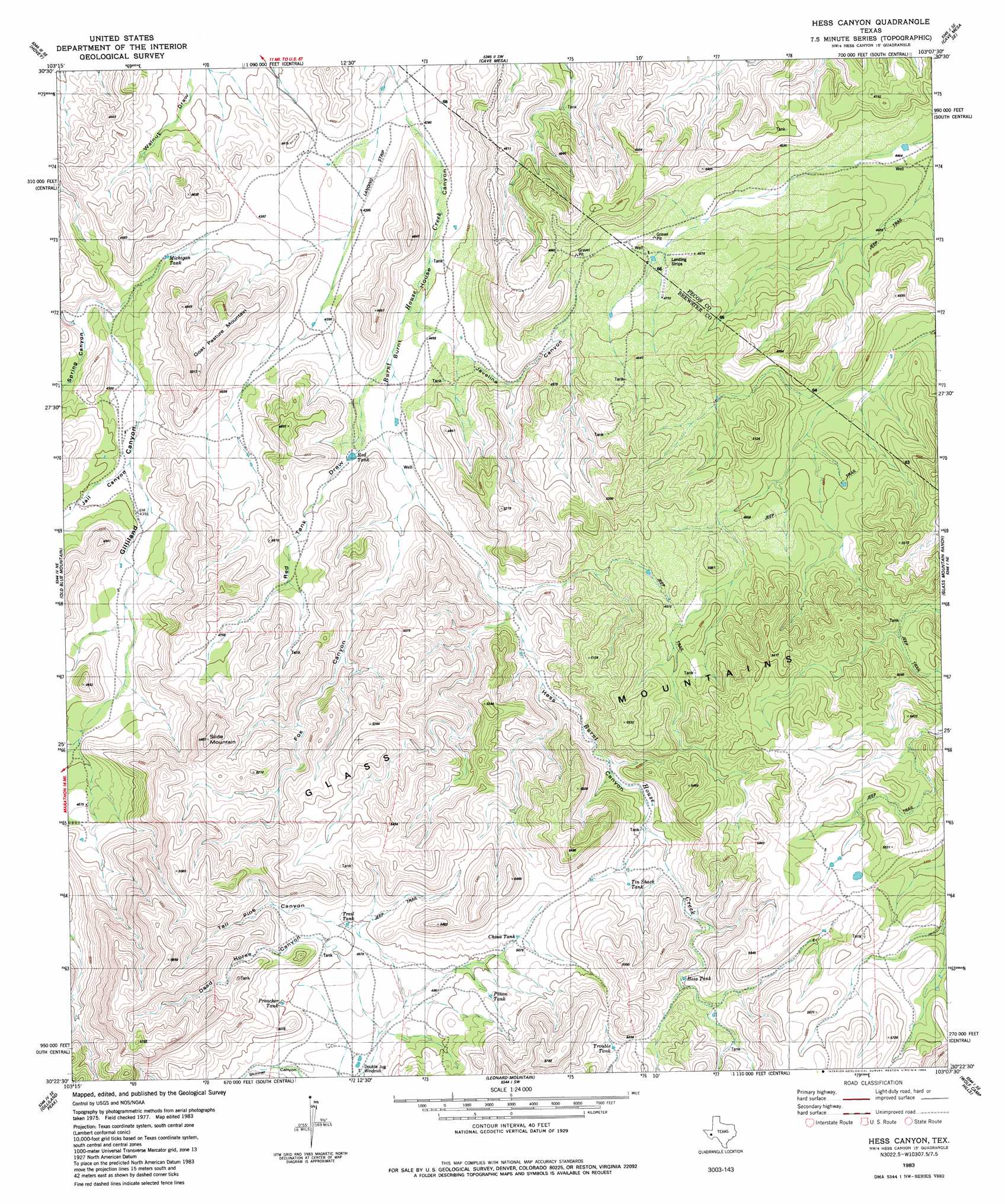
Hess Canyon Topo Map Texas
To zoom in, hover over the map of Hess Canyon
USGS Topo Quad 30103d2 - 1:24,000 scale
| Topo Map Name: | Hess Canyon |
| USGS Topo Quad ID: | 30103d2 |
| Print Size: | ca. 21 1/4" wide x 27" high |
| Southeast Coordinates: | 30.375° N latitude / 103.125° W longitude |
| Map Center Coordinates: | 30.4375° N latitude / 103.1875° W longitude |
| U.S. State: | TX |
| Filename: | o30103d2.jpg |
| Download Map JPG Image: | Hess Canyon topo map 1:24,000 scale |
| Map Type: | Topographic |
| Topo Series: | 7.5´ |
| Map Scale: | 1:24,000 |
| Source of Map Images: | United States Geological Survey (USGS) |
| Alternate Map Versions: |
Hess Canyon TX 1983, updated 1984 Download PDF Buy paper map Hess Canyon TX 2010 Download PDF Buy paper map Hess Canyon TX 2012 Download PDF Buy paper map Hess Canyon TX 2016 Download PDF Buy paper map |
1:24,000 Topo Quads surrounding Hess Canyon
Leoncita Ranch |
Hovey Ne |
Chancellor |
Cave Mesa Ne |
Sierra Madera Nw |
Hovey Sw |
Hovey |
Cave Mesa |
Cave Mesa Se |
Sierra Madera |
Bissett Mountain |
Old Blue Mountain |
Hess Canyon |
Glass Mountain Ranch |
Marathon Gap |
Altuda |
Gilliland Peak |
Leonard Mountain |
Wolf Camp Hills |
Dimple Hills |
Dugout Mountain |
Beckwith Hills |
Marathon |
Lightening Hills |
Housetop Mountains |
> Back to 30103a1 at 1:100,000 scale
> Back to 30102a1 at 1:250,000 scale
> Back to U.S. Topo Maps home
Hess Canyon topo map: Gazetteer
Hess Canyon: Populated Places
Old Oscar Nance Place elevation 1329m 4360′Old Parker Place elevation 1311m 4301′
Hess Canyon: Valleys
Hess Canyon elevation 1390m 4560′Red Tank Draw elevation 1363m 4471′
Skinner Canyon elevation 1487m 4878′
Spring Canyon elevation 1281m 4202′
Hess Canyon digital topo map on disk
Buy this Hess Canyon topo map showing relief, roads, GPS coordinates and other geographical features, as a high-resolution digital map file on DVD: