Leoncita Ranch Topo Map Texas
To zoom in, hover over the map of Leoncita Ranch
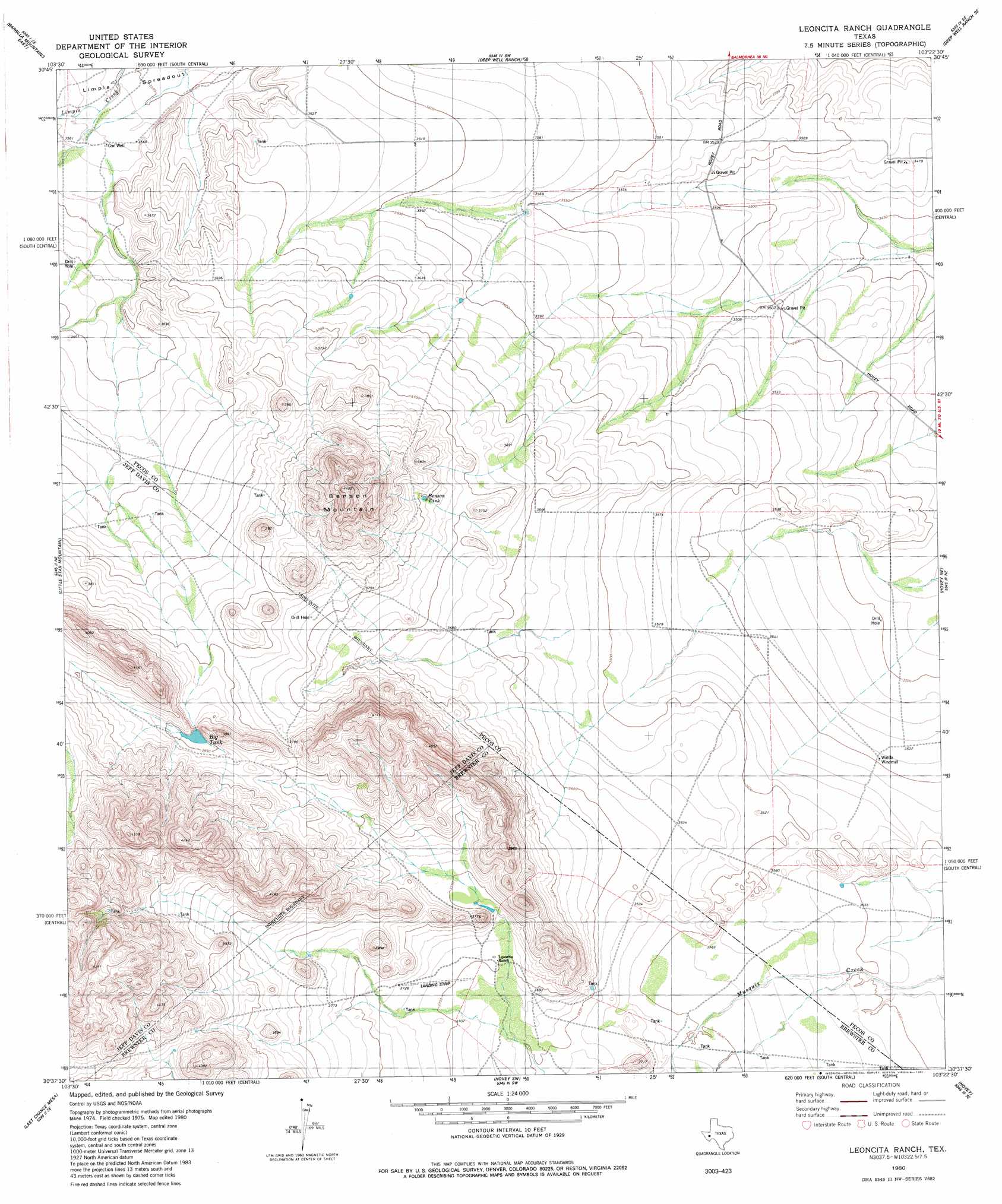
USGS Topo Quad 30103f4 - 1:24,000 scale
| Topo Map Name: | Leoncita Ranch |
| USGS Topo Quad ID: | 30103f4 |
| Print Size: | ca. 21 1/4" wide x 27" high |
| Southeast Coordinates: | 30.625° N latitude / 103.375° W longitude |
| Map Center Coordinates: | 30.6875° N latitude / 103.4375° W longitude |
| U.S. State: | TX |
| Filename: | o30103f4.jpg |
| Download Map JPG Image: | Leoncita Ranch topo map 1:24,000 scale |
| Map Type: | Topographic |
| Topo Series: | 7.5´ |
| Map Scale: | 1:24,000 |
| Source of Map Images: | United States Geological Survey (USGS) |
| Alternate Map Versions: |
Leoncita Ranch TX 1980, updated 1981 Download PDF Buy paper map Leoncita Ranch TX 2010 Download PDF Buy paper map Leoncita Ranch TX 2012 Download PDF Buy paper map Leoncita Ranch TX 2016 Download PDF Buy paper map |
1:24,000 Topo Quads surrounding Leoncita Ranch
Balmorhea |
Cox Draw |
Deep Well Ranch Nw |
Tucker Hill |
Belding Nw |
Barrilla Mountains West |
Barrilla Mountains East |
Deep Well Ranch |
Deep Well Ranch Se |
Belding Sw |
Major Peak |
Little Star Mountain |
Leoncita Ranch |
Hovey Ne |
Chancellor |
Henderson Mesa |
Last Chance Mesa |
Hovey Sw |
Hovey |
Cave Mesa |
Alpine North |
Elam Mountain |
Bissett Mountain |
Old Blue Mountain |
Hess Canyon |
> Back to 30103e1 at 1:100,000 scale
> Back to 30102a1 at 1:250,000 scale
> Back to U.S. Topo Maps home
Leoncita Ranch topo map: Gazetteer
Leoncita Ranch: Areas
The Trans-Pecos elevation 1085m 3559′Leoncita Ranch: Reservoirs
Benson Tank elevation 1143m 3750′Leoncita Ranch: Springs
Leoncita Spring elevation 1136m 3727′Leoncita Ranch: Valleys
Upper Coyanosa Draw elevation 1131m 3710′Leoncita Ranch: Wells
Cox Well elevation 1089m 3572′Leoncita Ranch digital topo map on disk
Buy this Leoncita Ranch topo map showing relief, roads, GPS coordinates and other geographical features, as a high-resolution digital map file on DVD: