Smith Hills Topo Map Texas
To zoom in, hover over the map of Smith Hills
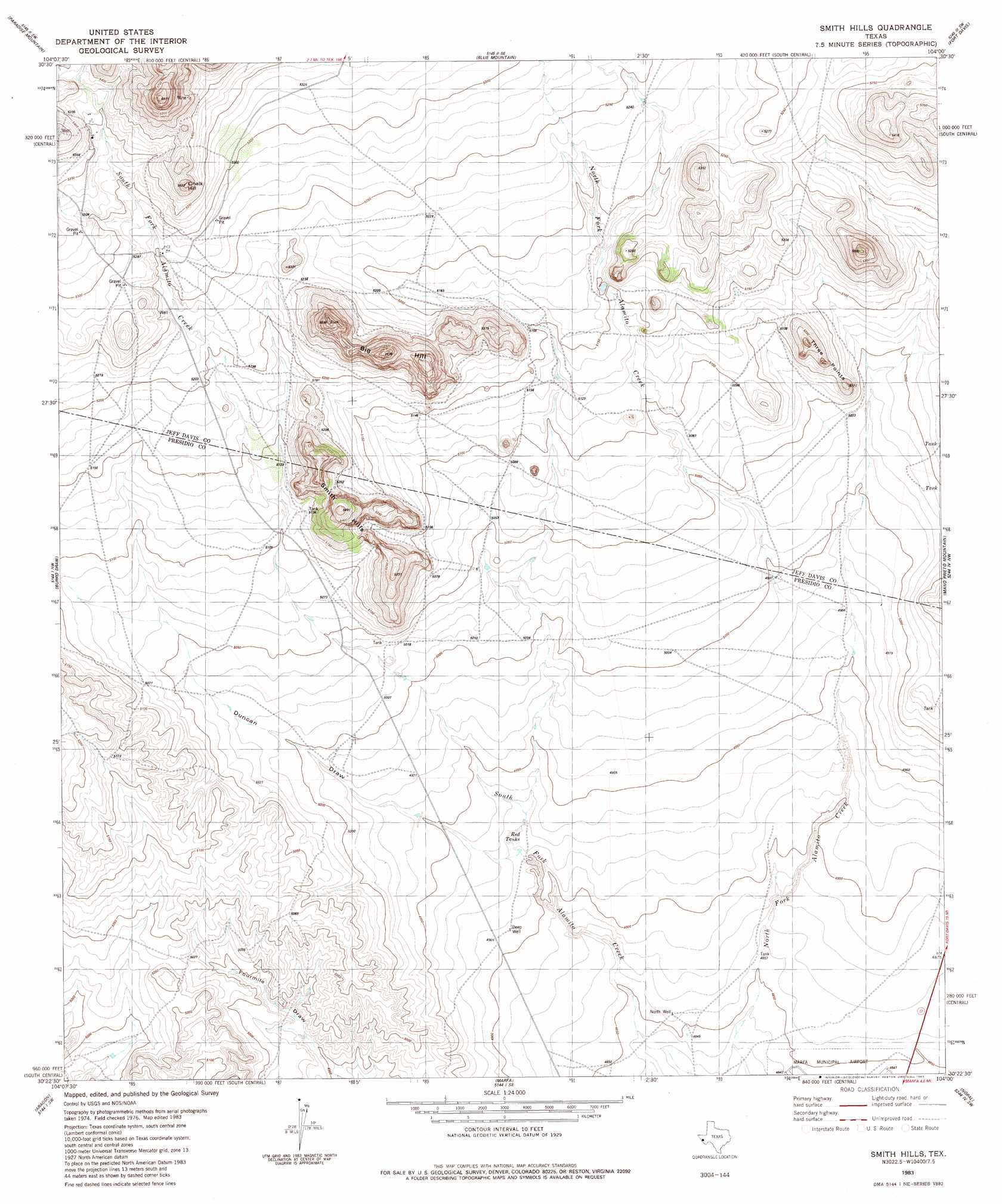
USGS Topo Quad 30104d1 - 1:24,000 scale
| Topo Map Name: | Smith Hills |
| USGS Topo Quad ID: | 30104d1 |
| Print Size: | ca. 21 1/4" wide x 27" high |
| Southeast Coordinates: | 30.375° N latitude / 104° W longitude |
| Map Center Coordinates: | 30.4375° N latitude / 104.0625° W longitude |
| U.S. State: | TX |
| Filename: | o30104d1.jpg |
| Download Map JPG Image: | Smith Hills topo map 1:24,000 scale |
| Map Type: | Topographic |
| Topo Series: | 7.5´ |
| Map Scale: | 1:24,000 |
| Source of Map Images: | United States Geological Survey (USGS) |
| Alternate Map Versions: |
Smith Hills TX 1983, updated 1983 Download PDF Buy paper map Smith Hills TX 2010 Download PDF Buy paper map Smith Hills TX 2012 Download PDF Buy paper map Smith Hills TX 2016 Download PDF Buy paper map |
1:24,000 Topo Quads surrounding Smith Hills
El Muerto Peak |
Mount Livermore |
Mount Locke |
Casket Mountain |
Swayback Mountain |
San Antonio Pass |
Paradise Mountain |
Blue Mountain |
Fort Davis |
Fort Davis Se |
Ryan |
Burro Draw |
Smith Hills |
Mano Prieto Mountain |
Mitre Peak |
Oak Hills North |
Aragon |
Marfa |
Nopal |
Paisano |
Oak Hills South |
Oak Creek |
San Estaban Lake |
Tinaja |
Tinaja Ne |
> Back to 30104a1 at 1:100,000 scale
> Back to 30104a1 at 1:250,000 scale
> Back to U.S. Topo Maps home
No gazetteer data is available for the Smith Hills topo map sheet.
Smith Hills digital topo map on disk
Buy this Smith Hills topo map showing relief, roads, GPS coordinates and other geographical features, as a high-resolution digital map file on DVD: