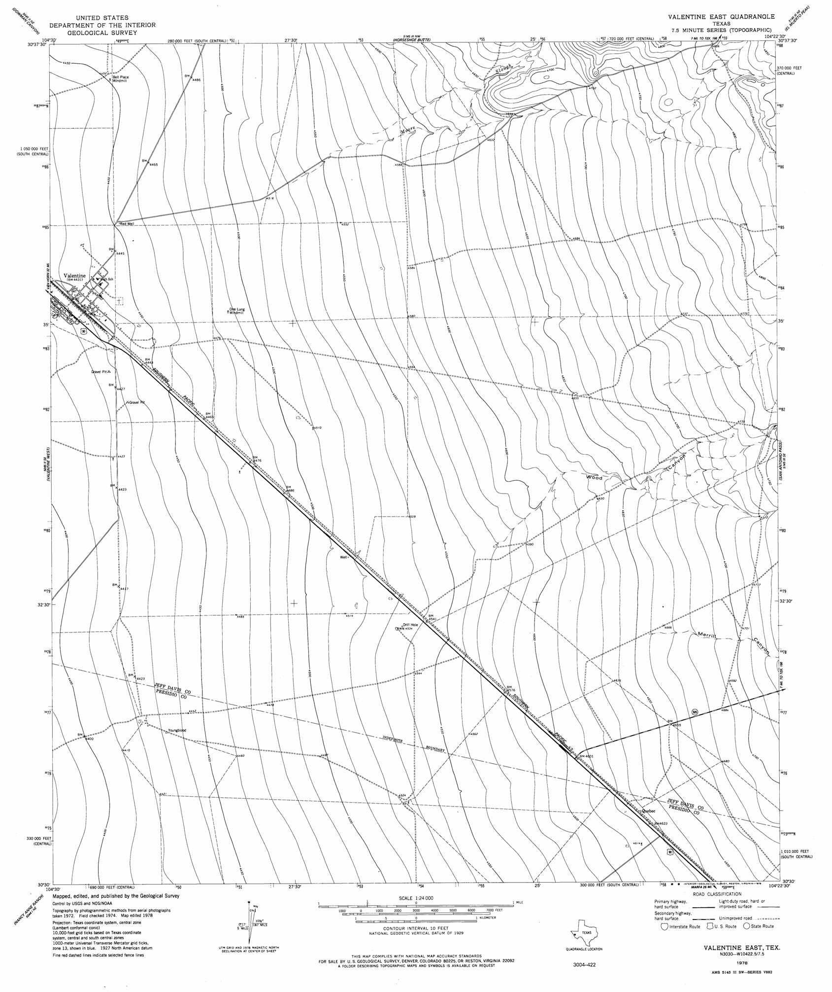
Valentine East Topo Map Texas
To zoom in, hover over the map of Valentine East
USGS Topo Quad 30104e4 - 1:24,000 scale
| Topo Map Name: | Valentine East |
| USGS Topo Quad ID: | 30104e4 |
| Print Size: | ca. 21 1/4" wide x 27" high |
| Southeast Coordinates: | 30.5° N latitude / 104.375° W longitude |
| Map Center Coordinates: | 30.5625° N latitude / 104.4375° W longitude |
| U.S. State: | TX |
| Filename: | o30104e4.jpg |
| Download Map JPG Image: | Valentine East topo map 1:24,000 scale |
| Map Type: | Topographic |
| Topo Series: | 7.5´ |
| Map Scale: | 1:24,000 |
| Source of Map Images: | United States Geological Survey (USGS) |
| Alternate Map Versions: |
Valentine East TX 1978, updated 1978 Download PDF Buy paper map Valentine East TX 2010 Download PDF Buy paper map Valentine East TX 2012 Download PDF Buy paper map Valentine East TX 2016 Download PDF Buy paper map |
1:24,000 Topo Quads surrounding Valentine East
Chispa Mountain |
Mayfield Hills |
Boggy Draw |
Bare Mountain |
Robbers Roost Canyon |
Chispa |
Dowman Canyon |
Horseshoe Butte |
El Muerto Peak |
Mount Livermore |
Vieja Pass |
Valentine West |
Valentine East |
San Antonio Pass |
Paradise Mountain |
Gettysburg Peak |
Nancy Anne Ranch |
Deer Peak |
Ryan |
Burro Draw |
Mccomb Canyon |
Capote Peak |
Ryan Sw |
Oak Hills North |
Aragon |
> Back to 30104e1 at 1:100,000 scale
> Back to 30104a1 at 1:250,000 scale
> Back to U.S. Topo Maps home
Valentine East topo map: Gazetteer
Valentine East: Populated Places
Bell Place Windmill elevation 1357m 4452′Quebec elevation 1411m 4629′
Valentine elevation 1351m 4432′
Valentine East: Streams
Moore Slough elevation 1381m 4530′Valentine East: Valleys
Merrill Canyon elevation 1421m 4662′Wood Canyon elevation 1393m 4570′
Valentine East digital topo map on disk
Buy this Valentine East topo map showing relief, roads, GPS coordinates and other geographical features, as a high-resolution digital map file on DVD: