El Muerto Peak Topo Map Texas
To zoom in, hover over the map of El Muerto Peak
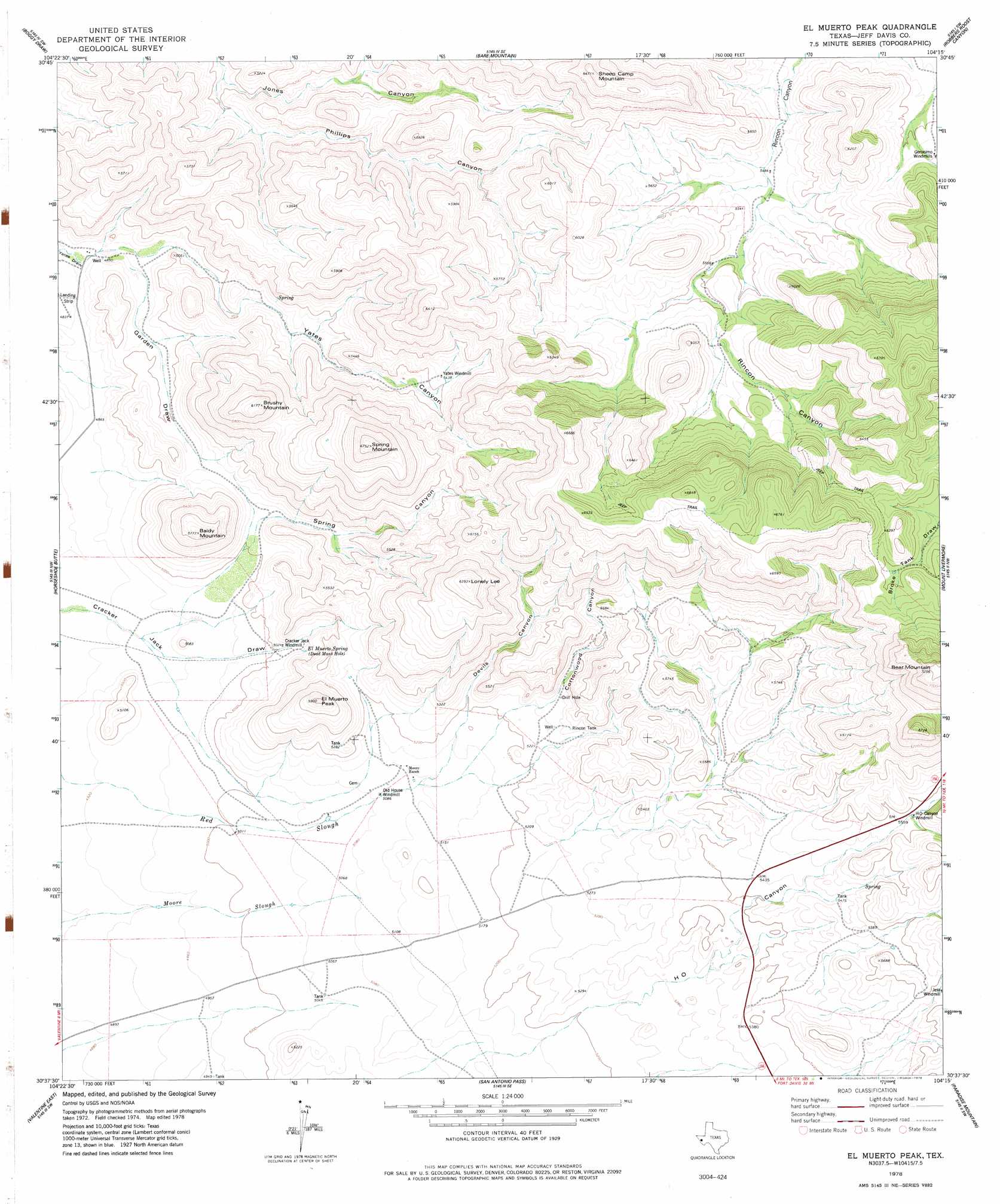
USGS Topo Quad 30104f3 - 1:24,000 scale
| Topo Map Name: | El Muerto Peak |
| USGS Topo Quad ID: | 30104f3 |
| Print Size: | ca. 21 1/4" wide x 27" high |
| Southeast Coordinates: | 30.625° N latitude / 104.25° W longitude |
| Map Center Coordinates: | 30.6875° N latitude / 104.3125° W longitude |
| U.S. State: | TX |
| Filename: | o30104f3.jpg |
| Download Map JPG Image: | El Muerto Peak topo map 1:24,000 scale |
| Map Type: | Topographic |
| Topo Series: | 7.5´ |
| Map Scale: | 1:24,000 |
| Source of Map Images: | United States Geological Survey (USGS) |
| Alternate Map Versions: |
El Muerto Peak TX 1978, updated 1978 Download PDF Buy paper map El Muerto Peak TX 2010 Download PDF Buy paper map El Muerto Peak TX 2012 Download PDF Buy paper map El Muerto Peak TX 2016 Download PDF Buy paper map |
1:24,000 Topo Quads surrounding El Muerto Peak
Chispa Mountain Ne |
Boracho Peak |
Herds Pass |
Echo Canyon |
Buckhorn Mountain |
Mayfield Hills |
Boggy Draw |
Bare Mountain |
Robbers Roost Canyon |
Friend Mountain |
Dowman Canyon |
Horseshoe Butte |
El Muerto Peak |
Mount Livermore |
Mount Locke |
Valentine West |
Valentine East |
San Antonio Pass |
Paradise Mountain |
Blue Mountain |
Nancy Anne Ranch |
Deer Peak |
Ryan |
Burro Draw |
Smith Hills |
> Back to 30104e1 at 1:100,000 scale
> Back to 30104a1 at 1:250,000 scale
> Back to U.S. Topo Maps home
El Muerto Peak topo map: Gazetteer
El Muerto Peak: Reservoirs
Rincon Tank elevation 1616m 5301′El Muerto Peak: Springs
El Muerto Spring elevation 1548m 5078′El Muerto Peak: Summits
Baldy Mountain elevation 1758m 5767′Bear Mountain elevation 2209m 7247′
Brushy Mountain elevation 1883m 6177′
El Muerto Peak elevation 1795m 5889′
Lonely Lee elevation 1943m 6374′
Sheep Camp Mountain elevation 1954m 6410′
Spring Mountain elevation 2051m 6729′
El Muerto Peak: Valleys
Cottonwood Canyon elevation 1608m 5275′Devils Canyon elevation 1586m 5203′
Garden Draw elevation 1488m 4881′
Phillips Canyon elevation 1511m 4957′
Spring Canyon elevation 1536m 5039′
Yates Canyon elevation 1499m 4917′
El Muerto Peak digital topo map on disk
Buy this El Muerto Peak topo map showing relief, roads, GPS coordinates and other geographical features, as a high-resolution digital map file on DVD: