Robbers Roost Canyon Topo Map Texas
To zoom in, hover over the map of Robbers Roost Canyon
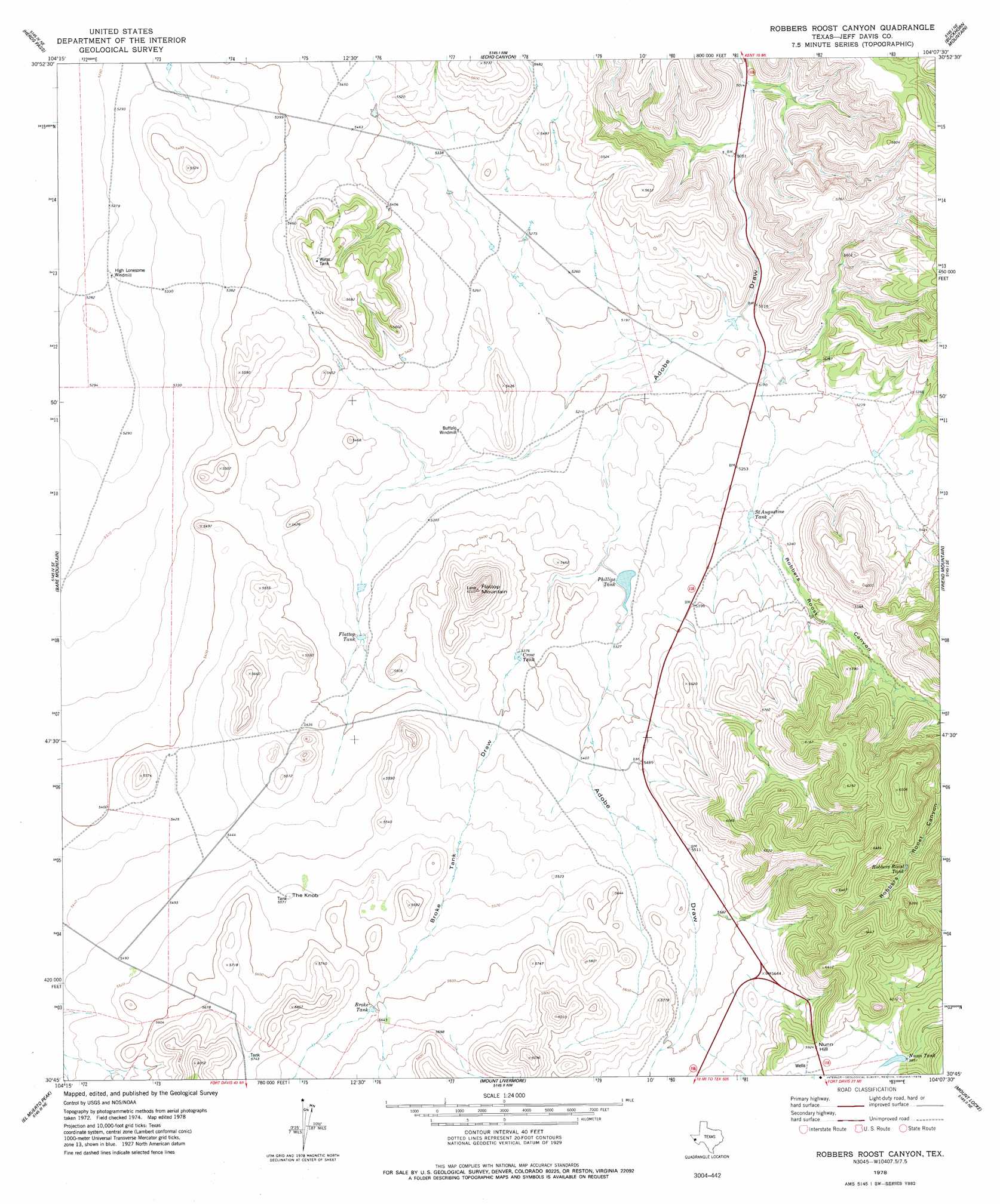
USGS Topo Quad 30104g2 - 1:24,000 scale
| Topo Map Name: | Robbers Roost Canyon |
| USGS Topo Quad ID: | 30104g2 |
| Print Size: | ca. 21 1/4" wide x 27" high |
| Southeast Coordinates: | 30.75° N latitude / 104.125° W longitude |
| Map Center Coordinates: | 30.8125° N latitude / 104.1875° W longitude |
| U.S. State: | TX |
| Filename: | o30104g2.jpg |
| Download Map JPG Image: | Robbers Roost Canyon topo map 1:24,000 scale |
| Map Type: | Topographic |
| Topo Series: | 7.5´ |
| Map Scale: | 1:24,000 |
| Source of Map Images: | United States Geological Survey (USGS) |
| Alternate Map Versions: |
Robbers Roost Canyon TX 1978, updated 1978 Download PDF Buy paper map Robbers Roost Canyon TX 2010 Download PDF Buy paper map Robbers Roost Canyon TX 2012 Download PDF Buy paper map Robbers Roost Canyon TX 2016 Download PDF Buy paper map |
1:24,000 Topo Quads surrounding Robbers Roost Canyon
Boracho |
Fencepost Draw |
Kent |
Gomez Peak |
Sotol Hill |
Boracho Peak |
Herds Pass |
Echo Canyon |
Buckhorn Mountain |
Antelope Flat |
Boggy Draw |
Bare Mountain |
Robbers Roost Canyon |
Friend Mountain |
Little Aguja Mountain |
Horseshoe Butte |
El Muerto Peak |
Mount Livermore |
Mount Locke |
Casket Mountain |
Valentine East |
San Antonio Pass |
Paradise Mountain |
Blue Mountain |
Fort Davis |
> Back to 30104e1 at 1:100,000 scale
> Back to 30104a1 at 1:250,000 scale
> Back to U.S. Topo Maps home
Robbers Roost Canyon topo map: Gazetteer
Robbers Roost Canyon: Reservoirs
Broke Tank elevation 1708m 5603′Crow Tank elevation 1635m 5364′
Flattop Tank elevation 1628m 5341′
Nunn Tank elevation 1782m 5846′
Phillips Tank elevation 1612m 5288′
Robbers Roost Tank elevation 1802m 5912′
Saint Augustine Tank elevation 1609m 5278′
Robbers Roost Canyon: Summits
Flattop Mountain elevation 1835m 6020′Nunn Hill elevation 1812m 5944′
The Knob elevation 1695m 5561′
Robbers Roost Canyon: Valleys
Broke Tank Draw elevation 1609m 5278′Robbers Roost Canyon elevation 1621m 5318′
Robbers Roost Canyon digital topo map on disk
Buy this Robbers Roost Canyon topo map showing relief, roads, GPS coordinates and other geographical features, as a high-resolution digital map file on DVD: