Boggy Draw Topo Map Texas
To zoom in, hover over the map of Boggy Draw
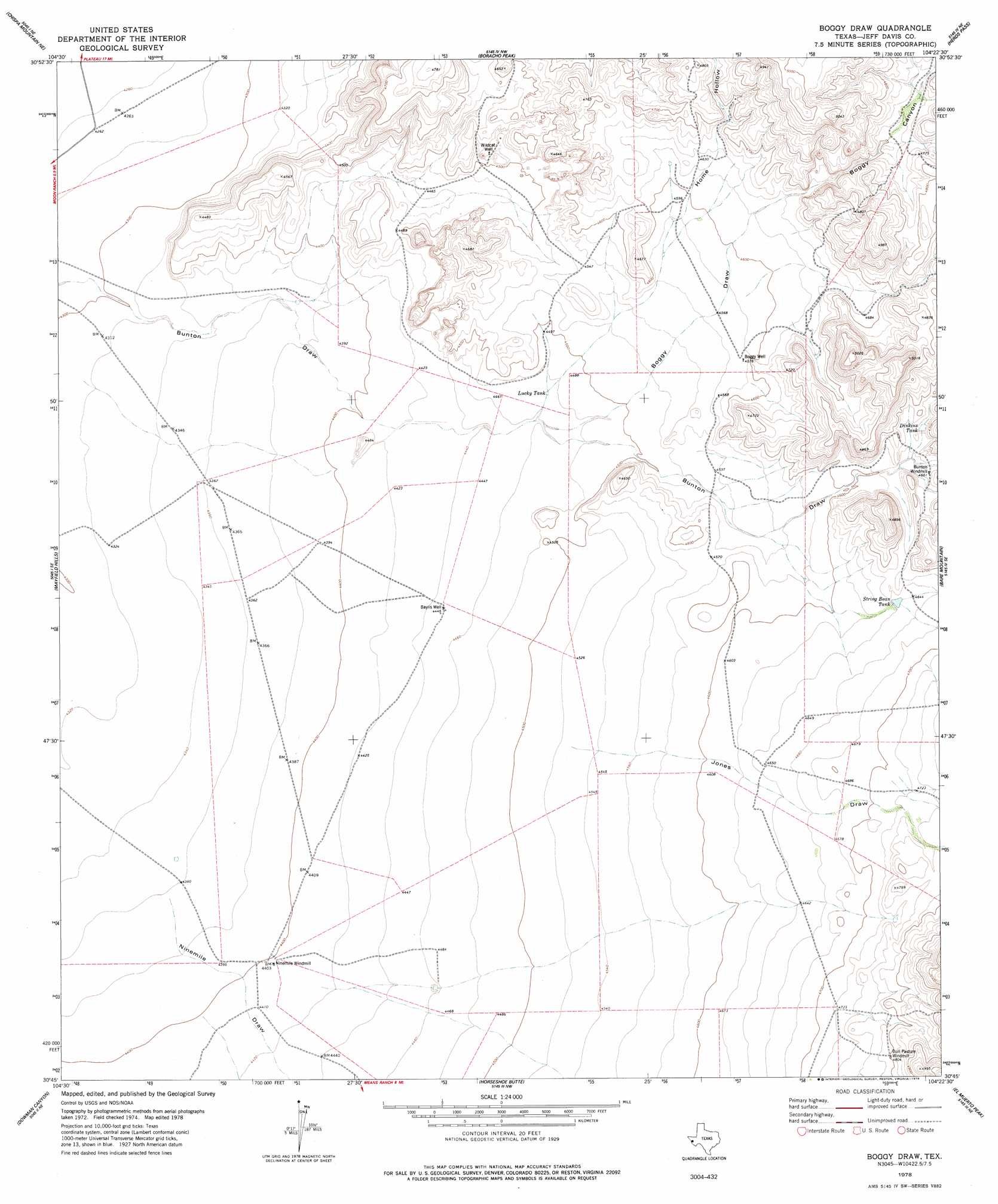
USGS Topo Quad 30104g4 - 1:24,000 scale
| Topo Map Name: | Boggy Draw |
| USGS Topo Quad ID: | 30104g4 |
| Print Size: | ca. 21 1/4" wide x 27" high |
| Southeast Coordinates: | 30.75° N latitude / 104.375° W longitude |
| Map Center Coordinates: | 30.8125° N latitude / 104.4375° W longitude |
| U.S. State: | TX |
| Filename: | o30104g4.jpg |
| Download Map JPG Image: | Boggy Draw topo map 1:24,000 scale |
| Map Type: | Topographic |
| Topo Series: | 7.5´ |
| Map Scale: | 1:24,000 |
| Source of Map Images: | United States Geological Survey (USGS) |
| Alternate Map Versions: |
Boggy Draw TX 1978, updated 1978 Download PDF Buy paper map Boggy Draw TX 2010 Download PDF Buy paper map Boggy Draw TX 2012 Download PDF Buy paper map Boggy Draw TX 2016 Download PDF Buy paper map |
1:24,000 Topo Quads surrounding Boggy Draw
Wild Horse |
Plateau |
Boracho |
Fencepost Draw |
Kent |
Chispa Mountain Nw |
Chispa Mountain Ne |
Boracho Peak |
Herds Pass |
Echo Canyon |
Chispa Mountain |
Mayfield Hills |
Boggy Draw |
Bare Mountain |
Robbers Roost Canyon |
Chispa |
Dowman Canyon |
Horseshoe Butte |
El Muerto Peak |
Mount Livermore |
Vieja Pass |
Valentine West |
Valentine East |
San Antonio Pass |
Paradise Mountain |
> Back to 30104e1 at 1:100,000 scale
> Back to 30104a1 at 1:250,000 scale
> Back to U.S. Topo Maps home
Boggy Draw topo map: Gazetteer
Boggy Draw: Reservoirs
Dinkins Tank elevation 1421m 4662′Lucky Tank elevation 1364m 4475′
String Bean Tank elevation 1415m 4642′
Boggy Draw: Valleys
Boggy Canyon elevation 1417m 4648′Boggy Draw elevation 1364m 4475′
Home Hollow elevation 1366m 4481′
Jones Draw elevation 1380m 4527′
Ninemile Draw elevation 1330m 4363′
Boggy Draw: Wells
Baylis Well elevation 1356m 4448′Boggy Well elevation 1395m 4576′
Wildcat Well elevation 1382m 4534′
Boggy Draw digital topo map on disk
Buy this Boggy Draw topo map showing relief, roads, GPS coordinates and other geographical features, as a high-resolution digital map file on DVD: