Indian Hot Springs Topo Map Texas
To zoom in, hover over the map of Indian Hot Springs
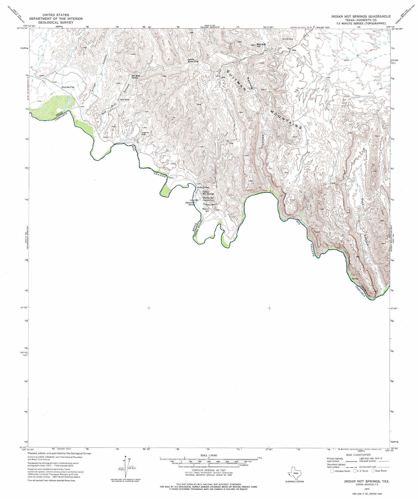
USGS Topo Quad 30105g3 - 1:24,000 scale
| Topo Map Name: | Indian Hot Springs |
| USGS Topo Quad ID: | 30105g3 |
| Print Size: | ca. 21 1/4" wide x 27" high |
| Southeast Coordinates: | 30.75° N latitude / 105.25° W longitude |
| Map Center Coordinates: | 30.8125° N latitude / 105.3125° W longitude |
| U.S. State: | TX |
| Filename: | o30105g3.jpg |
| Download Map JPG Image: | Indian Hot Springs topo map 1:24,000 scale |
| Map Type: | Topographic |
| Topo Series: | 7.5´ |
| Map Scale: | 1:24,000 |
| Source of Map Images: | United States Geological Survey (USGS) |
| Alternate Map Versions: |
Indian Hot Springs TX 1972, updated 1975 Download PDF Buy paper map Indian Hot Springs TX 2010 Download PDF Buy paper map Indian Hot Springs TX 2012 Download PDF Buy paper map Indian Hot Springs TX 2016 Download PDF Buy paper map |
1:24,000 Topo Quads surrounding Indian Hot Springs
Neely Canyon |
Sierra Blanca Sw |
Devil Ridge |
Grayton Lake |
Allamoore |
Schroder Arroyo |
Cedar Arroyo |
Eagle Mountains Nw |
Eagle Mountains Ne |
|
Indian Hot Springs |
Eagle Mountains Sw |
Eagle Mountains Se |
||
Bramlett Ranch |
||||
> Back to 30105e1 at 1:100,000 scale
> Back to 30104a1 at 1:250,000 scale
> Back to U.S. Topo Maps home
Indian Hot Springs topo map: Gazetteer
Indian Hot Springs: Dams
Gibson Dam elevation 1025m 3362′Indian Hot Springs: Flats
Suicide Flat elevation 1019m 3343′Indian Hot Springs: Lakes
Indian Water Hole elevation 1123m 3684′Indian Hot Springs: Populated Places
Indian Hot Springs elevation 1012m 3320′Indian Hot Springs: Reservoirs
Gibson Reservoir elevation 1025m 3362′Indian Hot Springs: Springs
Beauty Spring elevation 1013m 3323′Chief Springs elevation 1010m 3313′
Dynamite Spring elevation 1008m 3307′
Indian Hot Springs elevation 1008m 3307′
Masins Spring elevation 1011m 3316′
Red Bull Spring elevation 1065m 3494′
Soda Spring elevation 1014m 3326′
Squaw Spring elevation 1011m 3316′
Stump Spring elevation 1011m 3316′
Indian Hot Springs: Summits
Red Bull Hill elevation 1197m 3927′Indian Hot Springs: Valleys
Arroyo Caballo elevation 1018m 3339′Goat Canyon elevation 1000m 3280′
Mayfield Canyon elevation 1004m 3293′
Red Bull Canyon elevation 1018m 3339′
Indian Hot Springs digital topo map on disk
Buy this Indian Hot Springs topo map showing relief, roads, GPS coordinates and other geographical features, as a high-resolution digital map file on DVD: