Browntown Topo Map Georgia
To zoom in, hover over the map of Browntown
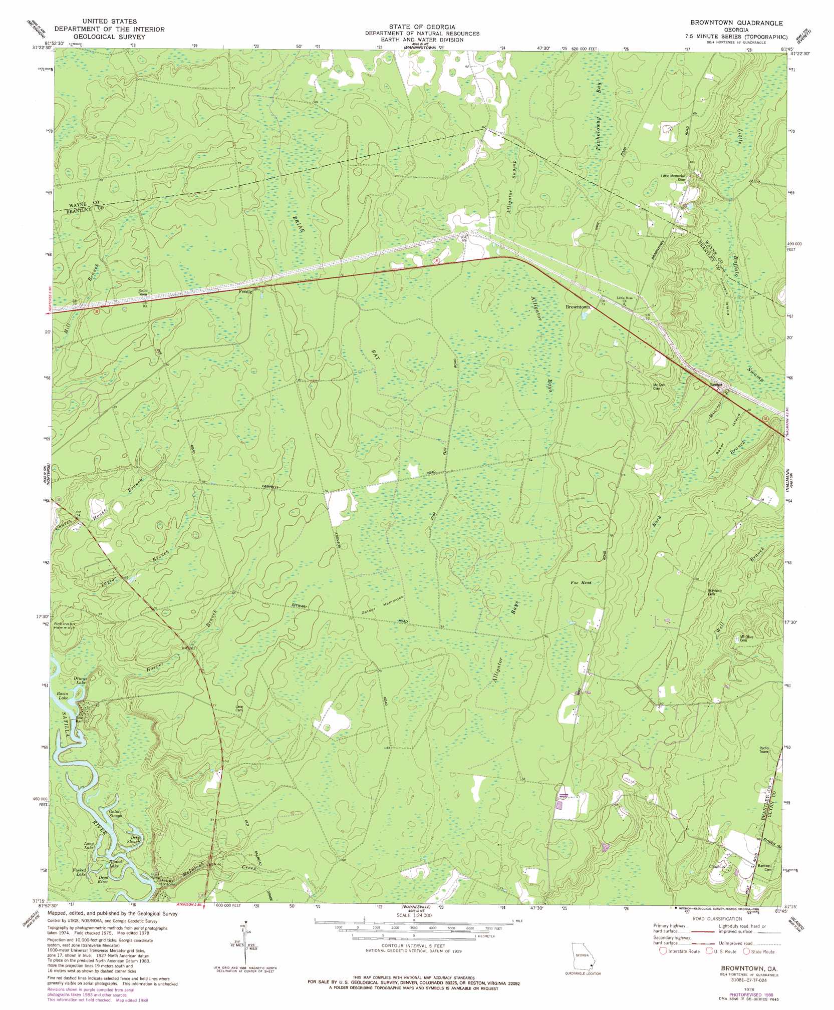
USGS Topo Quad 31081c7 - 1:24,000 scale
| Topo Map Name: | Browntown |
| USGS Topo Quad ID: | 31081c7 |
| Print Size: | ca. 21 1/4" wide x 27" high |
| Southeast Coordinates: | 31.25° N latitude / 81.75° W longitude |
| Map Center Coordinates: | 31.3125° N latitude / 81.8125° W longitude |
| U.S. State: | GA |
| Filename: | o31081c7.jpg |
| Download Map JPG Image: | Browntown topo map 1:24,000 scale |
| Map Type: | Topographic |
| Topo Series: | 7.5´ |
| Map Scale: | 1:24,000 |
| Source of Map Images: | United States Geological Survey (USGS) |
| Alternate Map Versions: |
Browntown GA 1978, updated 1988 Download PDF Buy paper map Browntown GA 2011 Download PDF Buy paper map Browntown GA 2014 Download PDF Buy paper map |
1:24,000 Topo Quads surrounding Browntown
Ritch |
Jesup West |
Jesup East |
Bug Island |
Townsend |
Screven |
Mckinnon |
Manningtown |
Everett |
Cox |
Patterson Se |
Hortense |
Browntown |
Thalmann |
Sterling |
Hoboken East |
Nahunta |
Waynesville |
Bladen |
Brunswick West |
Winokur |
Boons Lake |
Tarboro |
Waverly |
Dover Bluff |
> Back to 31081a1 at 1:100,000 scale
> Back to 31080a1 at 1:250,000 scale
> Back to U.S. Topo Maps home
Browntown topo map: Gazetteer
Browntown: Bays
Alligator Bays elevation 19m 62′Briar Bay elevation 21m 68′
Browntown: Bends
McIntosh Bend elevation 7m 22′Browntown: Channels
Buzzard Roost Reach elevation 9m 29′Flat Wood Bluff Reach elevation 7m 22′
Browntown: Cliffs
Flatwoods Bluff elevation 8m 26′Browntown: Guts
Deep Slough elevation 7m 22′Gator Slough elevation 7m 22′
Browntown: Islands
Baker Island elevation 7m 22′Flowers Island elevation 7m 22′
Robinson Hammock elevation 16m 52′
Zetser Hammock elevation 21m 68′
Browntown: Lakes
Basin Lake elevation 8m 26′Cypress Lake elevation 7m 22′
Drurys Lake elevation 9m 29′
Forked Lake elevation 7m 22′
Long Lake elevation 7m 22′
Round Lake elevation 7m 22′
Browntown: Populated Places
Browntown elevation 22m 72′Fendig elevation 26m 85′
Browntown: Streams
Back Branch elevation 4m 13′Dead River elevation 7m 22′
Harper Branch elevation 8m 26′
McIntosh Creek elevation 7m 22′
Mineral Branch elevation 4m 13′
Taylor Branch elevation 16m 52′
Browntown: Swamps
Alligator Swamp elevation 17m 55′Fox Head elevation 21m 68′
Browntown: Valleys
Happy Hollow elevation 8m 26′Browntown digital topo map on disk
Buy this Browntown topo map showing relief, roads, GPS coordinates and other geographical features, as a high-resolution digital map file on DVD: