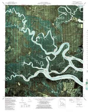
Seabrook Topo Map Georgia
To zoom in, hover over the map of Seabrook
USGS Topo Quad 31081f3 - 1:24,000 scale
| Topo Map Name: | Seabrook |
| USGS Topo Quad ID: | 31081f3 |
| Print Size: | ca. 21 1/4" wide x 27" high |
| Southeast Coordinates: | 31.625° N latitude / 81.25° W longitude |
| Map Center Coordinates: | 31.6875° N latitude / 81.3125° W longitude |
| U.S. State: | GA |
| Filename: | p31081f3.jpg |
| Download Map JPG Image: | Seabrook topo map 1:24,000 scale |
| Map Type: | Orthophoto |
| Topo Series: | 7.5´ |
| Map Scale: | 1:24,000 |
| Source of Map Images: | United States Geological Survey (USGS) |
| Alternate Map Versions: |
Seabrook GA 1954, updated 1959 Download PDF Buy paper map Seabrook GA 1954, updated 1969 Download PDF Buy paper map Seabrook GA 1979, updated 1979 Download PDF Buy paper map Seabrook GA 1979, updated 1997 Download PDF Buy paper map Seabrook GA 2011 Download PDF Buy paper map Seabrook GA 2014 Download PDF Buy paper map |
1:24,000 Topo Quads surrounding Seabrook
> Back to 31081e1 at 1:100,000 scale
> Back to 31080a1 at 1:250,000 scale
> Back to U.S. Topo Maps home
Seabrook topo map: Gazetteer
Seabrook: Airports
Eagle Neck Airport elevation 4m 13′Harris Neck Airport elevation 4m 13′
Stevens Airfield elevation 3m 9′
Seabrook: Bends
The Halfmoon elevation 0m 0′Seabrook: Capes
Belvedere Point elevation 1m 3′Carrs Neck elevation 2m 6′
Seabrook: Channels
Carrs Neck Creek elevation 0m 0′Cross Tide Creek elevation 0m 0′
South Newport Cut elevation 0m 0′
Seabrook: Flats
Olmstead Pasture elevation 4m 13′Seabrook: Islands
Cattle Hammock elevation 1m 3′Colonels Island elevation 5m 16′
Seabrook: Parks
Harris Neck National Wildlife Refuge elevation 3m 9′Seabrook: Populated Places
Drum Point Landing elevation 1m 3′Dunham (historical) elevation 4m 13′
Halfmoon Landing elevation 1m 3′
Seabrook elevation 9m 29′
Thomas Landing elevation 4m 13′
Seabrook: Streams
Jones Creek elevation 0m 0′Payne Creek elevation 0m 0′
South Hampton Creek elevation 0m 0′
Seabrook digital topo map on disk
Buy this Seabrook topo map showing relief, roads, GPS coordinates and other geographical features, as a high-resolution digital map file on DVD:


